Columbia River Plateau
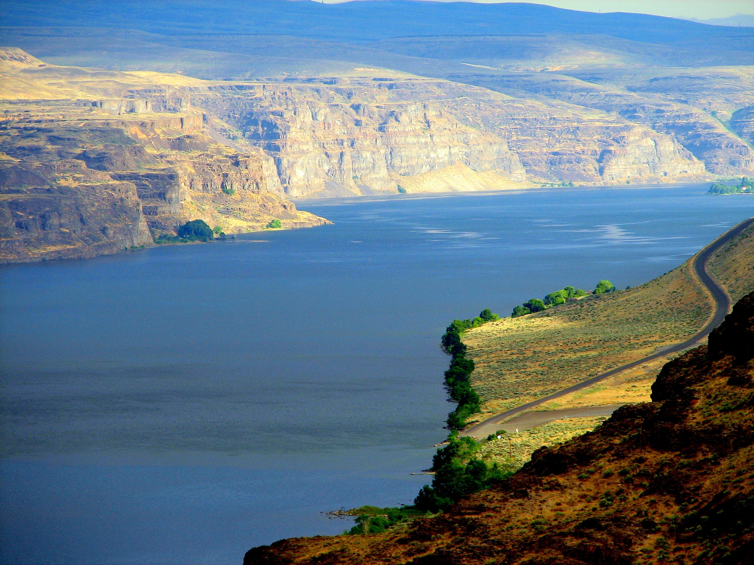
Fly over eastern Washington and the land tells its own story in frozen lava and scoured rock. Between 6 and 17 million years ago, flood after flood of volcanic basalt buried nearly 64,000 square miles of the Pacific Northwest under flows up to a mile thick. Then, at the end of the last ice age, something stranger happened: Glacial Lake Missoula burst its ice dam repeatedly, sending walls of water down the Columbia Gorge that dwarfed every river on Earth combined. The channeled scablands they carved remain - dry coulees with vertical basalt walls, massive ripple marks visible only from the air, and Dry Falls, where water once dropped over a cliff five times wider than Niagara. Today, irrigation has turned the desert green; dams generate enough hydropower for entire cities; and the same geology that created the scablands now produces some of America's finest wine.
Floods Beyond Imagination
Geologist J Harlen Bretz spent decades defending a theory that seemed too outlandish to accept: that the bizarre landscape of eastern Washington had been carved by catastrophic flooding. The scientific establishment resisted until aerial photography revealed the truth. The Channeled Scablands bear the unmistakable marks of rushing water - giant current ripples, streamlined loess islands, dry waterfalls, and coulees carved into solid basalt. Dry Falls once carried more water than all the world's rivers combined, a 400-foot cascade nearly four miles wide. Banks Lake now fills the Grand Coulee, a canyon carved in mere days by ice-age floods. The evidence is everywhere, once you know how to read it.
Power and Transformation
Grand Coulee Dam is the largest concrete structure in the United States and among the largest hydroelectric producers in the world. Built during the Depression, it transformed the Columbia from a wild river into a managed system of reservoirs and generating stations. The power it produced helped build the atomic bombs of World War II at the Hanford Site downstream - a facility that manufactured plutonium for decades and left behind the most contaminated nuclear site in the Western Hemisphere. Today, Hanford is undergoing a decades-long cleanup, and the historic B Reactor offers tours to visitors willing to confront the complex legacy of American nuclear ambition.
Wine and Water
The same basalt that created the scablands creates ideal conditions for viticulture: rocky, well-drained soils that stress grapevines into producing intensely flavored fruit, plus long summer days and cool nights on the high plateau. Walla Walla and the Yakima Valley have emerged as two of America's premier wine regions, supporting hundreds of wineries. The Yakima Valley also produces three-quarters of all hops grown in the United States - the region's beer industry traces directly to its agricultural roots. Irrigation from the Columbia and its tributaries turned sagebrush country into farmland; today the plateau grows apples, wheat, potatoes, and an astonishing variety of produce in what was once considered wasteland.
A Land of Extremes
Summer temperatures routinely exceed 100F in the Tri-Cities; winter can bring subzero cold and occasional heavy snow. Rattlesnakes are common outside developed areas. The plateau offers some of the most dramatic geology in North America - from the hexagonal basalt columns at Frenchman Coulee to the ancient petroglyph sites along the Columbia. Kennewick Man, one of the oldest and most complete human skeletons found in North America, was discovered here, dated to nearly 9,000 years ago. The Whitman Mission National Historic Site commemorates a darker history: the 1847 killing of Marcus Whitman and others by Cayuse people, an event that triggered war and shaped the region's settlement. This is not gentle country. It rewards those willing to meet it on its own terms.
From the Air
Located at approximately 46.5N, 119.6W, the Columbia River Plateau spans most of eastern Washington. Terrain is generally flat to rolling, elevation 500-2,000 ft, with dramatic coulees and river canyons. Grand Coulee Dam and Banks Lake are prominent landmarks in the north. Major airports: Tri-Cities (KPSC), Yakima (KYKM), Spokane (KGEG, on the eastern edge). The Columbia River threads through the region. Weather is continental: hot summers, cold winters, generally excellent VFR conditions with clear skies common. Dust devils and strong winds possible in summer. The terrain can be deceptively uniform from the air - coulees may be invisible until directly overhead. Hanford Site restricted airspace (R-6714) lies along the Columbia north of Richland.