Columbia Trail
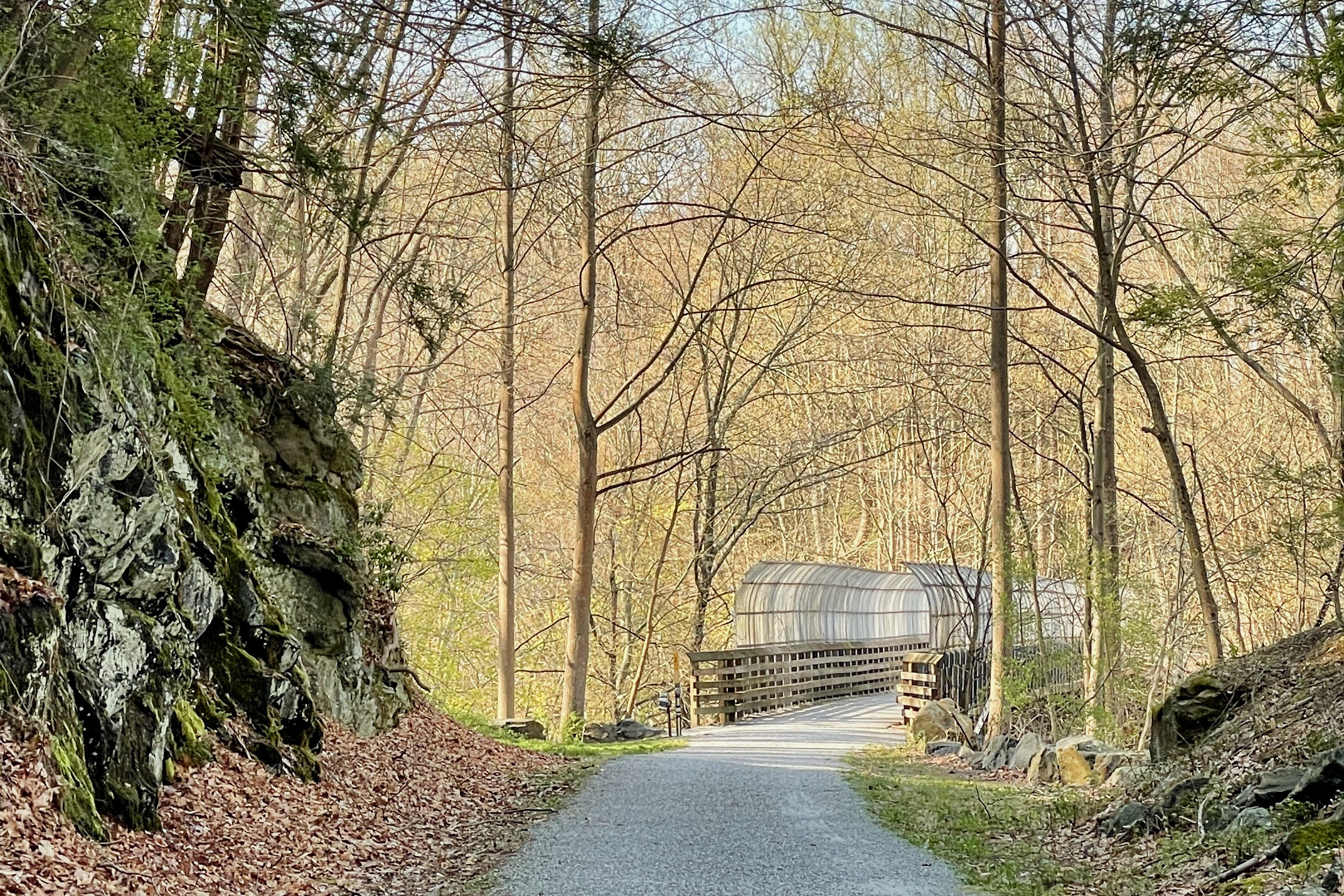
On April 18, 1885, an iron ore train derailed on the trestle over Ken Lockwood Gorge and plunged into the river below. Engine 112 -- sometimes romantically called the Columbia, though contemporary newspaper accounts mention only the number -- crashed through the bridge and disappeared into the South Branch of the Raritan River. Today, a 60-foot trestle carries hikers and cyclists over that same gorge on a crushed-stone path where railroad ties still occasionally surface through the gravel like bones through skin.
Iron Rails to Iron Ore
Lewis H. Taylor, a trustee of the Central Railroad of New Jersey, brought the railroad to High Bridge in 1876. The High Bridge Branch existed for a single industrial purpose: hauling coal and iron ore from mines in Morris County to the Taylor Wharton Iron and Steel Company and other foundries at High Bridge and Wharton. Taylor Wharton was the oldest foundry in United States history, and for decades the branch line fed its furnaces. Passenger service ran alongside the freight until 1935, carrying commuters and day-trippers through a landscape that even then attracted visitors for its natural beauty. The South Branch of the Raritan River paralleled the tracks for much of the route, its fast-flowing waters cutting through limestone gorges and wooded valleys.
Death and Rebirth of a Railroad
By 1976, the High Bridge Branch had become redundant. Its new owner, Conrail, saw no future in a branch line whose industrial customers had vanished, and the rails were dismantled in 1980. The right-of-way might have reverted to forest if not for the Columbia Gas Transmission Company, which bought the corridor in the mid-1990s and laid an underground gas pipeline beneath it. The surface was resurfaced as a trail in 2004, and the Hunterdon County Division of Parks and Recreation and the Morris County Park Commission now operate and maintain the 15.1-mile route under lease. Ownership of the right-of-way remains with Columbia Gas -- a detail that has generated controversy, with some arguing that the trail's name effectively promotes a private utility on publicly maintained land.
Through the Gorge
The Columbia Trail's most dramatic stretch is the Ken Lockwood Gorge, between Califon and High Bridge. Here the South Branch narrows into a fast-flowing channel through a rock-walled corridor, and the trail follows the old rail bed along the cliff face above the water. Fly fishers work the pools below -- the gorge is one of the most prized trout streams in the state -- while the trestle bridge carries the trail 60 feet above the river at the gorge's narrowest point. North of the gorge, the trail mellows through the village of Califon, where a small section of preserved track and a rarely open railroad museum in the old train station mark the route's heritage. Beyond Califon, the path continues through Long Valley, connecting to Patriots' Path and the South Branch Wildlife Management Area.
Two Counties, One Corridor
The trail runs from its southern trailhead at 79 Main Street in High Bridge, Hunterdon County, northeast to Washington Township in Morris County, traversing a landscape that shifts from suburban fringe to rural countryside. The meandering South Branch of the Raritan River accompanies the trail across both counties, its presence a constant through every season. At High Bridge, the trail connects to the New Jersey Transit Raritan Valley Line, making it accessible by train from New York. At its northern end, the active Morristown and Erie Railway still operates freight service to Wharton, a reminder that this corridor's industrial purpose has not entirely vanished. The surface is flat crushed stone throughout -- a deliberate choice that keeps the trail accessible to walkers, runners, and cyclists while preserving the gentle grade that once allowed heavy ore trains to roll downhill toward the foundries.
From the Air
Located at 40.747N, 74.826W, stretching from High Bridge (Hunterdon County) northeast to Washington Township (Morris County), New Jersey. From the air, the trail appears as a narrow linear corridor following the South Branch of the Raritan River through hilly, wooded terrain. The Ken Lockwood Gorge section is particularly visible as a narrow river valley. Nearby airports include Somerset Airport (KSMQ) approximately 10 nm east and Solberg-Hunterdon Airport (KSHD) about 5 nm southwest. Recommended viewing altitude 2,000-3,000 ft AGL to trace the full trail corridor.