Comala
In 1961, the residents of Comala made a collective decision that still defines their town: they painted it white. Every building, every wall -- white stucco topped with red clay tile roofs. The idea was simple: distinguish Comala from the surrounding communities in the shadow of the Colima Volcano. It worked. Today the Pueblo Blanco, the White Town, draws some 400,000 visitors a year, making it the second most important tourist destination in the state of Colima after the beach resort of Manzanillo. But the whitewash covers layers of history reaching back three thousand years, through Olmec, Nahua, Toltec, and Purepecha cultures, through the Spanish encomienda system, through a divisive religious war, and into a present where coffee plantations and handcraft workshops still anchor the local economy.
Where Comals Were Made
The name Comala comes from the Nahuatl word comalli -- a flat ceramic cooking surface -- with the suffix -an, meaning "place of." Place of comals. The name is functional, not mythic, and it tells you that this was a settlement defined by what its people produced. The first humans reached the Colima region an estimated three thousand years ago. Evidence of Olmec, Nahua, Toltec, and Chichimeca habitation or influence runs through the archaeological record. After the twelfth century, the Purepecha culture dominated until the Spanish arrived in the 1520s. Comala, along with neighboring Suchitlan and Zacualtipan, has pre-Hispanic roots that survive in the layout of the land and the names on the map. After the Conquest, the area became an encomienda under Bartolome Lopez in 1527, and Franciscan missionaries established the chapel of Ajuchitlan. By 1554, Spanish rule was formalized over the villages.
Coffee, Electricity, and a Religious War
Modern Comala began to take shape in 1883, when a German businessman named Arnold Vogel established the municipality's first coffee plantation. Coffee would drive agricultural and industrial development for generations. In 1906, the state of Colima's first electrical plant, called El Remate, was built in the municipality, bringing power to Comala, the city of Colima, and Villa de Alvarez. A train line connecting Colima to the Cerro Grande began hauling lumber in 1910. The Cristero War of the mid-1920s hit Colima especially hard. Comala's municipality held two Cristero strongholds -- communities that resisted liberal reforms targeting the Catholic Church -- one in the Cerro Grande mountains and another near the Colima Volcano. Suchitlan, meanwhile, became the site of the area's first ejido in 1918, a communal land grant that represented a very different vision of Mexico's future.
Masks, Baskets, and Volcanic Soil
Agriculture still employs over forty-two percent of Comala's population. Corn, tomatoes, sorghum, coffee, and sugar cane lead the crop list, joined by tomatillos, rice, chili peppers, beans, jicama, limes, mangos, tamarind, avocados, mamey, and guava -- a roster that reads like a menu of Mexican cooking itself. The volcanic soil at the base of the Colima Volcano and the Cerro Grande makes this abundance possible. Industry in Comala means handcrafts: the Artesanias Pueblo Blanco workshop produces furniture, and artisans throughout the municipality carve wooden masks for traditional dances, weave baskets, and shape comals -- the same cooking vessels that gave the town its name centuries ago. Coffee and dairy processing round out a modest industrial base. It is an economy still rooted in the land and in traditions that predate the white paint by a wide margin.
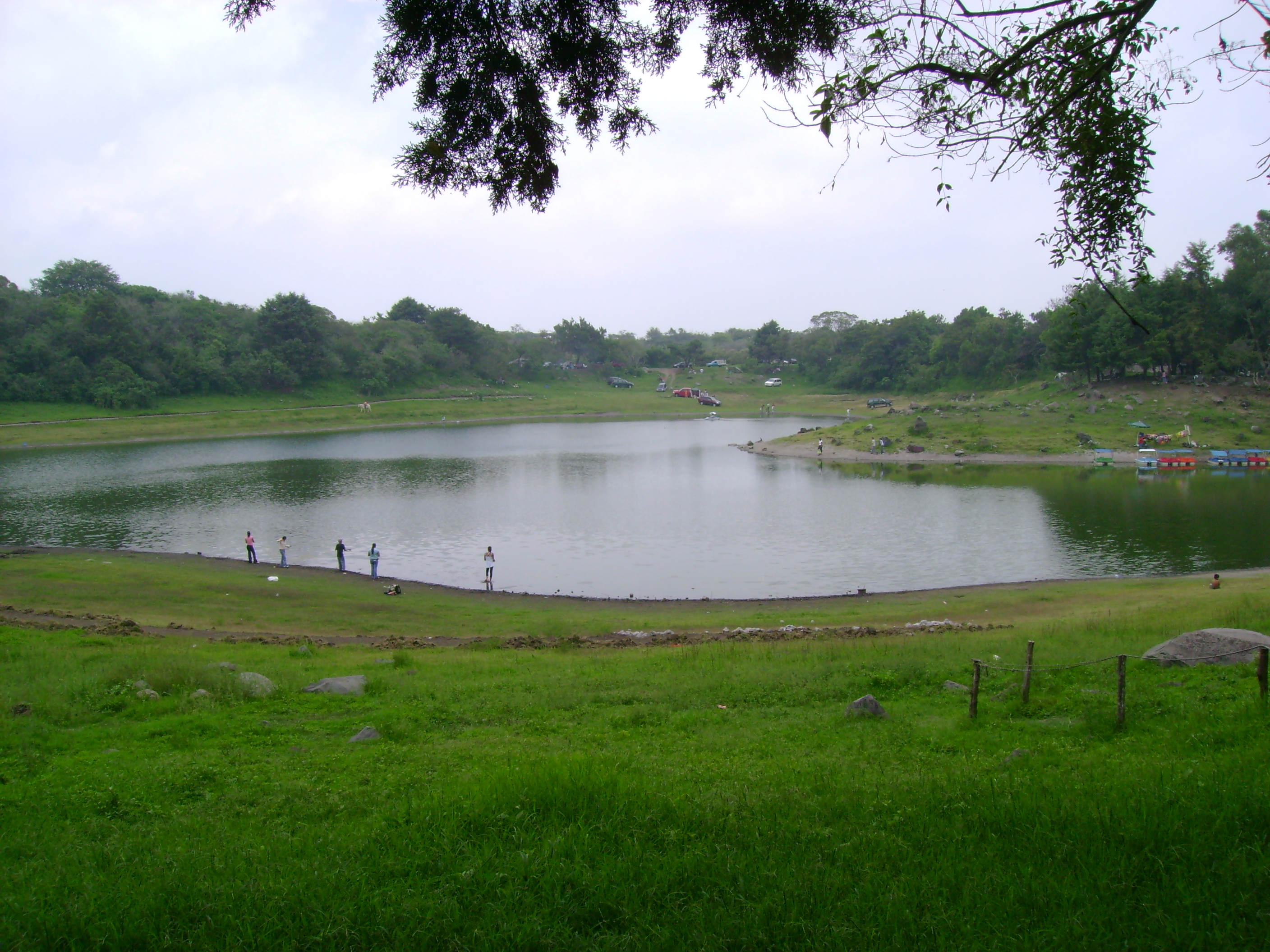
Haciendas and Lakeside Trails
Beyond the white-walled historic center -- declared a Historic Monument Zone by presidential decree in 1988 -- Comala's attractions spread into the surrounding countryside. The former hacienda of Nogueras, just outside town, belonged to the artist Alejandro Rangel Hidalgo and has been restored as a cultural landmark. The hacienda of San Antonio draws visitors to its grounds. Lakes dot the municipality -- Jabali, La Maria, and Carrizalillos -- offering boating, fishing, and lakeside dining. La Maria sits among oaks and pines, with cabins for overnight stays. Hiking draws visitors to the Cerro Grande and the slopes of the volcano itself. The El Remate reserve preserves the site of that first electrical plant while promoting the ecological and cultural heritage of the area. In Suchitlan, a retreat called the Centro de Reflexion perches along the ravine of the Suchitlan River, accommodating up to one hundred people in a landscape chosen for its natural beauty.
From the Air
Located at 19.32N, 103.76W in the state of Colima, at the foot of the Colima Volcano. The town's white-walled buildings with red tile roofs may be distinguishable from altitude against the green volcanic slopes. The Colima Volcano (Volcan de Fuego, 3,820 m) is a major visual landmark to the north. Nearest airport is Playa de Oro International Airport (MMIA) near Manzanillo, approximately 70 km southwest. The city of Colima is just to the south.