Congaree National Park
They call it a swamp, but Congaree is something far stranger. Eighteen miles southeast of Columbia, South Carolina, the Congaree River spills across its floodplain into a forest that has no real equivalent left in America. This is the largest remaining tract of old-growth bottomland hardwood forest in the United States, a place where loblolly pines grow taller than anywhere else on Earth and bald cypress trees have been standing since before Columbus crossed the Atlantic. The canopy here ranks among the highest of any temperate deciduous forest in the world, yet Congaree remains one of the least visited national parks in the country.
A Forest That Breathes Water
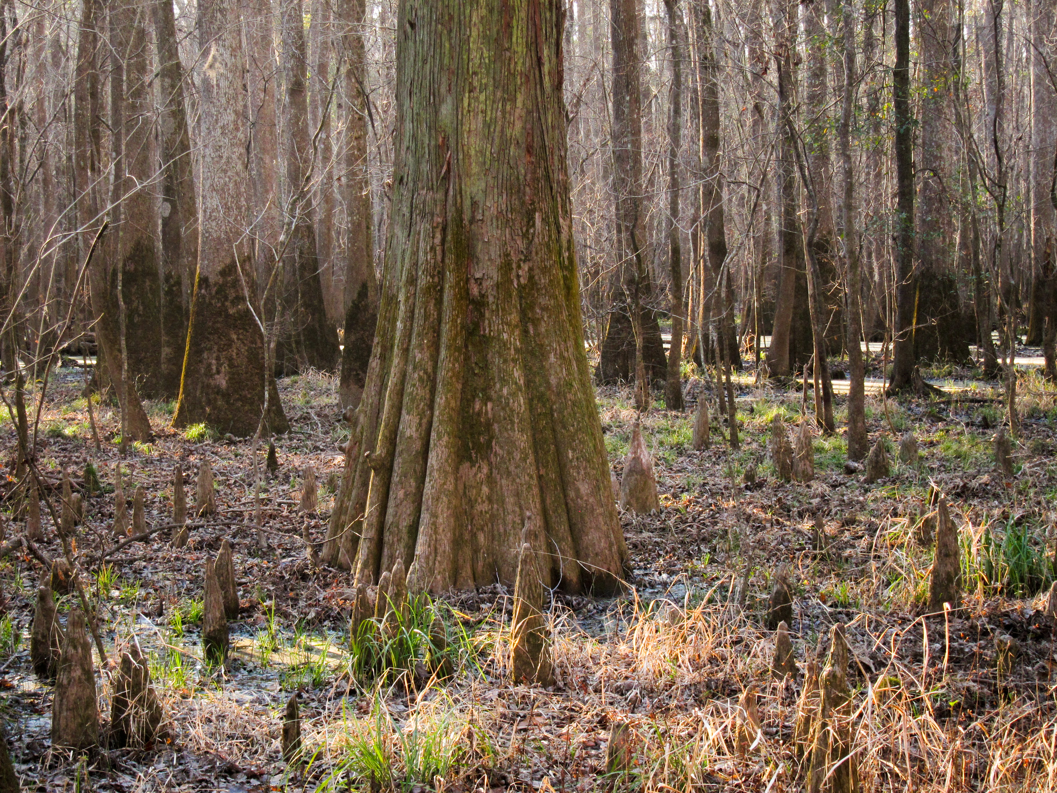
Congaree is not a static swamp but a dynamic floodplain, periodically inundated by the Congaree River. When the water rises, it deposits fresh sediment across the forest floor, feeding a cycle of growth that has produced record-breaking trees. The park's champion loblolly pines are the tallest and largest of their species alive today, with some individuals exceeding 42 cubic meters in volume. Bald cypress trees along the waterways are well over 500 years old, their buttressed trunks flaring wide above the dark water. The river's slow meander has carved oxbow lakes across the landscape, each one an isolated pocket of still water teeming with bowfin, alligator gar, and catfish. Bobcats, otters, and armadillos move through the understory, largely unseen.
Saved by Stubbornness
The forest nearly vanished. In 1898, the Santee River Cypress Logging Company, owned by Chicago businessman Francis Beidler and Benjamin F. Ferguson, began cutting the great cypress trees along the Congaree. Logging continued until 1914, and though the Beidler heirs held the land afterward, they resumed cutting in 1969. That decision sparked a fight. Newspaper editor Harry Hampton had been advocating for the forest since the 1950s, forming the Beidler Forest Preservation Association in 1961. When the chainsaws returned, a new coalition, the Congaree Swamp National Preserve Association, joined forces with the Sierra Club to push for federal protection. Senators Strom Thurmond and Ernest Hollings introduced legislation, and on October 18, 1976, Congaree Swamp National Monument was signed into law. The full national park designation came in 2003, capping a grassroots campaign that had stretched across three decades.
The Boardwalk and Beyond
Most visitors experience Congaree from the Boardwalk Loop, an elevated walkway that threads through the swampy forest without disturbing the delicate fungi and plant life at ground level. It is a gentler introduction to a park that can otherwise feel impenetrable. Beyond the boardwalk, trails range from the short Bluff Trail at 0.7 miles to the 11.1-mile King Snake Trail, where deer, raccoon, and opossum tracks mark the mud alongside the occasional bobcat print. Cedar Creek offers a marked canoe trail for paddlers willing to navigate the blackwater under cathedral-like canopy. But the park's most magical attraction requires nothing more than patience: on certain summer evenings, synchronous fireflies stage displays so coordinated that the forest pulses with rhythmic light, drawing visitors who wait in darkness for the show to begin.
Layers of Deep Time
The park sits entirely within the Congaree River Floodplain Complex, a geological canvas painted in sand, silt, and clay. Muck and peat accumulate from centuries of vegetation decay. To the north lies the Augusta Fault, trending northeast to southwest, flanked by Pliocene fluvial terraces. To the south, the Southern Bluffs have been eroding since the Late Pleistocene. To the west, the Fall Line marks the boundary between Piedmont and Coastal Plain. Congaree occupies this transition zone, and its biology reflects the convergence. The park holds designations as a UNESCO biosphere reserve, a National Natural Landmark, and an Important Bird Area, recognition of an ecosystem that operates at the intersection of geology, hydrology, and time.
From the Air
Congaree National Park sits at 33.78N, 80.78W, roughly 18 miles southeast of Columbia, South Carolina. From the air, the park appears as a dense green floodplain forest along the Congaree River, visually distinct from the surrounding agricultural and suburban land. Look for the serpentine river and oxbow lakes at lower altitudes. The park is best viewed below 5,000 feet in clear conditions. Nearest airports: Columbia Metropolitan (KCAE) 15nm northwest, Jim Hamilton - L.B. Owens Airport (KCUB) 10nm northwest. Humid subtropical climate means frequent haze in summer months.