Congo Basin
The boat leaves when it is full. There is no schedule, no ticket counter, no departure board. You pay the captain, find a spot among the sacks of cassava and cages of chickens, and wait. This is how travel works in the Congo Basin, a region encompassing the provinces of Equateur, Oriental, and Maniema in the Democratic Republic of the Congo -- an area of tropical forest second in size only to the Amazon, where the Congo River and its tributaries serve as the primary transportation network because roads barely exist at all.
A River for a Highway
The Congo River, called the Lualaba in its upper reaches, bisects the basin into two navigable sections separated by rapids between Kisangani and Ubundu. Downstream from Kisangani to Kinshasa, boats and barges move with some regularity -- arriving in Mbandaka almost daily, though reaching Kisangani may take two to three weeks from the capital. Upstream from Ubundu toward Lubumbashi, river traffic thins to perhaps a couple of boats per month. A short portage railroad bypasses the rapids, connecting Kisangani to Ubundu and theoretically allowing continuous river travel from Kinshasa to Kindu. Smaller vessels called pirogues -- often dugout tree trunks, some fitted with motors -- serve as the capillary system of this watery network. Finding one going your direction requires patience measured in days, and fuel for the motorized ones can be scarce.
Where the Road Ends
Only one decent road enters the Congo Basin: National Route 4, a sealed highway running from Bukavu on the Rwandan border to Kisangani. Beyond that, the word 'road' becomes aspirational. Muddy tracks through the forest can take weeks to traverse and become entirely impassable during and after the rainy season. Trucks carry paying passengers atop carefully stacked cargo, and the dangers are concrete -- falling from an overloaded vehicle, overturning on a makeshift log bridge, or simply breaking down for days in the mud. Three rail lines cross the basin, but service is erratic at best. The line from Lubumbashi to Kindu, rehabilitated in the late 2000s with secondhand rolling stock from Europe and India, takes four to eight days. Passengers should expect no sleeper compartments, no dining car, and weeks between departures.
Versailles in the Jungle
The basin's few cities anchor themselves along the rivers. Kisangani, the third-largest city in the DRC, sits at the point where the Congo becomes navigable downstream to the capital. Mbandaka marks the river's junction with other major waterways. And then there is the hometown of former dictator Mobutu Sese Seko, once nicknamed the Versailles of the Jungle for lavish palaces that now stand in ruin -- monuments to the kind of grandiose ambition that the forest eventually reclaims. Most of the basin's inhabitants still live in small villages scattered through the jungle, their lives organized around river rhythms and subsistence agriculture rather than any national economy.
Into the Green Unknown
The Congo Basin's rainforest is not merely large -- it is the second-largest contiguous tropical forest on Earth, a carbon sink of global significance and a reservoir of biodiversity that scientists are still cataloging. Getting around by air offers the only quick option, but scheduled commercial flights within the region are rare and unreliable. Airlines have been known to cancel at the last minute for lack of passengers. The United Nations maintains a flight network for its extensive operations in the region, and small private planes crisscross the basin, though securing a seat on either requires connections and luck. Much of the northeast remains in a state of conflict, and solo travel into the jungle interior is strongly discouraged. For those who do venture into the Congo Basin, the journey itself is the point -- days on the river watching the forest slide past, nights in villages where electricity has never arrived, and the persistent, humbling awareness of traveling through a landscape that operates on its own terms entirely.
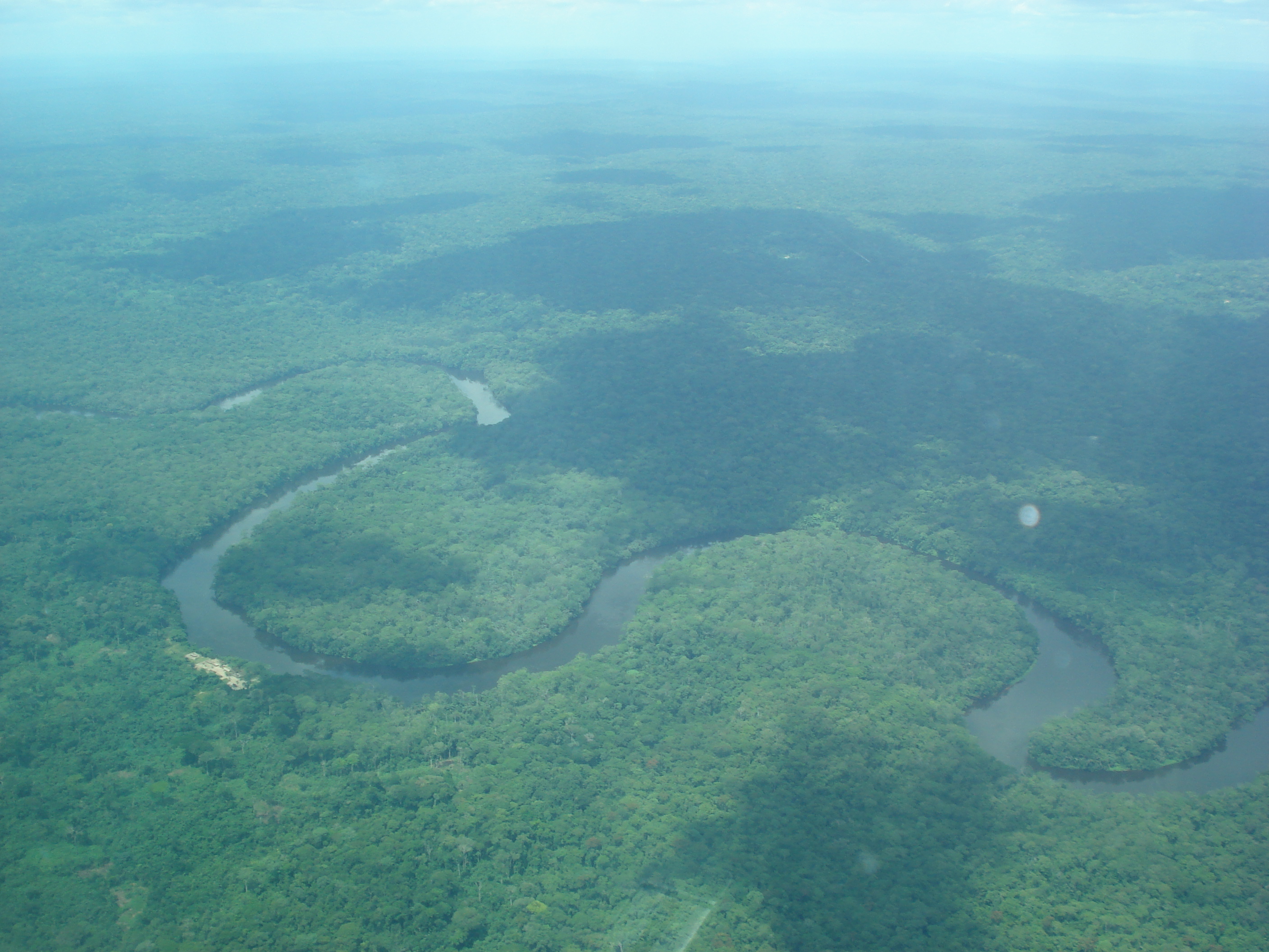
From the Air
Centered at approximately 0.00N, 22.00E, at the equator in the heart of central Africa. The nearest major airports are N'djili International in Kinshasa (FZAA) and Bangoka International in Kisangani (FZIC). From altitude, the Congo Basin appears as an unbroken expanse of dark green canopy threaded by brown and silver river channels -- the Congo River and its tributaries form visible arterial patterns. At cruising altitude (30,000+ feet), the sheer scale of uninterrupted forest is the dominant visual impression, stretching in every direction to the horizon.