Continental Divide Trail
At Triple Divide Peak in Montana, a single raindrop faces an extraordinary choice. Fall on one slope and your water flows to the Pacific Ocean. Land on another and you reach the Atlantic via Hudson Bay. Slip to the third face and you drain into the Gulf of Mexico. This hydrological curiosity marks the only point in North America where three ocean watersheds meet, and the Continental Divide Trail passes directly through it. The CDT is not just a hiking path but a 3,100-mile journey along the geographic spine of a continent, tracing the invisible line where water decides which ocean to seek. From the sun-scorched deserts of New Mexico to the glacier-carved peaks of Montana, this trail demands everything from those who attempt it and rewards them with wilderness few Americans will ever know.
The Line That Divides Waters
The Continental Divide is a concept made visible. Every drop of precipitation that falls on its western slope eventually reaches the Pacific; every drop on the east flows toward the Atlantic or the Gulf. The trail that traces this divide was established in 1978 as a National Scenic Trail, and after decades of work, it remains only about 70 percent complete. Where dedicated trail exists, hikers traverse pristine wilderness. Where gaps remain, they walk roads, both paved and dirt. The CDT crosses 25 National Forests, 21 Wilderness Areas, 3 National Parks, and 8 Bureau of Land Management regions. It threads through five states along a corridor that stays within 50 miles of the actual divide, rising and falling with the terrain but always following that fundamental geographic truth: this is where water chooses its ocean.
Deserts, Volcanoes, and Cliff Dwellings
The trail begins at Crazy Cook Monument in New Mexico's remote Bootheel, a place so isolated that reaching the trailhead requires a four-wheel-drive vehicle and significant planning. From here, thru-hikers face their first test: the sun-baked Chihuahuan Desert, where water caches hidden by trail angels can mean survival. The landscape transforms as the trail enters Gila National Forest, where hot springs bubble from the earth and ancient cliff dwellings speak of peoples who walked these lands centuries ago. At El Malpais, hikers cross the jagged black expanse of a volcanic lava field, a terrain so sharp it can shred boots. Near Ghost Ranch, the red cliffs that inspired Georgia O'Keeffe's paintings glow in the desert light. By the time hikers cross Cumbres Pass into Colorado, they have already traveled through a world of extraordinary contrasts.
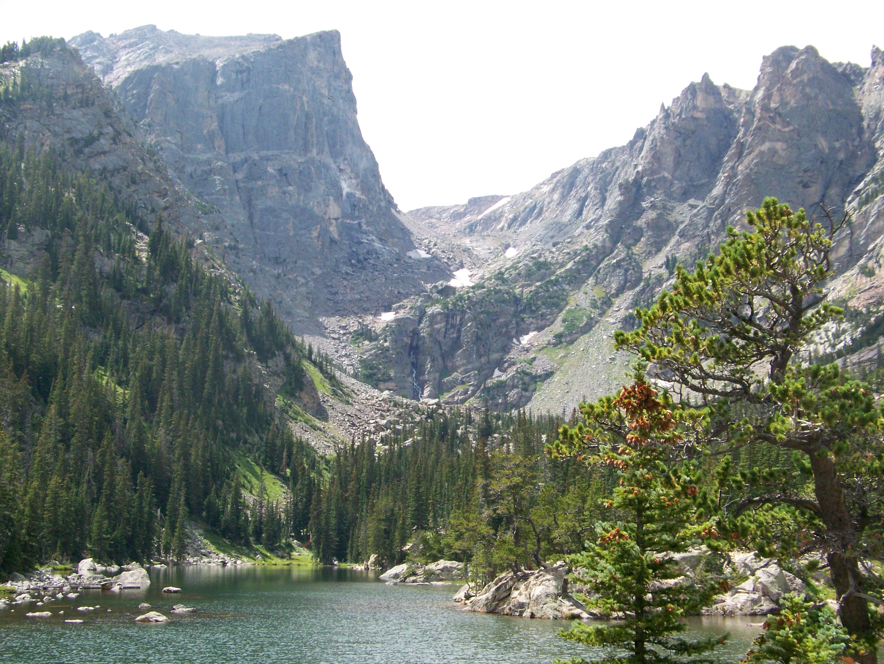
Colorado's High Kingdom
Colorado holds the highest elevations of the entire CDT, and the Weminuche Wilderness alone would make a world-class trek. The trail climbs through the San Juan Mountains, a range of thirteeners and fourteeners that keeps hikers above treeline for days at a stretch. Snow lingers in these heights well into summer, forcing careful timing, northbound hikers who start too early face dangerous snowpack, while those who start too late risk autumn storms at altitude. The trail passes through the Sawatch Range, where Colorado's tallest peaks crowd the horizon, then descends to historic mining towns like Leadville, where resupply comes with a dose of Silver Rush history. Rocky Mountain National Park offers a crown jewel stretch, though backcountry permits are required for overnight stays. By the time hikers reach the Mount Zirkel Wilderness and look north toward Wyoming, they have crossed some of the most dramatic mountain terrain on the continent.
The Basin Where Water Stays
Wyoming's Great Divide Basin breaks every rule. Here, the Continental Divide splits into two arms, enclosing a vast internal drainage where precipitation neither reaches the Pacific nor the Atlantic but simply evaporates under the relentless high-desert sun. Hikers cross this stark landscape knowing that water sources are scarce, shade is nonexistent, and temperatures swing wildly between day and night. After the Basin, the Wind River Range offers redemption: jagged granite peaks, turquoise glacial lakes, and the kind of alpine grandeur that makes hardship worthwhile. The trail then enters Yellowstone, the world's first national park, where geysers erupt, hot springs steam, and bison graze in valleys that feel untouched by time. Old Faithful marks a surreal waypoint on a journey defined by wilderness.
The Wild North
The final stretch through Montana and Idaho is arguably the most remote on the entire CDT. The Bob Marshall Wilderness Complex, one of the largest contiguous wilderness areas in the lower 48 states, offers no roads, no cell service, and no easy exits. Grizzly bears are common. The Chinese Wall, a twelve-mile limestone escarpment rising 1,000 feet above the forest, stands as one of the trail's most iconic landmarks. At last, Glacier National Park welcomes hikers with turquoise lakes, hanging glaciers, and the promise of Canada just ahead. The northern terminus at Waterton Lake sits at just 4,200 feet, the lowest elevation on the entire CDT, a fitting descent from the rooftop of the continent. Only about two dozen hikers complete the entire trail each year. For those who do, the journey takes four to six months and transforms everything they thought they knew about walking, about wilderness, and about themselves.
From the Air
The Continental Divide Trail runs 3,100 miles from its southern terminus at Crazy Cook Monument (31.50°N, 108.21°W) in New Mexico's Bootheel to Waterton Lake on the Canadian border in Montana. The trail follows the Continental Divide through five states. Notable waypoints from the air include El Malpais lava fields in New Mexico, the San Juan Mountains and Rocky Mountain National Park in Colorado, the Wind River Range and Yellowstone in Wyoming, and Glacier National Park in Montana. The divide itself is often visible as the high ridgeline separating drainages. Major access airports include El Paso (KELP), Denver (KDEN), Jackson Hole (KJAC), and Glacier Park International (KGPI).