Cook Landing Site (Waimea)
The beach where James Cook stepped ashore on January 20, 1778, no longer exists in quite the same place. Over two and a half centuries, the Waimea River has deposited enough sediment to push the shoreline outward, burying the exact spot under layers of sand and time. What remains is a National Historic Landmark designation, a statue in nearby Hofgaard Park, and the knowledge that somewhere along this stretch of southwestern Kauai's coast, European contact with Hawaii began -- an arrival that would transform a civilization.
Landfall on a Third Voyage
Captain James Cook was not looking for Hawaii. On his third voyage into the Pacific, launched in 1776, his mission was to chart the northwest coast of North America and search for a passage connecting the Pacific and Atlantic oceans. He had spent months in the South Pacific, charting islands and reprovisioning, before turning north. On January 18, 1778, lookouts aboard HMS Resolution and HMS Discovery sighted Oahu and Kauai through the haze. Prevailing winds carried the ships toward Kauai's shore. The next day, as the expedition coasted along the island's eastern coast, Native Hawaiians paddled out in canoes to trade. Cook sent a scouting party ahead to find safe anchorage, and they identified Waimea Bay as, in Cook's own measured phrase, a "tolerable" spot. The afternoon of January 20, Cook anchored and came ashore with an armed escort.
First Contact at the River's Mouth
Hawaiians had congregated "in considerable numbers" on the sandy beach at the mouth of the Waimea River. Cook established friendly relations quickly -- his experience with Pacific island cultures across two previous voyages had taught him the value of calm diplomacy backed by visible strength. The next day, he explored upriver, taking detailed notes on the people, their agriculture, their social structures, and their religious practices. These observations became ethnographic records of extraordinary importance, capturing a snapshot of Hawaiian society before contact began to change it. Cook was the first European known to have sighted the Hawaiian Islands, and this January landing on Kauai was his first step onto Hawaiian ground. He spent two weeks in the islands, also visiting neighboring Niihau, before sailing north to map the Pacific coast from Oregon to the Bering Strait.
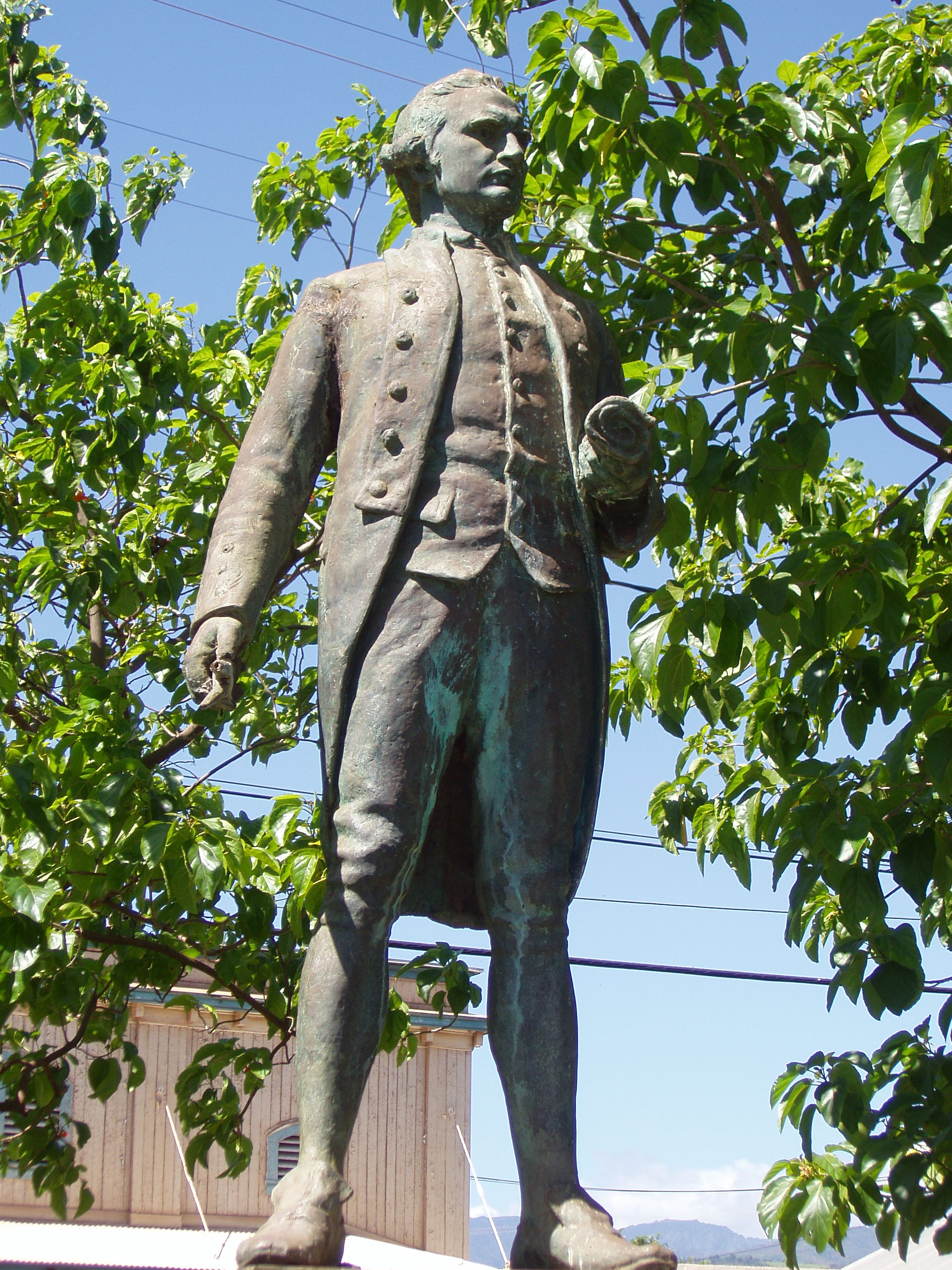
A Monument to an Ambiguous Legacy
Cook named the archipelago the Sandwich Islands, after his patron the Earl of Sandwich. He returned a year later, anchoring off the Big Island, where a dispute over a stolen boat escalated into violence. Cook was killed by Native Hawaiians at Kealakekua Bay on February 14, 1779 -- just thirteen months after his peaceful first landing at Waimea. Today, the landing site is commemorated at Hofgaard Park, a small county park located one block inland from the shore and one block from the Waimea River. A bronze statue of Cook stands there alongside plaques describing the event. Across the river, the ruins of Russian Fort Elizabeth -- built four decades after Cook's visit during Russia's brief and unsuccessful attempt to gain a foothold in Hawaii -- add another layer to Waimea's concentrated history. The Cook Landing Site was designated a National Historic Landmark on December 29, 1962. Lucy Wright Park, closer to the actual shore, is believed to be nearest to where Cook came ashore, though the shifting coastline means certainty is impossible.
Where the Shore Keeps Moving
The Waimea River carries red volcanic soil down from Waimea Canyon -- often called the Grand Canyon of the Pacific -- and deposits it at its mouth. Over centuries, this process has extended the shoreline, meaning the beach Cook walked onto in 1778 now lies some distance inland from the current waterline. The landscape itself has become a record of geological time, with each layer of sediment representing decades of the river's patient work. Standing at the park today, the visitor looks out at a bay that is both the same body of water Cook anchored in and a fundamentally different shore. The palm trees, the red-dirt roads of Waimea town, the sound of waves on a beach that was not there when Cook arrived -- all of it speaks to the paradox of commemorating a place that will not stay put.
From the Air
The Cook Landing Site is located at approximately 21.95N, 159.67W, on the southwestern coast of Kauai at the mouth of the Waimea River. The nearest airport is Lihue Airport (PHLI), about 20 nm to the east along the coast. From the air, look for the distinctive red sediment plume where the Waimea River meets the ocean. Russian Fort Elizabeth's octagonal ruins are visible just across the river to the southeast. Pacific Missile Range Facility (PHBK/Barking Sands) lies approximately 6 nm to the northwest along the coast. Best viewed at 1,500-3,000 feet altitude.