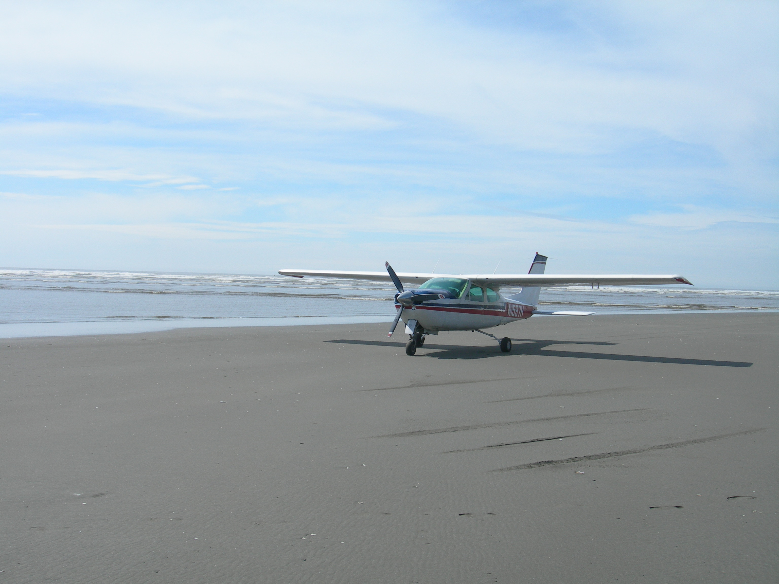
Copalis State Airport
Check the tide tables before you check the weather. At Copalis State Airport, the runway is the beach itself -- 4,500 feet of packed sand stretching from the mouth of the Copalis River to a line of rocks a mile north. When the tide comes in, the runway disappears. When it goes out, pilots land on what the Pacific Ocean has temporarily agreed to lend them. This is the only airport in Washington State where landing on the beach is legal, and the only FAA-approved beach runway in America. Its FAA identifier is S16. Its elevation is one foot above mean sea level. Everything about this place operates at the margin between land and water, between the permanent and the provisional.
Sand, Salt, and Runway 14/32
The runway is designated 14/32, oriented roughly northwest-southeast along the beach in Grays Harbor County. Its surface is sand -- not gravel, not compacted earth, but the same tidal sand that beachcombers walk on and waves reshape twice a day. The usable length was originally 4,500 feet by 150 feet wide, but river migration and beach erosion have shortened it by approximately 1,100 feet. The Copalis River, which bounds the southern end, has been slowly shifting its mouth, eating into the runway from one side while the Pacific gnaws from the other. Pilots who land here learn to read the beach the way sailors read the water -- checking for soft spots, debris, driftwood logs rolled in by storms, and the firmness of the sand at different points in the tidal cycle.
From Army Base to Public Strip
Before S16 became an official airport, the beach served military purposes. During the 1940s, this stretch of coast was part of the Grays Harbor Army Base, one of several coastal defense installations built along the Pacific Northwest shoreline during World War II, when the threat of Japanese attack was real -- submarine I-25 shelled Fort Stevens in Oregon and bombed forests near Brookings in 1942. Grays Harbor County first established the airport in 1951, formalizing what military pilots and local aviators had already been doing. The state took over management, and in 1976 it was designated as a state airport. For the 12-month period ending May 2011, the airport recorded about 200 general aviation operations -- roughly 16 landings or takeoffs per month, a modest number that reflects both the airport's remoteness and its tidal constraints.
Where the Sanctuary Meets the Shore
Copalis State Airport sits within the North Beach Seashore Conservation Area, adjacent to the Olympic Coast National Marine Sanctuary -- one of the richest marine ecosystems on the Pacific coast. The juxtaposition is striking: an active runway, however intermittent, sharing geography with a federally protected marine sanctuary. Gray whales migrate past in spring and fall. Bald eagles patrol the tideline. Razor clams burrow in the same sand that airplane wheels compress on approach. The airport's existence within this conservation area is a kind of negotiated truce between human use and natural preservation, one that works precisely because the ocean enforces its own schedule. No one builds hangars on a beach that floods twice a day. No one paves a runway the tide will dissolve.
Landing on Borrowed Ground
There is something clarifying about an airport that the ocean can erase. Pilots who fly into S16 must plan around tide charts, not just wind and weather. A late departure means no runway to return to. A miscalculated approach puts wheels into surf rather than sand. The experience strips away the infrastructure that makes most aviation feel routine -- the concrete, the taxiways, the tower frequencies -- and replaces it with something older: a flat stretch of earth, the sound of the Pacific, and a window of time that the moon controls. It is flying reduced to its essentials, and for the pilots who seek it out, that is precisely the point. The beach will be here tomorrow, and it will be an airport again, but only when the tide says so.
From the Air
Copalis State Airport (S16) is located at 47.142N, 124.190W on the Pacific coast of Washington in Grays Harbor County. Elevation is 1 foot MSL. Runway 14/32 is a sand beach surface, approximately 3,400 feet usable (reduced from original 4,500 feet due to erosion). CRITICAL: The runway is only available during low tide -- consult tide tables before planning an approach. Look for the Copalis River mouth at the southern end and rocks marking the northern boundary. The beach is within the North Beach Seashore Conservation Area. Nearest paved airports: Ocean Shores Municipal (W04) approximately 8nm south, Bowerman Airport (KHQM) in Hoquiam approximately 21nm southeast. Caution: soft sand, driftwood, and beach traffic. No services, fuel, or facilities at the airport.