Cordillera Real (Bolivia)
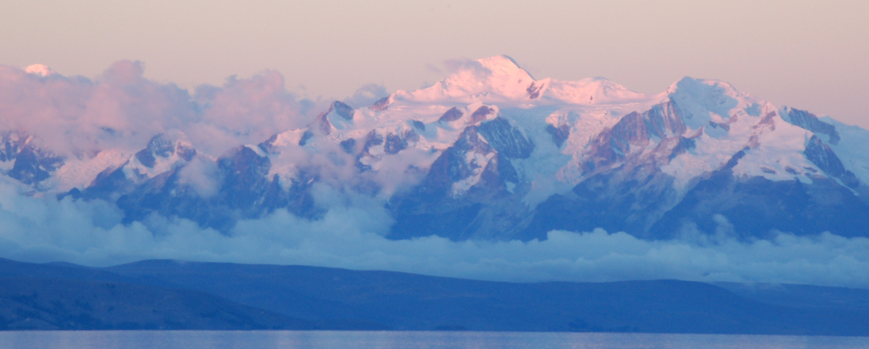
Llamas graze at 4,500 meters beneath peaks that carry glaciers to within 17 degrees of the equator. The Cordillera Real should not, by the usual rules of latitude, be so thoroughly iced. But the usual rules do not account for the Amazon. Moist air masses rising from the vast lowland basin to the east collide with the granite wall of Bolivia's Royal Range, dropping their moisture as snow on summits that stretch 125 kilometers in length and 20 kilometers in width southeast of Lake Titicaca. The result is one of the most densely glaciated tropical mountain ranges on Earth, a frozen spine running parallel to the Bolivian capital of La Paz.
Granite Monarchs
Illimani, the highest peak at 6,438 meters, dominates the southeastern skyline of La Paz with the authority that its Aymara name suggests — roughly translated as "golden eagle" or "resplendent one." Six additional peaks exceed 6,000 meters: Janq'u Uma at 6,427 meters, Illampu at 6,368, Layqa Qullu at 6,166, Ch'iyar Juqhu at 6,127, Wayna Potosi at 6,088, and Chachakumani at 6,074. The names are almost entirely Aymara, reflecting the indigenous peoples who have lived in the shadow of these mountains for centuries. Fold mountains composed largely of granite, the peaks of the Cordillera Real were pushed upward by the same tectonic forces that built the Andes, and their steep eastern faces drop dramatically toward the Yungas — the subtropical valleys where the highlands give way to jungle.
Ice in the Tropics
Tropical glaciation seems paradoxical, but the Cordillera Real demonstrates how altitude and moisture can override latitude. The Amazon lowlands, stretching endlessly to the east, generate massive convective systems that push wet air westward and upward against the Andean barrier. At elevations above 5,000 meters, temperatures remain low enough for this moisture to accumulate as ice year-round. The range holds dozens of glaciers, though climate data collected since the mid-twentieth century shows significant retreat. Chacaltaya, at 5,421 meters, once hosted the world's highest ski area, but its glacier has largely disappeared. The loss is more than recreational: glacial meltwater feeds rivers that supply La Paz and surrounding communities with drinking water and irrigation. The tension between the range's beauty and its vulnerability defines much of the conversation around the Cordillera Real today.
The Climber's Staircase
Mountaineers treat the Cordillera Real as a progression. Wayna Potosi, at 6,088 meters, is often described as one of the most accessible peaks above 6,000 meters in the world, reachable from La Paz in a two-day guided climb. From its summit, the lights of La Paz and El Alto glow in the valley below while the Altiplano stretches flat to the western horizon. Illampu, by contrast, demands technical skill and multiple days on the mountain. Between these extremes lie dozens of peaks in the 5,000-to-5,500-meter range, many of them carrying Aymara names that describe their appearance: Janq'u Laya (white place), Wila Lluxi (red slide), Ch'iyar Qullu (black mountain). The range's proximity to La Paz makes it one of the most accessible high-altitude climbing destinations in South America, though the word "accessible" requires qualification at elevations where oxygen runs thin.
Between Lake and Jungle
The Cordillera Real occupies one of the planet's most dramatic geographic transitions. To the northwest lies Lake Titicaca, the highest navigable lake in the world at 3,812 meters, its deep blue surface stretching across the border between Bolivia and Peru. To the east, the land plunges thousands of meters into the Yungas valleys and ultimately into the Amazon basin. This gradient — from altiplano to cloud forest to tropical lowland in barely 100 horizontal kilometers — produces extraordinary biodiversity. Andean condors soar along the ridgeline while spectacled bears inhabit the cloud forests below. The road from La Paz through the Yungas, once called the most dangerous road in the world, drops from the range's western flank to the town of Coroico through a series of hairpin turns carved into near-vertical slopes. From the air, the contrast is immediate: barren brown plateau gives way to snow-capped granite, then cascading green.
From the Air
The Cordillera Real runs southeast of Lake Titicaca at approximately 17°S, 67.17°W, with peaks exceeding 6,400 meters (21,000 feet). Illimani at 6,438 meters dominates the southeast skyline of La Paz. The range presents serious terrain hazards for aviation: mountain wave turbulence, rapid weather changes, and obscured peaks in cloud. La Paz/El Alto International Airport (SLLP) sits at 4,061 meters (13,325 feet), one of the highest commercial airports in the world. Pilots should maintain well above ridge altitudes and expect density altitude effects on aircraft performance. The dramatic transition from Altiplano to Amazon lowlands is clearly visible from cruising altitude.