Corfu
Even the name carries layers. Greeks call it Kerkyra, after the nymph Korkyra whom Poseidon spirited away to this island. Westerners call it Corfu, a corruption of Korypho, referring to the twin peaks of its fortress. The island itself sits at a crossroads that has made naming rights a recurring argument for millennia. Positioned between Italy and the Greek mainland, within sight of Albania's coast, Corfu has been claimed, fortified, and flavored by Venetians, French, British, and Greeks in turn. What remains is an island that feels like nowhere else in the Mediterranean -- a place where you can drink ginger beer at a Parisian-style arcade, eat Venetian-spiced pasta, and watch an Orthodox Easter procession all in the same afternoon.
The Shape of the Island
From the air, Corfu resembles a sickle laid against the Albanian coast. It stretches 62 kilometers north to south, narrowing in the south to just a few kilometers across. Two mountain ranges define its character. In the north, Mount Pantokrator rises to 906 meters, its limestone flanks dropping steeply to pebbly coves where the water runs so clear the seabed looks painted on. The southern range is gentler, trailing off into sandy beaches and the inland lagoon of Korission Lake. Between these spines, the island is intensely green -- olive groves that the Venetians incentivized with cash bounties per tree planted, creating a canopy that now shades an estimated four million trees. The northeast coast earned the nickname "Kensington-on-Sea" for the British aristocrats and writers who colonized its villas. Lawrence Durrell lived in the village of Kalami from 1935 to 1941, writing Prospero's Cell in a white house at the water's edge.
Centuries Written in Stone
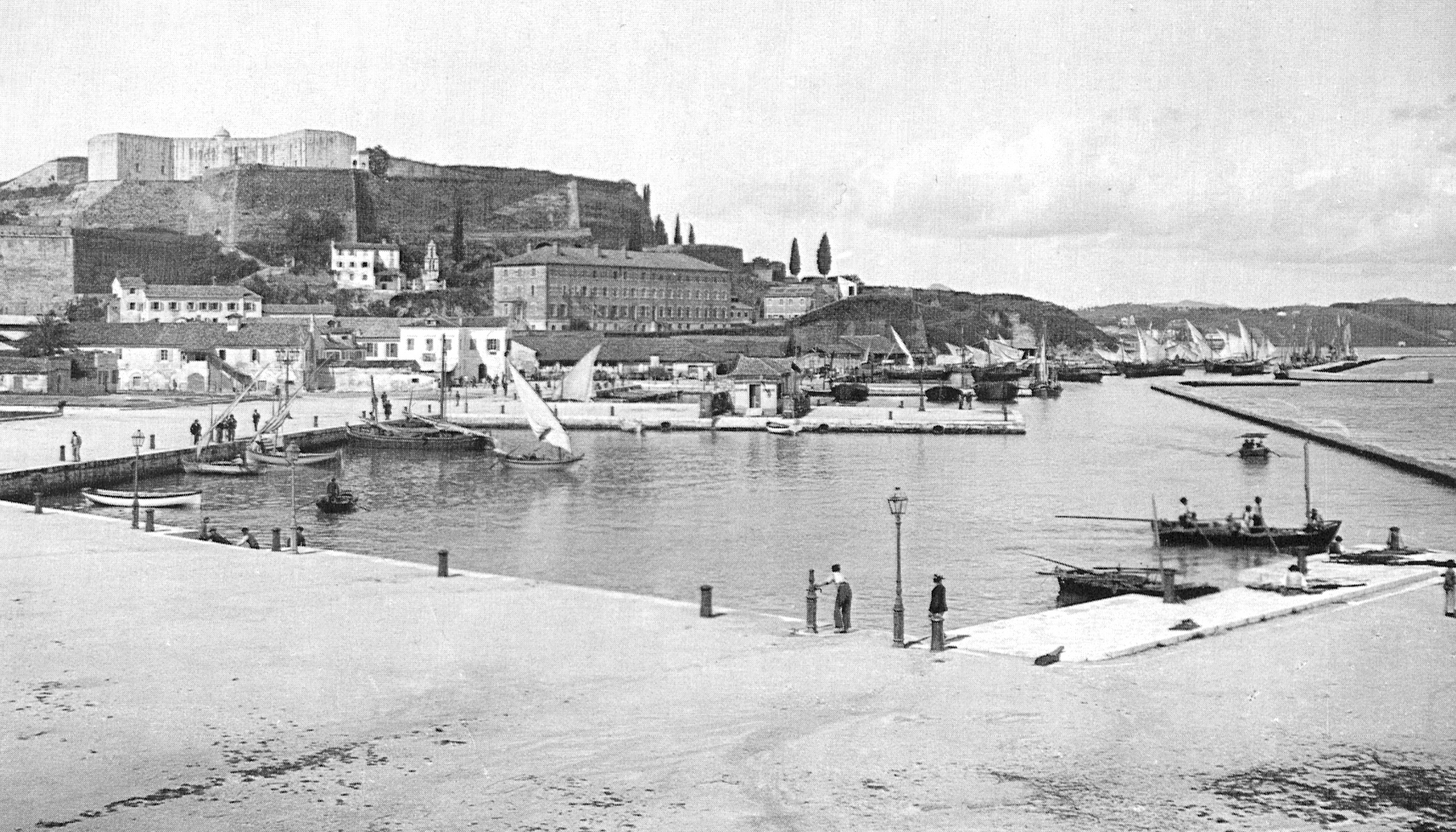
Corfu's old town, a UNESCO World Heritage Site, reads like a compressed history of Mediterranean power. The Venetians held the island for over four centuries, from 1386 to 1797, longer than they held most of their empire. They left behind the Liston, an arcaded promenade modeled on the Rue de Rivoli in Paris -- though it was actually built during the brief French occupation that followed Venice's fall. The British took over in 1815 and stayed until 1864, contributing a water supply system, a university, and the island's improbable fondness for ginger beer, locally called tsitsibeera. The Achilleion palace, built in 1890 for Empress Elisabeth of Austria, sits on a hill above the town, its gardens filled with statues of the Greek hero for whom it was named. Each ruler added a layer, and remarkably few layers were demolished. Walking through Corfu Town means passing Venetian fortifications, British neoclassical buildings, and French arcades within a few hundred meters.
A Kitchen Between Worlds
The Venetian centuries left their deepest mark in the kitchen. Pastitsada -- beef, rooster, or rabbit braised in spiced tomato sauce and served over bucatini pasta -- is the island's signature dish, its name descended from the Italian pasticiada. Sofrito, thinly sliced beef in a garlic and white wine reduction, could pass for something from a Venetian bacaro. Bourdeto, a scorpionfish stew fired with red pepper and garlic, pushes toward something hotter than either tradition alone. Even the island's drink culture reflects its layered past: kumquat liqueur from a fruit introduced by the British, local wines from grapes the Venetians encouraged, and that ginger beer, still brewed on the island and served cold in the cafes along the Liston. The Corfu Microbrewery in Arillas now produces unpasteurized ales good enough that the British chain Wetherspoon commissioned a special Olympic beer from them.
Village Life Above the Coast
Escape the coastal resorts and Corfu reveals an older self. Old Perithia, the island's oldest surviving village with records dating to around 1350, sits just below Mount Pantokrator in a designated Area of Natural Beauty. Its stone houses stand largely empty now, but the settlement is heritage-protected and slowly being restored. Nymfes, built at 200 meters elevation, takes its name from a legend that nymphs once bathed in the village waterfalls -- a walk to the cascades makes the myth feel reasonable. Makrades and Lakones offer views over the dramatic bay of Paleokastritsa, where sheer cliffs plunge into water that shifts between emerald and cobalt depending on the angle of the sun. The 222-kilometer Corfu Trail links the island end to end, threading through these mountain villages and passing from the alpine north to the subtropical south.
Gateway to the Ionian
Corfu functions as a hinge between worlds. Ferries connect it to Venice, Ancona, Bari, and Brindisi in Italy. Hydrofoils reach Saranda in Albania in under an hour, opening the door to the UNESCO site of Butrint just 14 kilometers beyond. Day trips to the tiny island of Paxi reveal an even quieter version of Ionian life. The island's international airport receives flights from across Europe, and Corfu Town's harbor handles cruise ships alongside fishing boats. For all the tourism that has transformed its coastline, the island keeps producing what has always defined it: olive oil from those millions of Venetian-planted trees, wine from hillside vineyards, and the particular quality of light that filters through maritime air onto limestone, turning ordinary afternoons golden.
From the Air
Corfu island lies at approximately 39.60N, 19.87E in the Ionian Sea off northwestern Greece. The island is 62 km long and clearly visible from cruise altitude. Mount Pantokrator (914 m) dominates the northern end. Corfu International Airport (ICAO: LGKR) sits on a narrow peninsula near Corfu Town, with a dramatic runway that appears to extend into the sea. The Albanian coast is visible to the east, less than 3 km away at the narrowest point. Look for the distinctive twin-peaked Old Fortress promontory at the eastern edge of Corfu Town.