Coron, Palawan
Somewhere beneath the warm waters off Coron Island, a dozen Japanese warships sit upright on the seafloor, their hulls encrusted with coral and patrolled by schools of barracuda. On September 24, 1944, American carrier-based aircraft caught the Imperial Japanese Navy's supply fleet sheltering in Coron Bay, sinking ship after ship in a devastating raid. Eight decades later, these wrecks have become one of the world's great diving destinations -- and the unlikely foundation of a tourist economy that transformed a quiet fishing municipality in northern Palawan into the commercial capital of the Calamian Archipelago.
A Name Shaped Like a Pot
Before the Spanish arrived, the Tagbanua people called this place by a word that sounded like "Corong" -- their term for a type of pot. The Spaniards adapted it to Penon de Coron, and by 1902 the name had been trimmed to simply Coron. But the municipality's original name, Bancuang, referenced the palms that once crowded the riverbanks and marshes near the town's freshwater spring. The Calamian Islands had been home to the Tagbanua and Calamianen peoples since at least the 11th century, when oral histories record that Datu Macanas ruled all of Busuanga Island. Spanish friars who visited noted a sharp contrast between the friendly inhabitants of Busuanga and the fierce independence of the Tagbanua living on Coron Island itself -- a distinction that persists in spirit. In 1998, the Philippine government formally recognized Coron Island as an ancestral domain of the Tagbanua, issuing Certificate of Ancestral Domain Claim No. 134.
War Beneath the Waves
The Japanese warships that draw divers today were not battleships or destroyers but supply and logistics vessels -- the unglamorous backbone of a naval fleet. When American planes struck on that September morning in 1944, they sent tankers, freighters, and auxiliary craft to the bottom of Coron Bay, where they came to rest at depths between 10 and 40 meters. The wrecks remained largely forgotten until sport diving popularized them in the late 20th century. Today, penetration dives through engine rooms and cargo holds offer an eerie intimacy with wartime history. The liberation of Coron itself came months later, in March 1945, when Filipino guerrillas and American forces arrived. PT boats bombarded the town -- burning many houses in the process -- before Lieutenant Trinidad Vizconde led the final assault. The airfield at Malaking Patag became a forward American base, and Captain Carlos Amores, recognized for his wartime leadership, went on to serve as Coron's mayor.
From Dynamite to Dive Flags
Coron's economy has reinvented itself more than once. During the Japanese occupation, manganese mining at Singay Mines in Barangay San Nicolas provided the dominant industry. After the war, commercial fishing drove prosperity through the 1970s and into the 1990s -- until blast fishing and sodium cyanide poisoning gutted the marine ecosystem and the catch collapsed. Rattan weaving declined in parallel as raw materials grew scarce. Tourism stepped into the vacuum, and the shift was dramatic. The lagoons, limestone cliffs, and crystal-clear lakes of Coron Island now anchor an industry that supports the municipality's population of roughly 69,000 people. Kayangan Lake, ringed by jagged karst walls, has become one of the most photographed sites in the Philippines. The Francisco B. Reyes Airport connects Coron to Manila, Cebu, and Angeles City, funneling visitors into a town that just decades ago had little reason to expect them.
Seven Sins and a Blue Park
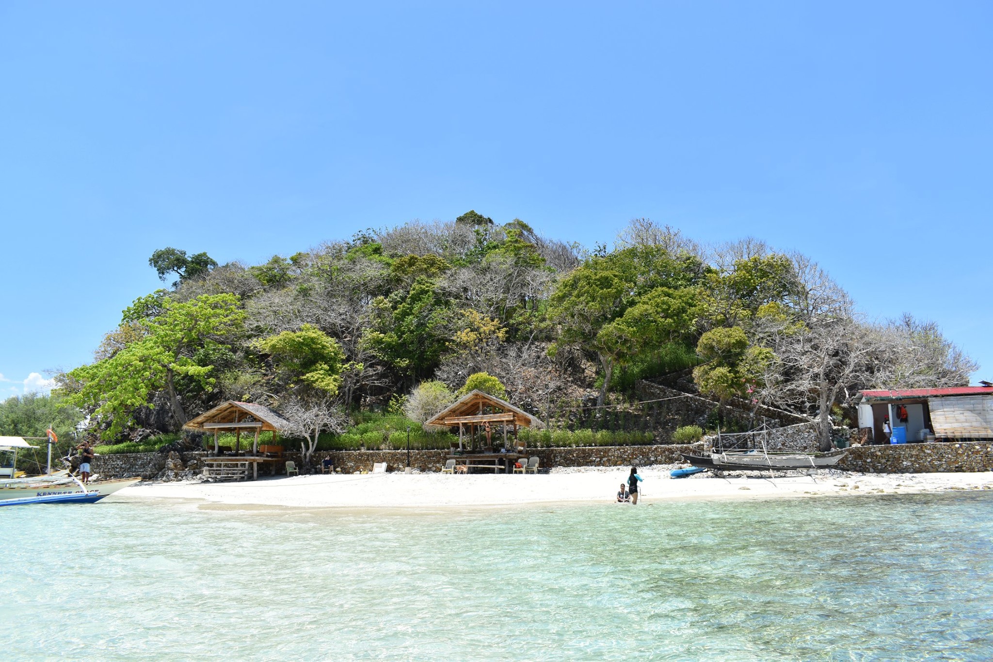
Just offshore from Coron's coast, seven small limestone islets rise from the water like a scattered handful of emeralds. This is Siete Pecados -- the Seven Sins -- a marine park that earned the Blue Park Award from the Marine Conservation Institute in April 2024, one of only three marine protected areas in the Philippines to receive the honor. Founded in 2005 with support from the United States Agency for International Development, Siete Pecados shelters a dense concentration of coral species and reef fish in remarkably shallow, accessible water. Snorkelers float above staghorn coral and giant clams while jackfish school in silver columns below. The award recognized Coron's broader conservation network across the Calamian Islands, a system that has managed to balance growing tourist pressure with genuine habitat protection -- no small achievement in a region where the scars of blast fishing are still visible on older reef structures.
Islands at the Crossroads
Coron municipality occupies the eastern half of Busuanga Island, the entirety of Coron Island, and roughly 50 smaller islets stretching from Tara Island in the northeast to Canipo Island in the south. Together they form the heart of the Calamian Archipelago, a chain that separates the South China Sea from the Sulu Sea. The geography creates a natural meeting point for marine currents, which enriches the surrounding waters and supports the biodiversity that makes the area remarkable. On Coron Island, the UNESCO World Heritage Tentative List includes the Coron Island Natural Biotic Area, recognized for its lakes, limestone formations, and endemic species. The town celebrates its patron saint, Augustine, every August 28, a fiesta that fills the Poblacion barangays with processions and music. For all its growing international reputation, Coron remains a place where fishing boats still outnumber dive boats in the harbor at dawn.
From the Air
Coron is located at 11.998N, 120.205E in the Calamian Archipelago of northern Palawan. From altitude, the municipality occupies the eastern portion of Busuanga Island, with Coron Island visible to the south. The limestone karst formations and lagoons of Coron Island are distinctive from above. Francisco B. Reyes Airport (RPSD) serves the area. The surrounding waters of the South China Sea and Sulu Sea provide dramatic contrast against the green islands. Best viewed at 5,000-10,000 feet for island chain perspective.