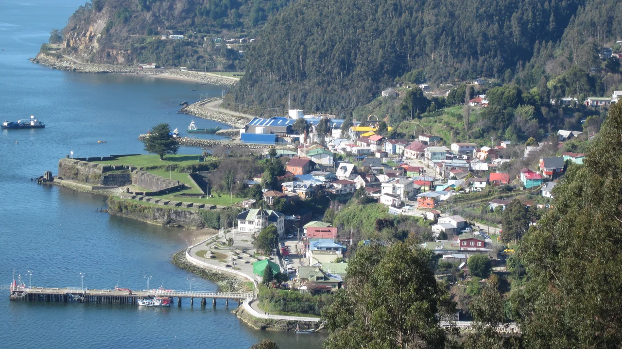

Corral
On a May afternoon in 1960, the sea drew back from Corral Bay and the people of this small Chilean port watched the water vanish. What came next was the largest earthquake science has ever measured, magnitude 9.5, and the wall of water it sent rolling back into the bay. Corral has spent its whole existence at the mercy of this stretch of coast, first as the armored gateway to a Spanish empire, later as an industrial gamble, and finally as ground zero for a catastrophe that would be felt across the entire Pacific.
The Gateway to Valdivia
Corral exists because of geography. The town sits on the southern shore of a bay that forms the seaward door to Valdivia, and in 1645 the Spanish made it the headquarters of the Valdivian Fort System built to seal that door against invaders. Spanish ships sailed up the river to Valdivia itself, but Corral took over the work of receiving the largest vessels. For a long time it was barely more than its guns; the fort held no more than four cannons until 1749. A real town only began to grow around the Castillo de Corral in the 1770s, and by 1798 the civilian settlement outside the fortress walls counted just 49 souls.
The Steel Boom That Wasn't
In 1910, Corral reached unexpectedly for the industrial age. The company Altos Hornos y Acerías de Corral opened what was then the largest steel mill in South America, its furnaces smelting pig iron with charcoal in a remote bay at the bottom of the continent. It was an audacious bet, and it failed slowly. The process was costly, the labor demands punishing, and the economics never closed. The mill limped through decades before shutting for good in 1958. The same century stripped away Corral's other advantages: new railways linked Valdivia and Osorno to central Chile, and the Panama Canal rerouted the shipping that had once made the port matter.
The Day the Bay Rose
On May 22, 1960, at 3:11 in the afternoon, the earth ruptured along the Chilean coast in the most powerful earthquake ever recorded. At Corral, the main port of the region, the water level climbed roughly four meters before it began to recede, the bay inhaling before the tsunami struck. The waves that followed swept through the town and tore its center apart, leaving Corral among the hardest-hit places on a coast where entire towns ceased to exist. The same tsunami would cross the ocean to kill people in Hawaii, Japan, and the Philippines. For Corral, it was the culmination of a long, hard relationship with the sea.
What the Water Left
Corral was once an important whaling port, its industry crippled during the First World War when supplies could not be imported, then revived afterward. Stilt houses lined the shore between Corral Bajos and Amargos; remnants of the old whaling infrastructure still rust on the land. Today a town of a few thousand people leans on forestry, fishing, aquaculture, and a growing trade in heritage and eco-tourism, reachable by road from Valdivia or by ferry across the bay from Niebla. Visitors come for the surviving Spanish fort, its weathered ramparts still facing the water they were built to command, watching over a bay that has shaped every chapter of this place.
From the Air
Corral lies at approximately 39.89°S, 73.43°W on the southern shore of Corral Bay, where the Valdivia River empties into the Pacific in Los Ríos Region. From the air the town is unmistakable: a small settlement at the foot of forested hills, its Spanish fort jutting on a point opposite Niebla across the bay mouth, with Mancera Island between them. The bay's narrow entrance and deep anchorage (maximum draught around 12 meters) explain both its strategic past and its exposure to tsunami surge. Recommended viewing altitude 2,000-3,500 ft to take in the fort, the bay geometry, and the ferry route to Niebla. Nearest airport is Pichoy / Valdivia (SCVD), roughly 30 km northeast. Expect frequent coastal rain and fog; clear days reveal the full sweep of the bay and the Coastal Range behind it.
Nearby Stories
- Riñihuazo 24 km away
- Lago Ranco 35 km away
- Villarrica 57 km away
- Sinking of Janequeo and Leucotón 91 km away
- La Imperial 95 km away
- Puyehue-Cordón Caulle 115 km away
- Isla Mocha 131 km away
- Battle of Agüi 224 km away