Crissy Field
Eighty-seven thousand tons. That is how much hazardous material was removed from Crissy Field before the site could become what it is today -- a restored tidal marsh and public beach stretching along the northern edge of San Francisco, framed by the Golden Gate Bridge to the west and the city skyline to the east. The land had been a salt marsh for millennia, then an Army airfield, then a toxic dump. Its transformation into one of the most popular urban parks in America required undoing more than a century of damage, one contaminated truckload at a time.
Before the Runways
For thousands of years, the Ohlone people harvested shellfish and fish from the 130-acre salt marsh and estuary that occupied this stretch of shoreline. Shell middens in the archaeological record document their seasonal camps. The Spanish arrived in 1776 and established El Presidio nearby, converting the wetlands to grazing and agricultural use. By the 1870s, the Army had begun filling in the marsh entirely. The transformation was completed just in time for the 1915 Panama-Pacific International Exposition, which needed flat ground nearby. After the fair, the Army paved over the filled marshland and created a kidney-shaped airfield with clay and sand runways.
Wings Over the Presidio
The field was named for Major Dana H. Crissy, the base commander of Mather Field in Sacramento, who died on October 8, 1919, when his de Havilland DH-4B crashed during a 61-airplane transcontinental reliability test. The Army accepted the facility as a sub-post of the Presidio on June 24, 1921. Its first unit, the 91st Observation Squadron, arrived from Mather that August. In its early years, the field served purposes both practical and pioneering: artillery spotting, aerial photography, liaison flights for headquarters staff, U.S. Air Mail support, and the first Western aerial forest fire patrols. Hangars and workshops lined the western edge, while officers' quarters perched on the bluff above, looking down at the aircraft below. The field remained active until 1974, when it closed as an operational airfield.
Digging Out the Damage
When the National Park Service took over the Presidio in 1994, they declared Crissy Field a "derelict concrete wasteland." Decades of military use had left the site saturated with hazardous chemicals. The NPS partnered with the Environmental Protection Agency to monitor contamination and with the Golden Gate National Parks Conservancy to plan a restoration. The largest private donation came from the Haas family foundations, which pledged $18 million -- at the time, the largest cash gift in National Park Service history. The project faced a fundamental tension: how to restore a culturally significant military airfield while simultaneously returning the landscape to something resembling the pre-military tidal marsh. The solution was to layer both histories into the design, preserving 1920s-era buildings while reconstructing wetlands around them.
The Marsh Returns
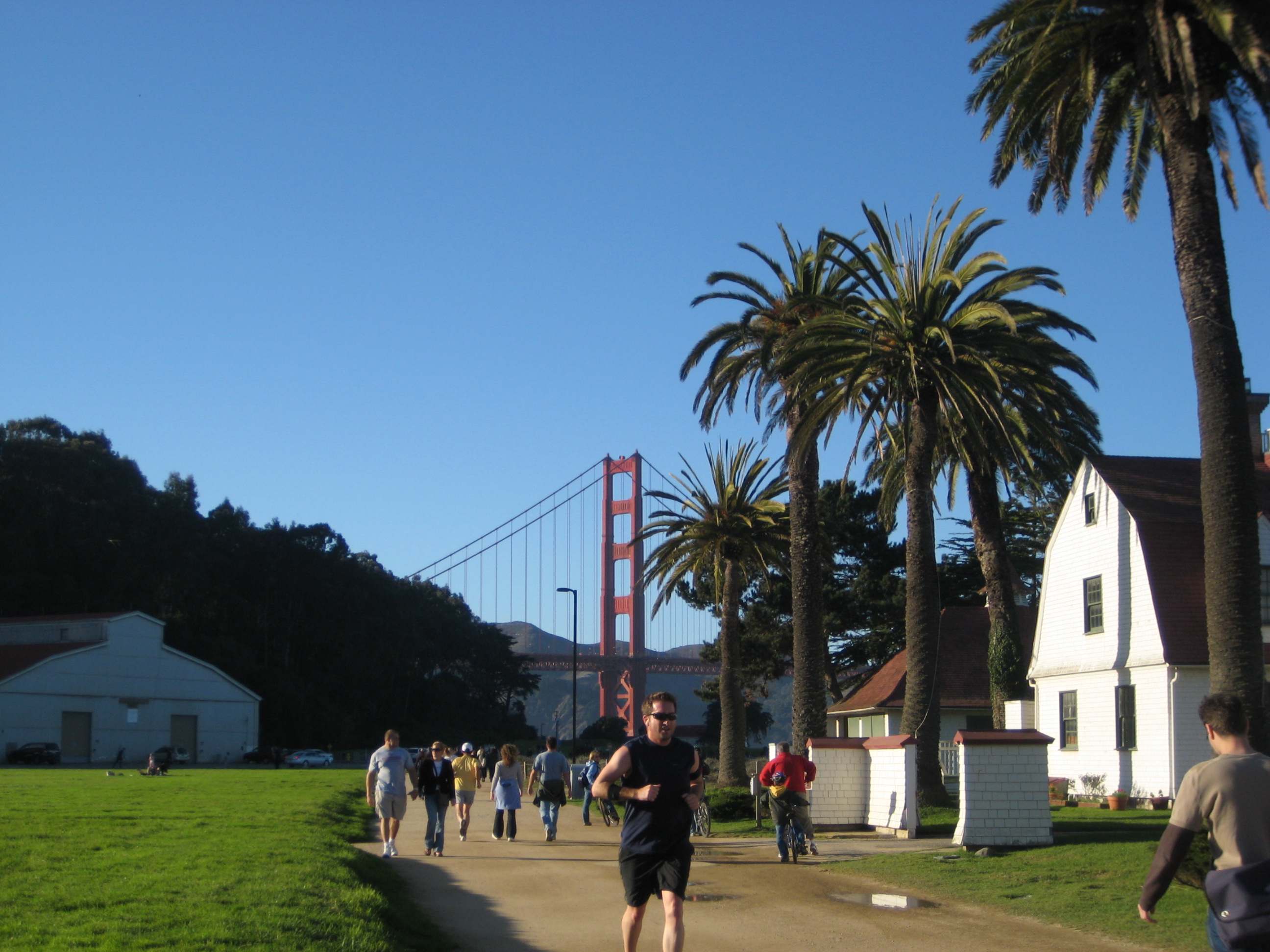
Crissy Field reopened to the public in 2001. The restored tidal marsh now hosts 17 fish species, and 135 species of birds have been spotted along its boardwalks. Sand dunes along the shoreline provide habitat for native plants that had been absent for over a century. The Golden Gate Promenade runs from the Crissy Field Center -- an environmental education facility for youth -- along the beach to the Warming Hut cafe near Fort Point. Joggers, dog walkers, and kite flyers share the path with birdwatchers scanning the marsh. The views are extraordinary: the Golden Gate Bridge fills the western horizon, Alcatraz floats in the middle distance, and on clear days the Marin Headlands seem close enough to touch. In 2013, SFMOMA placed eight massive Mark di Suvero sculptures on the field, steel abstractions set against the bridge cables. What was once a toxic dumping ground had become an outdoor gallery.
From the Air
Crissy Field is located at 37.8042N, 122.46W along the northern waterfront of San Francisco, immediately east of the Golden Gate Bridge. The former airfield is clearly visible from the air as a flat green strip between the Presidio and the bay. Best viewed from 1,500-3,000 feet AGL. Nearby airports: KSFO (San Francisco International, 12nm S), KOAK (Oakland International, 10nm E). The site is within San Francisco Class B airspace. Historic runway orientation was east-west.