Culebrita Lighthouse
On a mile-long key called Culebrita, accessible only by boat, the walls of a lighthouse built by the Spanish Crown are slowly coming apart. Construction began on September 25, 1882, and finished on February 25, 1886 -- not because the passage needed better navigation, though it did, but because Spain needed to plant a flag. The Culebrita Lighthouse was a sovereignty marker as much as a beacon, the easternmost light outside mainland Puerto Rico, guiding ships through the Virgin Passage and Vieques Sound and connecting the Puerto Rico Light System with the Cape San Juan Light on the mainland. It is the only remaining Spanish-era structure in the entire Culebra archipelago, and it is in danger of collapsing.
A Light to Claim an Island
In the 1880s, the Caribbean's island chains were still prizes to be held, and Culebra -- small, remote, barely inhabited -- was the kind of place that could slip from one empire to another through simple neglect. Building a lighthouse on Culebrita was Spain's way of saying the island mattered, that ships passing through the Virgin Passage would navigate by a Spanish light. The structure served that purpose for over a century, becoming one of the oldest operating lighthouses in the Caribbean. Mariners threading the passage between Puerto Rico and the Virgin Islands relied on its beam as they had relied on it since the final years of Spanish colonial rule. The lighthouse continued operating under American administration after 1898, a Spanish structure repurposed for a new sovereignty.
Abandoned Between Storms
In 1975, the U.S. Navy and Coast Guard closed the facility. The Coast Guard replaced the lighthouse with a solar-powered beacon -- functionally adequate, historically indifferent. The building was listed on the U.S. National Register of Historic Places on October 22, 1981, and added to the Puerto Rico Register of Historic Sites and Zones in 2001. Neither designation came with maintenance funding. The lighthouse stood empty, its stone walls absorbing salt air and rain, its interior open to whatever wandered in. Then came Hurricane Hugo in 1989, which caused extensive damage. Six years later, Hurricane Marilyn destroyed the tower. What remains is a structure that has been formally recognized as historically significant by two governments and actively maintained by neither.
A Foundation Without a Foundation
Since 1994, the Culebra Foundation has tried to attract local and federal attention to save the lighthouse. They have had little success. The challenge is partly logistical -- Culebrita is a half-mile-wide island with no permanent residents, no dock, and no road. Everything needed for restoration would have to arrive by boat. But the deeper problem is prioritization. Puerto Rico has no shortage of historic structures in distress, and a lighthouse on a tiny uninhabited key does not generate the political urgency that urban landmarks do. Visitors who make the boat trip from Culebra find a ruin that is equal parts beautiful and heartbreaking: thick stone walls framing empty windows, staircases leading to absent floors, vegetation reclaiming what the builders cut away. The views from what remains of the tower -- north toward the open Atlantic, south toward Culebra's green hills -- are among the most striking in the archipelago.
What the Walls Still Hold
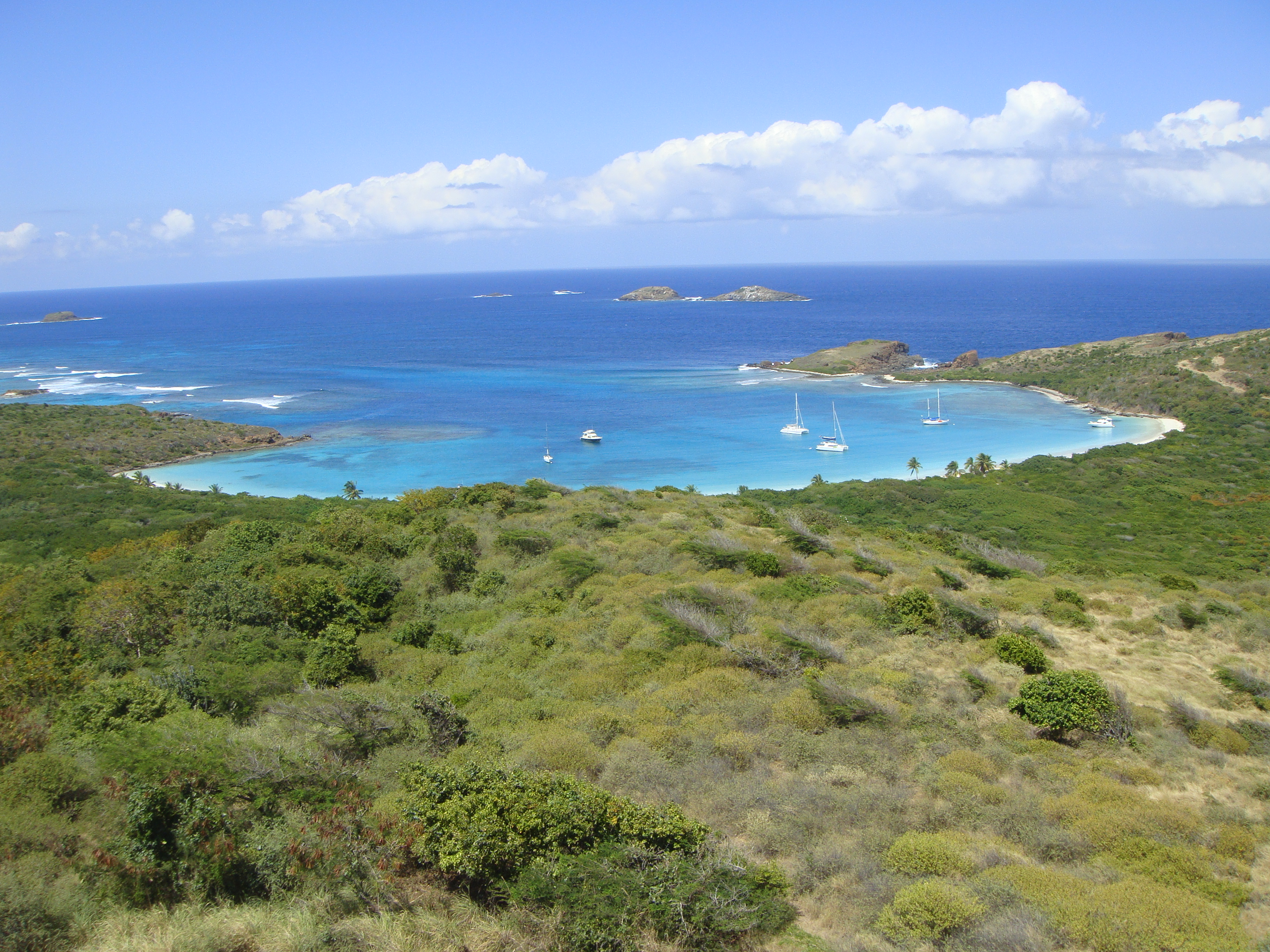
The lighthouse sits on Culebrita's highest point, and from that vantage the logic of its placement is obvious. Ships approaching from the east, from the Virgin Islands or the open Atlantic, would have seen this light before any other Puerto Rican beacon. The Virgin Passage below is deep water, a major shipping lane that connects the Atlantic to the Caribbean basin. Culebrita itself is a nature sanctuary, home to nesting seabirds and ringed by some of the clearest water in the region. The lighthouse anchors a landscape that has not changed much since 1886 -- the same rocky headland, the same turquoise shallows, the same wind. What has changed is the building itself, which edges closer to collapse with each passing hurricane season. Whether it survives long enough for restoration remains an open question that the salt air is answering a little more each year.
From the Air
Located at 18.303N, 65.219W on Culebrita, a small key east of Culebra island. The lighthouse ruin is visible from low altitude on the island's highest point. Culebrita is approximately one mile long and half a mile wide, with no airstrip. Nearest airport is Culebra's Benjamin Rivera Noriega Airport (TJCP), approximately 3nm to the west. The island is surrounded by clear turquoise water and is part of the Culebra National Wildlife Refuge. The Virgin Passage shipping lane runs to the east.