Cumberland Island
On September 21, 1996, John F. Kennedy Jr. and Carolyn Bessette slipped onto Cumberland Island by boat, walked into a one-room chapel called the First African Baptist Church, and filled its eight pews with friends and family. No media were permitted. The church, built by formerly enslaved people in the 1890s and rebuilt in the 1930s, sits in a community known simply as The Settlement. That a Kennedy wedding took place in a freedmen's church on a roadless barrier island off the Georgia coast says everything about Cumberland Island: it is a place where American stories overlap in ways that no one planned, layered across 4,000 years of continuous human presence on 36,415 acres of salt marsh, maritime forest, and undeveloped Atlantic beach.
The Oldest Footprints
Indigenous peoples settled Cumberland Island as early as 4,000 years ago. Later inhabitants spoke the Timucua language and belonged to the Mocama, a Timucua group whose Tacatacuru chiefdom controlled both the island and the adjacent mainland coast by the seventeenth century. The main village of Tacatacuru sat near the island's southern end. Spanish records document at least six additional villages on the island itself, with eleven more on the mainland. When the Spanish arrived in the 1550s, they named the island San Pedro and built a garrison and mission, San Pedro de Mocama, in 1603, folding Cumberland into the Mocama missionary province of Spanish Florida. The colonial era redrew the map repeatedly, but the island's isolation kept much of its character intact. When naturalist William Bartram visited in 1774, he found the island mostly uninhabited, its forests and marshes largely undisturbed.
Cotton, Carnegie, and Coca-Cola
Cumberland Island's modern history is inseparable from the families who claimed it. The Millers, a local family, grew the first long-staple Sea Island cotton here and helped Eli Whitney develop the cotton gin. Their estate, called Dungeness, burned in 1866. After the Civil War, formerly enslaved people stayed on the island, farming the Brick Hill area between 1862 and 1891. In the 1880s, The Settlement formed as a residential community for Black workers. The Carnegie family arrived in the Gilded Age, building grand estates across the island. The Candler family of Atlanta, whose fortune came from Coca-Cola, acquired part of the north end. At the height of the innkeeping era in the 1890s, the most prosperous hotel at High Point drew middle-class guests who arrived by steamboat and rode horse-drawn trolleys staffed by Black island residents. Hotel Cumberland was sold in 1918 and became a private club.
Wild Things
Cumberland Island's three major ecosystems give it a biological richness that belies its narrow footprint. Salt marshes line the western edge, where tidal creeks wind through mud flats. Inland, a dense maritime forest of gnarled live oaks draped in Spanish moss and edged by palmetto gives the island its brooding, prehistoric atmosphere. The eastern shore opens onto an unbroken stretch of Atlantic beach. The island's wildlife roster reads like a field guide sampler: white-tailed deer, raccoons, nine-banded armadillos, American alligators, and wild boars share the landscape. But the animals that define Cumberland Island are its feral horses, descendants of domesticated stock that roam freely through the dunes and forest. Offshore, the waters host endangered North Atlantic right whales, sea turtles, and dolphins, making the surrounding sea as ecologically significant as the island itself.
Saving the Island from Itself
In 1954, Carnegie family members invited the National Park Service to assess Cumberland Island's potential as a National Seashore. The agency declared it one of the most significant natural areas in the country. Then, in 1968, Carnegie descendants sold 3,000 acres to Charles Fraser, the developer who had transformed Hilton Head Island, South Carolina. Conservationist David Brower, then executive director of the Sierra Club, traveled to Cumberland to meet Fraser. Their negotiations were documented by John McPhee in his 1971 book Encounters with the Archdruid. Brower pushed for a 90/10 split, with ninety percent of the land left undeveloped. The prospect of condominiums and golf courses on Cumberland galvanized activists, the Carnegie and Candler families, the Georgia Conservancy, and the Sierra Club. They pressured Fraser to sell to the National Park Foundation and drove a bill through Congress. President Richard Nixon signed it on October 23, 1972, creating Cumberland Island National Seashore. Today there is still no bridge. The only public access is the Cumberland Ferry from St. Marys, Georgia, keeping the island as remote as the day Bartram walked its forests.
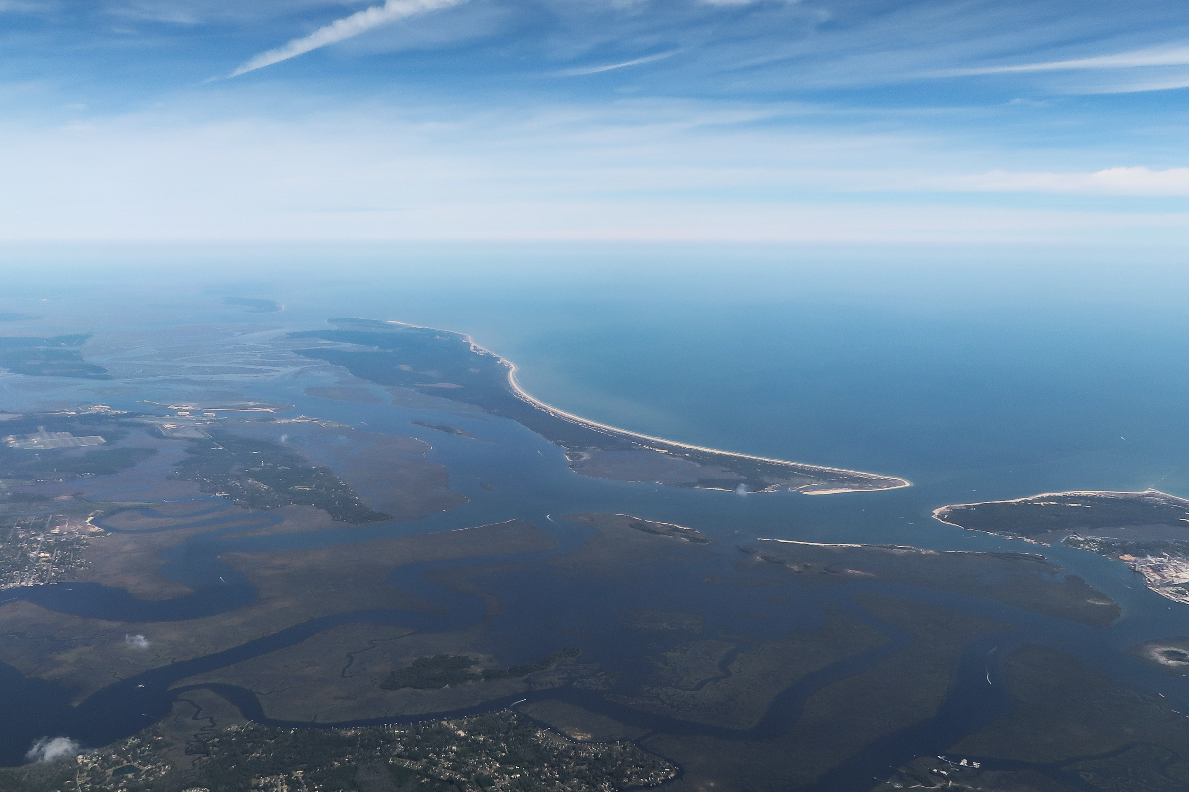
From the Air
Cumberland Island lies at 30.85N, 81.45W, Georgia's largest barrier island stretching approximately 18 miles along the coast in Camden County. The island has no bridge and is accessible only by ferry from St. Marys, GA. From altitude, the island's three ecosystems are clearly visible: salt marsh on the western edge, dense maritime forest in the center, and unbroken beach on the eastern Atlantic shore. Naval Submarine Base Kings Bay sits on the mainland directly opposite. The nearest airport is St. Marys Airport (4J6) on the mainland. Jacksonville International Airport (KJAX) is approximately 35 nm to the south. Best viewed at 3,000-5,000 ft AGL to appreciate the full length of the island and the contrast between developed mainland and wild barrier island.