Cypress Hills Interprovincial Park
No cypress trees grow here. French voyageurs mistook the lodgepole pines for the jack pines they called cyprès, and the name stuck to this forested plateau rising like an island from the surrounding grassland. The Cypress Hills climb to 1,468 meters at their western crown, making this the highest ground between the Canadian Rockies and Labrador. The twin provinces of Alberta and Saskatchewan share this elevated territory, creating Canada's first interprovincial park in 1989.
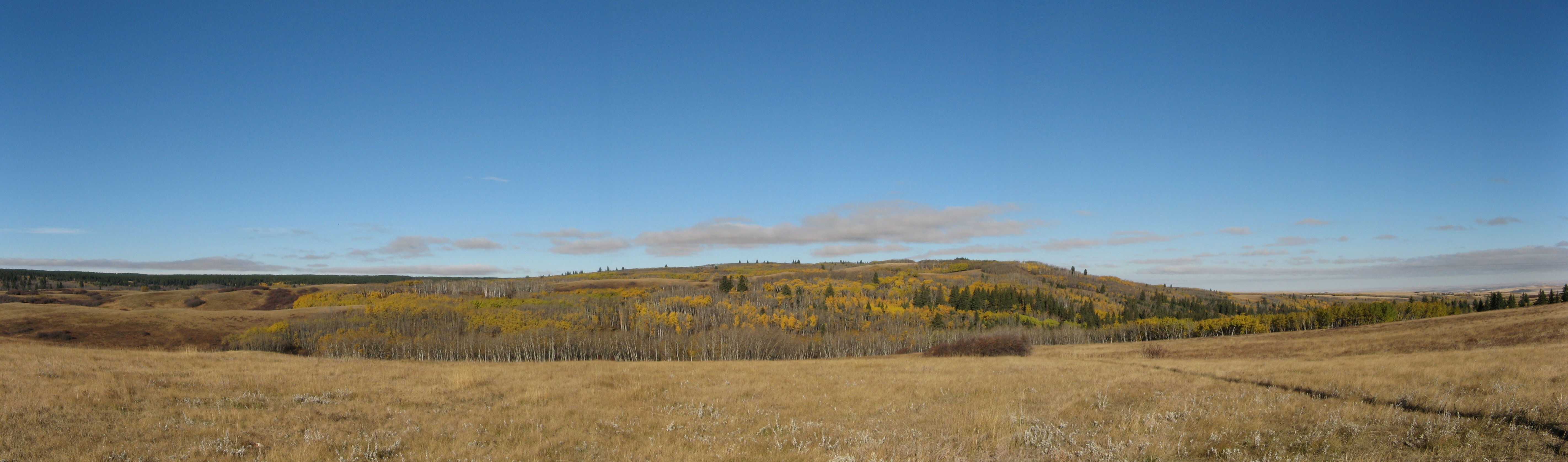
An Island in the Sky
The Cypress Hills escaped the glaciers that scraped the surrounding plains flat. While ice sheets a kilometer thick covered most of North America, these hilltops stood above the frozen tide, becoming a refugium where plants and animals survived the ice ages. The result is a biological anomaly. Walk the trails and you encounter flora more commonly found in Montana and Wyoming than anywhere else in Canada. Orchids bloom in fourteen different species. Cougars still patrol these slopes, ghosting through stands of spruce and aspen that have no business existing on the prairie.
Three Blocks, Two Provinces
The park divides into three distinct territories. Saskatchewan's Centre Block offers year-round facilities south of Maple Creek along Highway 21. The West Block remains wilder, providing rustic camping and access to Fort Walsh National Historic Site, where the North-West Mounted Police once maintained order during the turbulent 1870s. Across the provincial boundary, Alberta's portion centers on Elkwater Lake, where summer cabins cluster along the southern shore. Gravel roads connect the blocks, but winter often seals these routes, leaving each section isolated in its own white cocoon.
Where Darkness Matters
In September 2004, the Royal Astronomical Society of Canada joined with both provincial parks agencies to declare these hills a dark-sky preserve. The designation recognizes what prairie settlers knew instinctively. Away from the glow of cities, away from the sprawl of modern light pollution, the Cypress Hills offer one of the darkest skies on the continent. The Milky Way arches overhead with clarity that feels almost prehistoric. Star parties draw astronomers to these hilltops, their telescopes pointed at the same celestial displays that guided the peoples who hunted here for millennia.
Creatures of the High Prairie
Nearly 700 species of plants and animals make their home in this elevated ecosystem. The precipitation that falls on these highlands supports forests that the surrounding dry grassland cannot sustain. Wapiti graze the meadows. Mule deer and white-tailed deer browse the woodland edges. Pronghorn flash their white rumps across the open slopes. Bison, once extirpated, have returned to the landscape. The southern exposures tend toward prairie vegetation, while north-facing slopes wear dense forest. This creates a patchwork of habitats compressed into a relatively small area.
The View from Above
From flight altitude, the Cypress Hills appear as a dark smudge against the tawny prairie, their forested slopes obvious against the checkerboard of grain fields. The plateau rises gradually from Medicine Hat to the south, gaining elevation so steadily that the total climb approaches 500 meters before you reach the crown. Battle Creek threads through the central portions. The Trans-Canada Highway passes to the north, marking the most accessible route to this elevated territory. The nearest commercial airport is Medicine Hat, where the prairie begins its long ascent toward this improbable forest in the sky.
From the Air
Located at 49.58°N, 110.01°W, straddling the Alberta-Saskatchewan border. The plateau rises to 1,468 meters (4,816 feet) at Head of the Mountain. Visible as a distinct forested upland against surrounding prairie. Recommended viewing altitude 8,000-12,000 feet AGL for full plateau perspective. Nearest airport is Medicine Hat (CYXH), approximately 60 km northwest of the Alberta Block. Limited facilities and services in park area.