Dacian Fortresses of the Orastie Mountains
Somewhere in the Transylvanian highlands, Romans encountered walls they had never seen before. The Dacians had invented murus dacicus -- a construction technique that sandwiched rubble cores between inner and outer stone faces, cross-braced with timber beams socketed into the rock. The result was earthquake-resistant, siege-resistant, and unlike anything in the Roman engineering playbook. Six fortresses built this way crowned the ridgelines of the Orastie Mountains in what is now Hunedoara County, Romania, forming a defensive network that protected King Decebalus and his capital at Sarmizegetusa Regia. Rome would eventually break through, but it took two wars and one of the largest military campaigns in imperial history to do it.
A Kingdom Written in Stone
The six fortresses -- Sarmizegetusa Regia, Costesti-Cetatuie, Costesti-Blidaru, Piatra Rosie, Banita, and Capalna -- were built during the 1st centuries BC and AD across a mountainous corridor in the southern Carpathians. Five sit within Hunedoara County; the sixth, Capalna, lies just across the border in Alba County. Together they formed a layered defense for the Dacian heartland, with each fortress positioned to guard approaches, relay signals, and funnel attackers into killing grounds. Piatra Rosie -- Red Rock -- sat two days' march west of Costesti-Cetatuie, its 102-meter rectangular citadel perched on a hilltop that the builders had flattened to create a usable platform. Watch towers anchored each end, with outlying towers extending the line of sight. The Dacians understood terrain as well as any military planner in the ancient world.
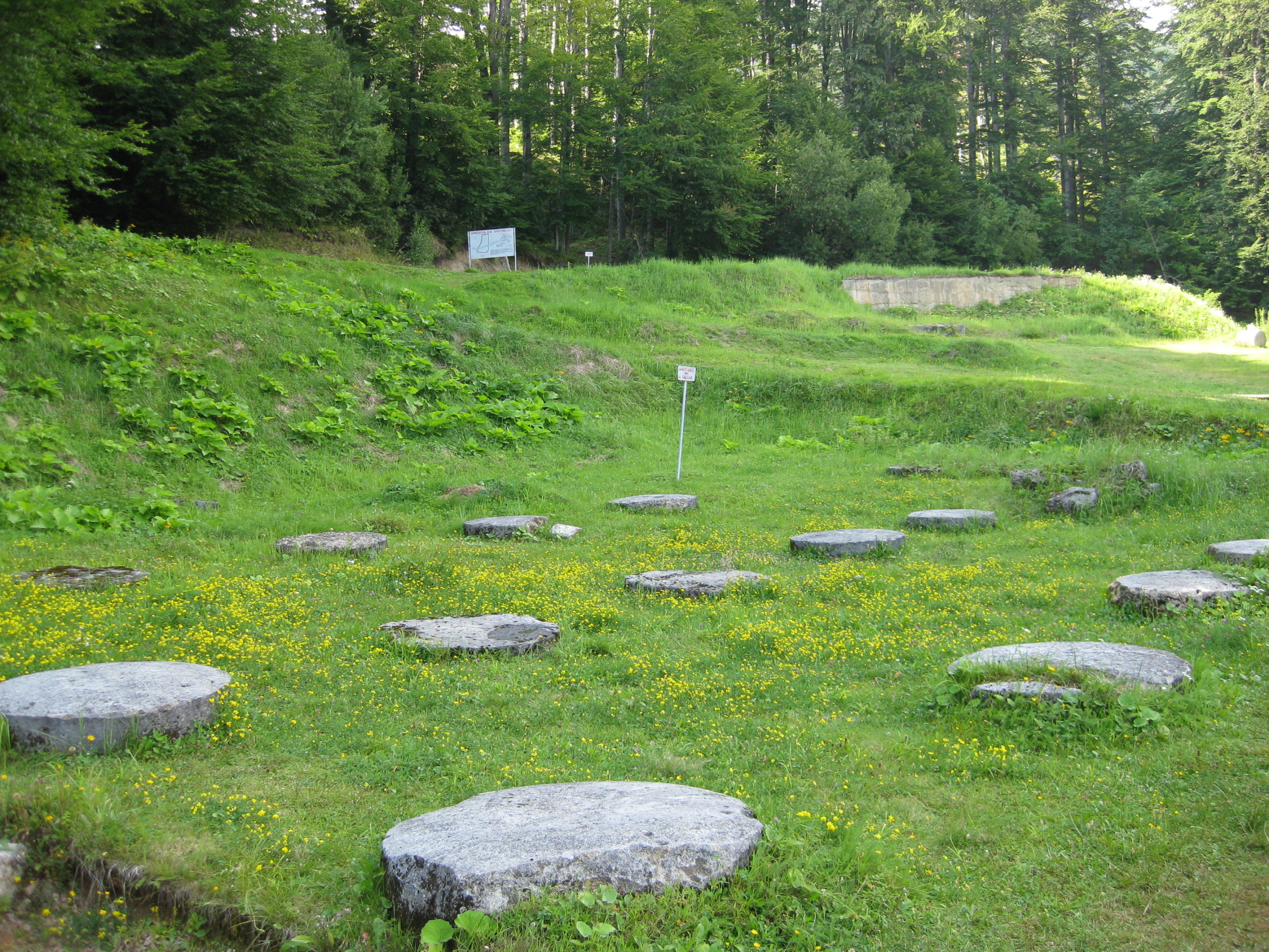
The Crown Jewel at 1,200 Meters
Sarmizegetusa Regia, the capital, occupied the summit of a 1,200-meter hill with commanding views in every direction. It was more than a fortress. The eastern side held a sacred precinct with a prominent plaza and circular shrines whose timber-post arrangements bear a passing resemblance to Stonehenge. Two settlement areas -- one east, one larger to the west -- housed nobles, servants, workshops, storage buildings, and agricultural processing facilities. Most remarkable for the era was a drinking water distribution system using ceramic pipes, channeling running water to residences. The Dacians had absorbed Greek and Roman knowledge of geometry and astronomy, and artifacts like the Andesite Sun -- an apparent sundial carved from volcanic stone -- suggest they put that learning to practical use.
Two Wars, One Conquest
The fortresses were designed to withstand exactly the kind of assault Rome eventually mounted. Emperor Trajan launched his First Dacian War in AD 101, and by 102 he had forced Decebalus into a humiliating peace. The Romans partly dismantled Sarmizegetusa's walls. But the Dacians rebuilt, possibly restoring fortifications in defiance of the treaty terms. Trajan returned in AD 105 with a massive army, and the Second Dacian War ended with the fall of Sarmizegetusa in 105-106 AD. The Romans established a military garrison on the ruins and began systematically tearing down the citadel -- not merely defeating the Dacians but erasing the physical symbols of their resistance. Trajan's Column in Rome, carved with 155 scenes of the campaigns, remains the most detailed visual record of these wars.
Treasure Hunters and Time
UNESCO designated all six fortresses as a World Heritage Site in 1999, recognizing what the organization called "a picture of a vigorous and innovative ancient civilization." The ruins are extensive and well-preserved enough to reveal the sophistication of murus dacicus construction, the layout of sacred and residential zones, and the strategic thinking behind the defensive network. But preservation has not been simple. Romania's weak archaeological protection laws have left the sites vulnerable to treasure hunters, who dig through the ruins searching for Dacian gold. The tension between national pride in these ancient monuments and the practical challenges of protecting remote mountain sites from looters and vandals defines the fortresses' modern story as much as their ancient one.
From the Air
Located at approximately 45.62N, 23.31E in the Orastie Mountains of Romania's southern Carpathians. The fortress sites are scattered across ridgelines at elevations between 800 and 1,200 meters. From the air, look for cleared hilltop ruins amid dense Carpathian forest. The terrain is mountainous with unpredictable weather; maintain safe altitude. Nearest significant airport is Sibiu International (LRSB), approximately 70 km east. Hunedoara and Deva, both in the valley below, provide ground reference points.