Dapitan Heritage Zone
Some cities wear their history openly. In Dapitan, on the northern coast of Mindanao's Zamboanga Peninsula, a compact district of heritage structures tells a story that stretches from prehistory through Spanish colonialism to the birth of Philippine nationalism. In 2011, the National Historical Commission of the Philippines designated a specific portion of downtown Dapitan as a Heritage Zone -- not for a single landmark, but for the density of history packed into a few walkable blocks. This is a place where a Jesuit mission from 1629, colonial-era buildings, and the sites of Jose Rizal's exile coexist within sight of each other.
Deep Roots in Mindanao
The Heritage Zone's significance begins with geology and archaeology. Dapitan is considered one of the oldest settlements in northern Mindanao, with prehistoric origins that predate any written record. The Subanens, an Austronesian people whose name derives from "suba" -- river -- were the earliest known inhabitants, living along the banks of the Dapitan River. When the Jesuits established a mission here in 1629, they were building on foundations that had supported human settlement for centuries. That layering of indigenous, missionary, and colonial history is precisely what the Heritage Zone designation recognizes: not a single era, but the accumulation of all of them in one place.
Where Rizal Walked
The Heritage Zone's most emotionally charged sites are tied to Jose Rizal, the physician, novelist, and reformist whom the Spanish colonial government exiled to Dapitan from 1892 to 1896. Rizal arrived and was initially detained at the Casa Real, the colonial governor's residence. He later moved to Talisay, a seaside barangay now preserved as the Jose Rizal Memorial Protected Landscape. But in the Heritage Zone itself, his presence lingers in the churches where he attended Mass, the plaza he helped beautify, and the streets he walked as a man forbidden from returning home. The concentration of Rizal-associated landmarks has earned Dapitan its official title: the "Shrine City of the Philippines."
Stone, Wood, and Official Recognition
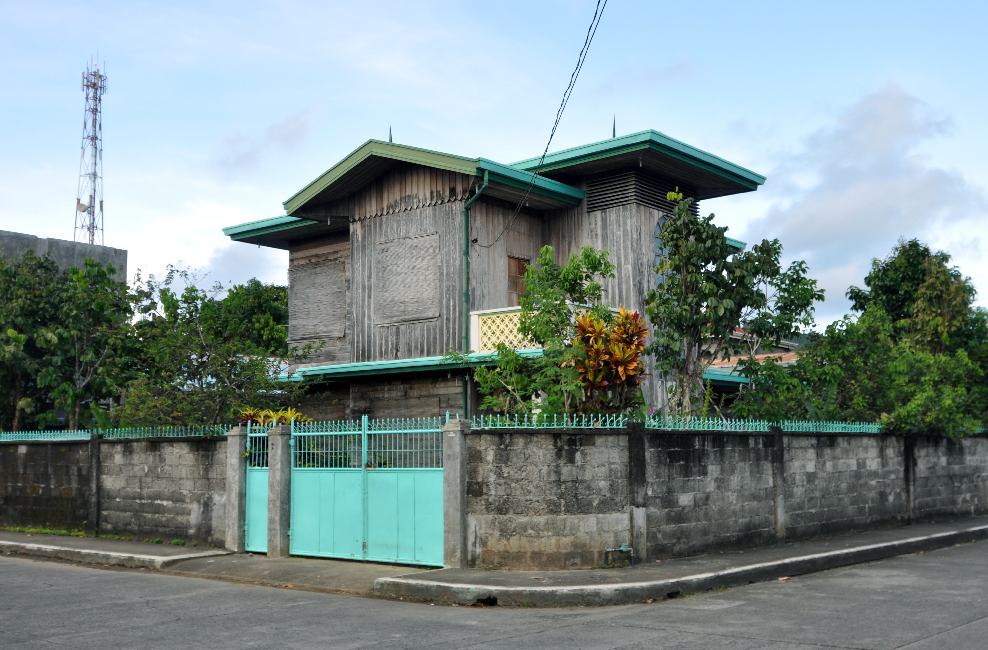
Within the Heritage Zone, several structures carry individual designations as National Historical Landmarks or National Cultural Treasures. The NHCP's 2011 board resolution cited the collection of heritage structures as a primary reason for the district-level declaration -- an acknowledgment that some places are more than the sum of their individual buildings. The churches, government buildings, and residences that survive here represent multiple architectural periods and construction techniques, from the thick coral-stone walls of Spanish-era churches to the wooden residential structures that reflect indigenous building traditions adapted to colonial requirements. Together, they form a streetscape that functions as a three-dimensional textbook of Philippine architectural and political history.
Living History on the Zamboanga Coast
The Heritage Zone is not a museum district frozen in time. Dapitan is a working city of nearly 88,000 people, and the heritage structures sit within an active urban fabric of markets, schools, and government offices. The challenge of preservation in a living city is real -- buildings age, typhoons strike, and development pressures are constant. But Dapitan's heritage designation, supported by the National Cultural Heritage Act of 2009 (Republic Act No. 10066), provides a framework for balancing preservation with growth. The zone is a short shuttle ride from Dipolog Airport, making it accessible to visitors exploring western Mindanao. For those who come, the reward is a place where the Philippines' layered history -- indigenous, colonial, revolutionary -- is not described in plaques but embodied in stone and wood, still standing under the Mindanao sun.
From the Air
The Dapitan Heritage Zone is located at approximately 8.66N, 123.42E on the northern coast of the Zamboanga Peninsula, Mindanao. From the air, look for the concentrated downtown area near the mouth of the Dapitan River on Dapitan Bay. Dipolog Airport (RPMG) is approximately 12 km to the east. The heritage district is near the waterfront and visible at lower altitudes. At 5,000-8,000 ft, the broader layout of Dapitan city and its position as the northernmost point of the Zamboanga Peninsula become clear.