Darién National Park
The Pan-American Highway stretches from Argentina to Alaska, threading through deserts, over mountains, and across plains for nearly 30,000 kilometers. Then it stops. In the lowland jungles of southeastern Panama, the road simply ends, swallowed by a wilderness so dense and so defiant that no engineer has managed to push through it. This 96-kilometer interruption is the Darién Gap, and at its heart sits Panama's largest national park: 5,790 square kilometers of rainforest, swamp, and coastline that form one of the most biologically intense places on Earth.
The Bridge Between Worlds
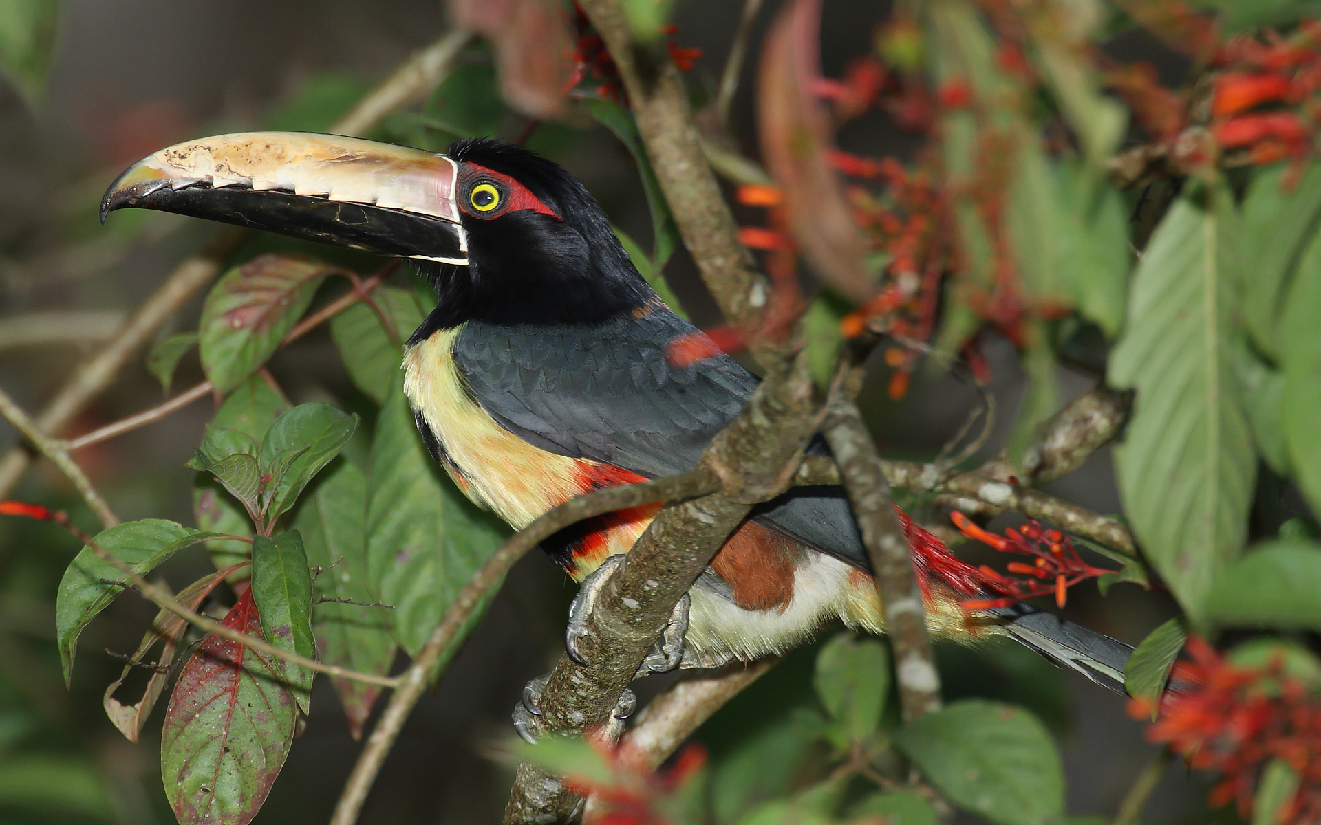
Darién National Park occupies a position of profound geographic significance. It sits on the land bridge connecting North and South America, a corridor that has channeled species in both directions for millions of years. Jaguars prowl territory here that links their populations across the hemisphere, and biologists have identified the park as one of seven places with the greatest long-term potential to sustain jaguar populations. The terrain ranges from Pacific coastline and mangrove estuaries at sea level to the cloud forests of Cerro Tacarcuna at 1,875 meters, passing through sandy beaches, rocky shores, palm forests, and countless freshwater wetlands along the way. More than 530 bird species have been recorded within its boundaries, including at least 30 restricted-range species found nowhere else. Among them, the harpy eagle -- Panama's national bird -- still hunts monkeys and sloths from the canopy, snatching prey with talons the size of grizzly bear claws.
Where People and Jungle Coexist
Darién is one of the few protected areas on Earth where indigenous communities continue to live within park boundaries. The Emberá and Wounaan peoples have called these forests home for centuries, building their villages along riverbanks and sustaining themselves through fishing, hunting, and small-scale farming. The Kuna people also maintain a presence in the region. These communities have preserved traditional practices -- from herbal medicine to the intricate body painting for which the Emberá are known -- despite centuries of contact with the outside world. Visitors who make the difficult journey into the park often arrive by pirogue, the dugout canoes that serve as highways along the Darién's many rivers, and the indigenous villages they encounter offer a window into a way of life that predates European contact by millennia.
Cana and the Ghost of Gold
Deep in the park's interior, near the eastern slope of Cerro Pirre, lies Santa Cruz de Cana. During the colonial era, Cana was one of the richest gold mines in the Western Hemisphere, attracting Spanish fortune-seekers who carved trails through the jungle to extract its wealth. The mines eventually played out, and the jungle reclaimed the settlement. Today Cana is renowned not for gold but for birds. Consistently ranked among the world's ten greatest birdwatching sites, it draws ornithologists who endure the arduous trek for a chance to spot species found nowhere else on the planet. On the opposite side of Cerro Pirre, the Pirre Station ranger post offers trails through primary forest thick with howler monkeys, spider monkeys, sloths, and tapirs. Travelers who stay in the basic dormitory there fall asleep to a chorus of frogs and insects that has sounded the same for thousands of years.
The Gap That Endures
Engineers have proposed closing the Darién Gap since the 1960s, and every attempt has stalled. Environmental concerns rank high among the reasons: a highway would fragment one of the last great wildlife corridors in the Americas and open fragile ecosystems to logging and settlement. There are also epidemiological fears, since the gap serves as a natural barrier preventing the spread of foot-and-mouth disease from South America to North American livestock herds. UNESCO designated the park a World Heritage Site in 1981, recognizing its exceptional biodiversity and the irreplaceable role it plays as a continental bridge. The designation has strengthened arguments against road construction, though illegal logging and encroachment remain constant threats. For now, the jungle holds. The highway ends, the forest begins, and somewhere in the canopy a harpy eagle watches from a ceiba tree, indifferent to the ambitions of the road below.
From the Air
Located at 7.74°N, 77.55°W in southeastern Panama, along the Colombian border. From the air, the park appears as an unbroken canopy stretching from the Pacific coast to the Serranía del Darién mountain range. The Darién Gap is visible as the point where cleared land and roads abruptly give way to dense forest. Nearest airports: Jaqué (MPJE) to the southwest and Yaviza airstrip to the northwest. Best viewed at moderate altitudes (5,000-10,000 ft) where the transition from settled land to wilderness is most dramatic. The Atrato and Tuira river systems are visible landmarks threading through the green.