Daulatabad Fort
In 1327, Sultan Muhammad bin Tughluq decided to move his capital. Not to a nearby city, not to a provincial seat, but 1,100 kilometers south from Delhi to a fortress called Devagiri, which he renamed Daulatabad, the City of Fortune. He ordered the entire population of Delhi to march there. The idea was not entirely irrational -- Daulatabad sat at the geographic center of his kingdom and was safer from Mongol raids that plagued the northern frontier. But the execution was catastrophic. Seven years later, Tughluq reversed the decision, earning himself the historical epithet 'Mad King.' The fortress he chose, however, was anything but mad. Its defenses were so ingenious that more than a thousand years of engineering, from the Yadava dynasty through the Mughals, could not render it obsolete.
A Hill Made Into a Weapon
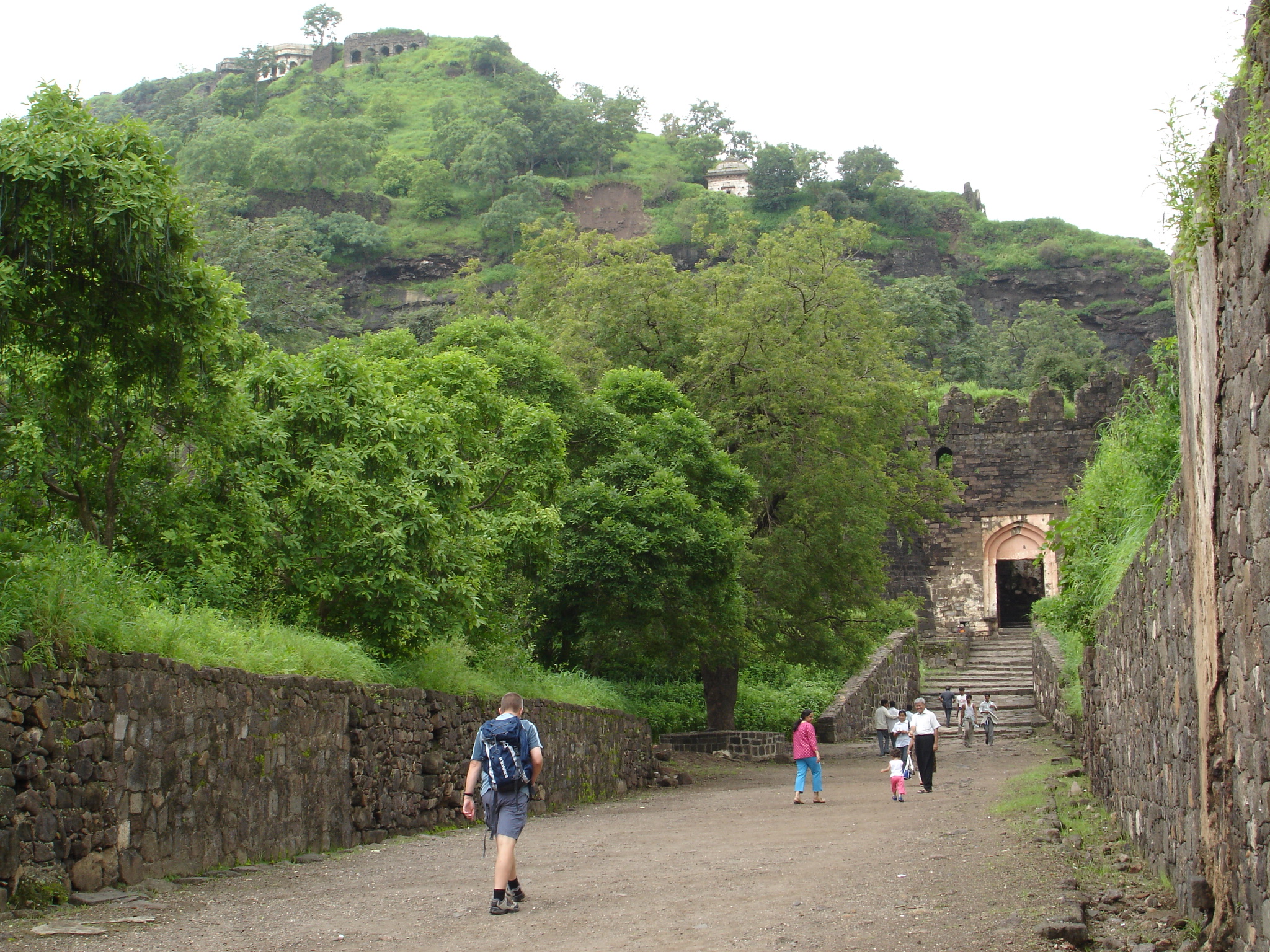
Daulatabad Fort rises from a conical basalt hill about 200 meters high, 16 kilometers northwest of Aurangabad. But the hill is not natural in the way visitors first assume. The Yadava rulers who began fortifying it around 1187 ordered the lower slopes carved away until the sides dropped vertically for 50 meters, creating sheer cliffs that no army could scale. At the base, they excavated a deep moat. Ancient sources describe crocodiles kept in the water to discourage swimmers. The only way up is a narrow bridge wide enough for two people abreast, leading to a long gallery tunneled through the living rock. The passage slopes gently upward, its monotony designed to lull invaders into complacency before the trap.
Architecture of Deception
Halfway up the tunnel, the gallery narrows to a steep staircase. Above the top step sits an iron grating, and in times of siege, the garrison above kept a fire blazing on it, turning the passage into an oven. The defenders also exploited psychology. There is no separate exit from the fort -- only the single entrance, designed to pull attackers deeper inside as they searched in vain for a way out. Parallel gates were deliberately avoided; instead, the approach uses curved walls and false doors to break an army's momentum. The flag mast sits on the left hill, tempting enemies to turn that direction, but the real gates open to the right while the left leads into dead-end traps. Gate doors were studded with iron spikes to kill war elephants used as battering rams. Every feature served a purpose, and the purpose was always the same: make the fort impossible to take by force.
Dynasties Written in Stone
The fort's history reads like a compressed timeline of medieval India. Bhillama V of the Yadava dynasty founded it around 1187 after breaking from the Chalukyas. The Yadavas ruled until Alauddin Khalji of the Delhi Sultanate raided Devagiri in 1296 and forced them into vassalage. Then came Tughluq's disastrous capital transfer. After the sultanate retreated north, Alauddin Bahmani built the Chand Minar in 1446, a 63-meter tower modeled on Delhi's Qutb Minar, employing Iranian architects who decorated it with lapis lazuli and red ochre. The Ahmadnagar Sultanate used Daulatabad as a secondary capital from 1499, and its Ethiopian-born prime minister Malik Ambar -- who had been brought to India as a slave and rose to lead a kingdom -- founded the nearby city of Aurangabad around 1610. The Mughals captured the fort in 1633, converting the elegant Chini Mahal palace into a prison. The Marathas took it in 1760.
The City That Shrank
Daulatabad once supported a sprawling capital city enclosed by the Ambarkot, an elliptical outer wall stretching two kilometers north to south. That wall, typically credited to Malik Ambar though it may date to the Tughluq period, enclosed mosques, markets, and residential quarters. The site has been occupied since at least 100 BCE, and remnants of Hindu and Jain temples similar to those at nearby Ajanta and Ellora survive within the fortifications. Today the great capital is a village. Most of the historic city lies unoccupied, its survival dependent on tourists who come to see the fort and stop on their way to the Ellora Caves, just 14 kilometers to the northwest. Massive old cannon still point outward from the summit over countryside that has long since stopped attacking. The fortress remains, outlasting every dynasty that built it, defended it, or tried to take it down.
From the Air
Located at 19.94N, 75.22E, approximately 16 km northwest of Aurangabad in Maharashtra. The conical hill with its vertically scarped sides is highly distinctive from the air and impossible to mistake for natural terrain. The Chand Minar tower is visible as a tall minaret near the hill. The Ellora Caves UNESCO site is 14 km to the northwest. Nearest airport: Aurangabad Airport (VAAU), approximately 20 km southeast. Best viewed at 3,000-6,000 feet to appreciate the engineered vertical walls, the moat, and the three concentric defense zones radiating outward from the hill.