Dawson City: The Gold Rush Town Built on Melting Ground
The buildings in Dawson City are drunk. They lean at angles, sag into softening ground, tilt toward each other like old friends unable to stand straight. The cause is permafrost - or rather, the loss of permafrost. Dawson City was built in 1896 on ground frozen solid for millennia, and the builders assumed it would stay that way. It hasn't. As the Yukon warms, permafrost thaws, and structures built on frozen ground find themselves settling unevenly into newly soft earth. The result is a gold rush town becoming a surrealist installation, its historic buildings demonstrating in real time what happens when the foundations of the world shift beneath your feet.
The Rush
Dawson City exploded into existence during the Klondike Gold Rush of 1896-99, growing from nothing to 40,000 people in three years. It was briefly the largest Canadian city west of Winnipeg, and the richest per capita city in the world. Prospectors who survived the journey over Chilkoot Pass descended the Yukon River to this confluence with the Klondike, where gold lay in the creeks for the taking. They built quickly, with whatever materials were available, on ground they assumed was permanent. The permafrost was foundation enough. Then the gold ran out, the population crashed, and Dawson became a frontier town with more history than people.
The Permafrost
Permafrost is ground that remains frozen for at least two consecutive years - in Dawson's case, for thousands. The Yukon's permafrost dates to the Pleistocene; it's been frozen since mammoths walked here. Buildings constructed on permafrost are stable as long as the ground stays frozen. But permafrost contains ice lenses - layers of pure ice within the soil matrix. When temperatures rise, the ice melts, the ground compacts, and anything built on top settles unevenly. The process is called thermokarst, and it's reshaping Dawson's architecture in slow motion.
The Warming
The Yukon is warming faster than almost anywhere on Earth - three times the global average. Permafrost that survived the Medieval Warm Period and every warm century since is now thawing. Ground temperatures that held steady for millennia are rising year by year. In Dawson, the effects are visible: buildings tilt, foundations crack, the ground itself seems uncertain. Roads buckle where permafrost was once reliable. Infrastructure designed for frozen ground struggles with increasingly unfrozen conditions. The changes will accelerate; permafrost, once thawed, doesn't refreeze easily.
The Architecture
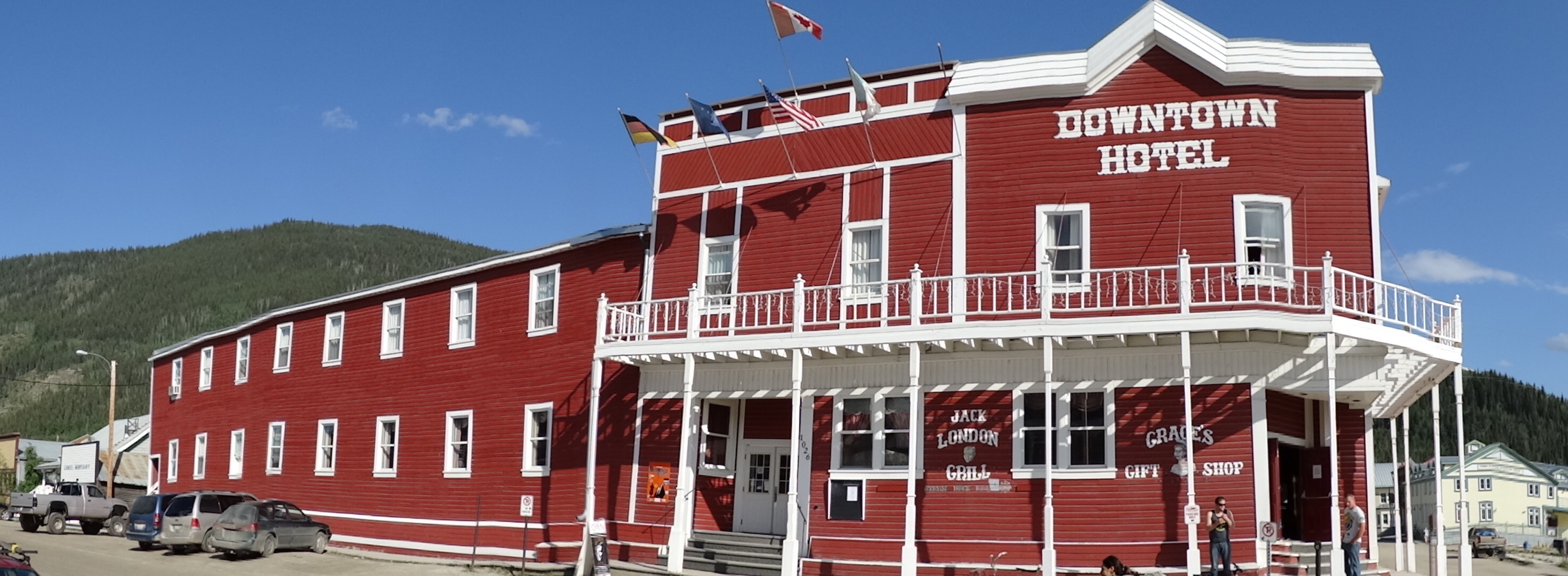
Dawson's tilted buildings are now a tourist attraction - the same permafrost damage that threatens infrastructure creates photogenic leaners that appear in every visitor's Instagram. The town has preserved many gold rush buildings, adapting them for continued use despite their angles. The strategies vary: some structures are jacked and leveled periodically; others are stabilized with new foundations; some are simply allowed to tilt as charm. The result is a town that looks pickled, preserved, slightly hallucinatory - historic preservation meeting geological uncertainty in a place that was never meant to be permanent anyway.
Visiting Dawson City
Dawson City is located at the confluence of the Yukon and Klondike Rivers, accessible via the Klondike Highway from Whitehorse (530 km). Air North operates flights from Whitehorse and Vancouver. The town preserves extensive gold rush history: Dredge No. 4 (the largest wooden-hulled gold dredge in North America), Discovery Claim on Bonanza Creek, and Diamond Tooth Gerties Gambling Hall (Canada's oldest casino). Walking tours highlight the leaning buildings. The Dawson City Museum interprets the gold rush. Summer brings midnight sun; winter brings aurora and -40°C temperatures. Services are limited compared to larger towns; book accommodations in advance for summer. The ferry crosses the Yukon River; the Top of the World Highway connects to Alaska (seasonal).
From the Air
Located at 64.06°N, 139.43°W at the confluence of the Yukon and Klondike Rivers. From altitude, Dawson City appears as a small grid of streets where two rivers meet, surrounded by forested hills scarred by gold mining. Tailings piles from dredging operations are visible along Bonanza and Eldorado Creeks. The town's historic buildings are too small to distinguish individually, but the town pattern is clear - a surprisingly orderly grid in complete wilderness. The Klondike Highway approaches from the south; the Top of the World Highway heads west toward Alaska. The Yukon River is broad and brown; the Klondike joins from the south. This was once one of the richest places on Earth; now it's slowly sinking.