Death Valley
Death Valley holds the record for the highest reliably recorded air temperature on Earth: 134°F (56.7°C) on July 10, 1913, at Furnace Creek. The name itself comes from the winter of 1849, when a group of gold seekers lost in the valley's maze of canyons watched some of their party die before finding an escape route. 'Goodbye, Death Valley,' one survivor reportedly said as they climbed out. The name stuck. Yet Death Valley is more than heat and death - it's a landscape of stark beauty, where salt flats shimmer below sea level, sand dunes glow at sunrise, and mountain peaks rise over 11,000 feet above the desert floor. It's one of the driest, lowest, hottest places in North America, and also one of the largest national parks in the contiguous United States, protecting 3.4 million acres of wilderness that kills the unprepared while astounding those who come ready.
The Geography
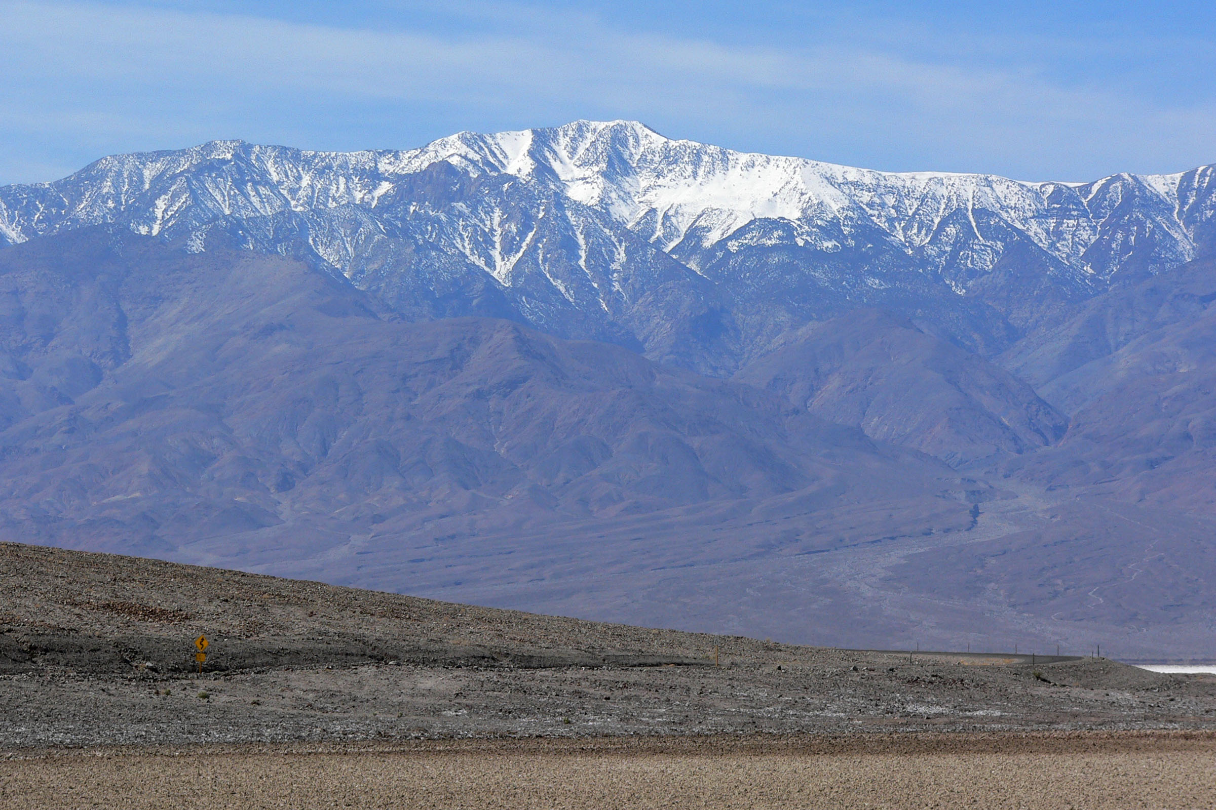
Death Valley lies between the Amargosa Range to the east and the Panamint Range to the west, a trough formed by the same geological forces that created the Basin and Range Province. Badwater Basin, at 282 feet below sea level, is the lowest point in North America. Telescope Peak, 15 miles away, rises to 11,043 feet - one of the greatest vertical reliefs in the contiguous United States. The valley floor is a mix of salt flats, sand dunes, alluvial fans, and volcanic craters. The surrounding mountains strip moisture from Pacific storms, creating a rain shadow so extreme that average annual precipitation is less than two inches. Summer temperatures routinely exceed 120°F; the ground surface can reach 200°F.
The History
The Timbisha Shoshone have lived in Death Valley for at least a thousand years, following seasonal migrations between the valley floor and cooler mountains. They called it Tümpisa, 'rock paint,' for the red ochre found in the canyons. The name 'Death Valley' came from the Forty-Niners, gold seekers who attempted a shortcut to California in the winter of 1849-50. Lost in the maze of canyons, the party split and scattered. At least one man died; others nearly did. The survivors, when they finally escaped through what's now called Emigrant Pass, left behind a name that captured their suffering. Later, prospectors found borax, gold, and other minerals, leaving ghost towns throughout the region.
The Heat
Death Valley's record temperature - 134°F on July 10, 1913 - is sometimes disputed, but modern measurements consistently reach 130°F in summer. The heat results from a combination of factors: the below-sea-level elevation concentrates air and heat; the surrounding mountains trap hot air; the lack of vegetation means nothing absorbs solar radiation; the dry air holds no moisture to moderate temperature swings. The salt flats reflect heat rather than absorbing it. People have died hiking here even in spring and fall. The National Park Service posts summer heat advisories and recommends avoiding hiking after 10:00 AM. Air conditioning failure can be fatal. The valley is beautiful but unforgiving.
The Mystery
Death Valley's most famous mystery is the 'sailing stones' of Racetrack Playa, rocks that appear to move across a dry lakebed, leaving trails behind them. For decades, no one witnessed the movement. Explanations ranged from wind to aliens to magnetic anomalies. In 2014, scientists finally documented the phenomenon: thin ice sheets forming on the playa after rare rain events, then breaking apart and being pushed by light winds, carrying rocks along. The explanation is satisfyingly mundane, but the trails remain eerie. Other mysteries persist: the strange acoustics of the sand dunes, the origins of the pupfish that survive in isolated springs, the ghost stories from abandoned mining camps.
Visiting Death Valley
Death Valley National Park is accessible year-round, though summer visits require extreme caution. The main visitor center at Furnace Creek provides orientation, exhibits, and ranger programs. Key sites include Badwater Basin (the lowest point), Dante's View (a spectacular overlook), Zabriskie Point (eroded badlands), Mesquite Flat Sand Dunes, Artists Drive (colorful volcanic deposits), and the ghost town of Rhyolite just outside the park. Lodging ranges from the historic Furnace Creek Inn to campgrounds at various elevations. Spring (March-May) brings wildflower blooms and moderate temperatures. Winter offers comfortable hiking weather. Summer visitors should carry abundant water, check vehicle radiators, and avoid midday outdoor activity. Las Vegas (LAS) is 120 miles southeast; the park is also accessible from Los Angeles (270 miles) and Reno (280 miles).
From the Air
Located at 36.50°N, 117.08°W in eastern California and western Nevada, between the Amargosa Range and Panamint Range. From altitude, Death Valley is unmistakable - a vast, pale depression surrounded by brown and purple mountains. The salt flats of Badwater Basin appear white; sand dunes are visible near Stovepipe Wells. The stark contrast between the below-sea-level valley floor and the mountain peaks is dramatic from the air.