Death Valley National Park
On July 10, 1913, the temperature at Furnace Creek reached 134 degrees Fahrenheit - the hottest air temperature ever reliably recorded on Earth. This is Death Valley's signature: extremes that strain comprehension. The park contains both the lowest point in North America (Badwater Basin, 282 feet below sea level) and mountains rising above 11,000 feet. It receives less than two inches of rain annually yet contains pupfish that have survived here since the Pleistocene. Gold prospectors in 1849 gave the valley its name after a harrowing crossing killed one of their party, but millions of visitors now come to experience a landscape that seems to belong on Mars rather than California.
The Lowest Place
Badwater Basin sits 282 feet below sea level, the lowest point in North America. The salt flats that stretch across its floor formed as an ancient lake evaporated, leaving behind layer upon layer of concentrated minerals. From this nadir, the Panamint Range rises more than 11,000 feet to the west - one of the greatest vertical reliefs in the contiguous United States. Telescope Peak, the highest point in the park at 11,049 feet, sometimes wears snow while temperatures on the valley floor exceed 120 degrees. The geological story is one of fault-block mountains and a sinking basin, the landscape still stretching and dropping as the earth's crust pulls apart. Every geological era has left its mark: ancient metamorphic rocks, fossil-bearing limestones, volcanic cinder cones, and the alluvial fans that spill from every canyon mouth.
Sculptors of Stone
Death Valley's geology provides a master class in erosion. Artist's Palette displays hillsides streaked with oxidized metals - green, pink, purple, gold - the remnants of volcanic ash weathered into surreal bands of color. Zabriskie Point overlooks badlands carved from lake sediments five million years old, the soft mudstone eroded into ridges and gullies that glow gold at sunrise. The Racetrack, accessible only by rough dirt road, features stones that slide across a dry lakebed, leaving trails hundreds of feet long - a mystery solved only recently as wind pushes the rocks across thin sheets of ice. The moving rocks, the sculpted canyons, the sand dunes that can reach 680 feet - Death Valley is landscape as art, shaped by forces that continue their work while we watch.
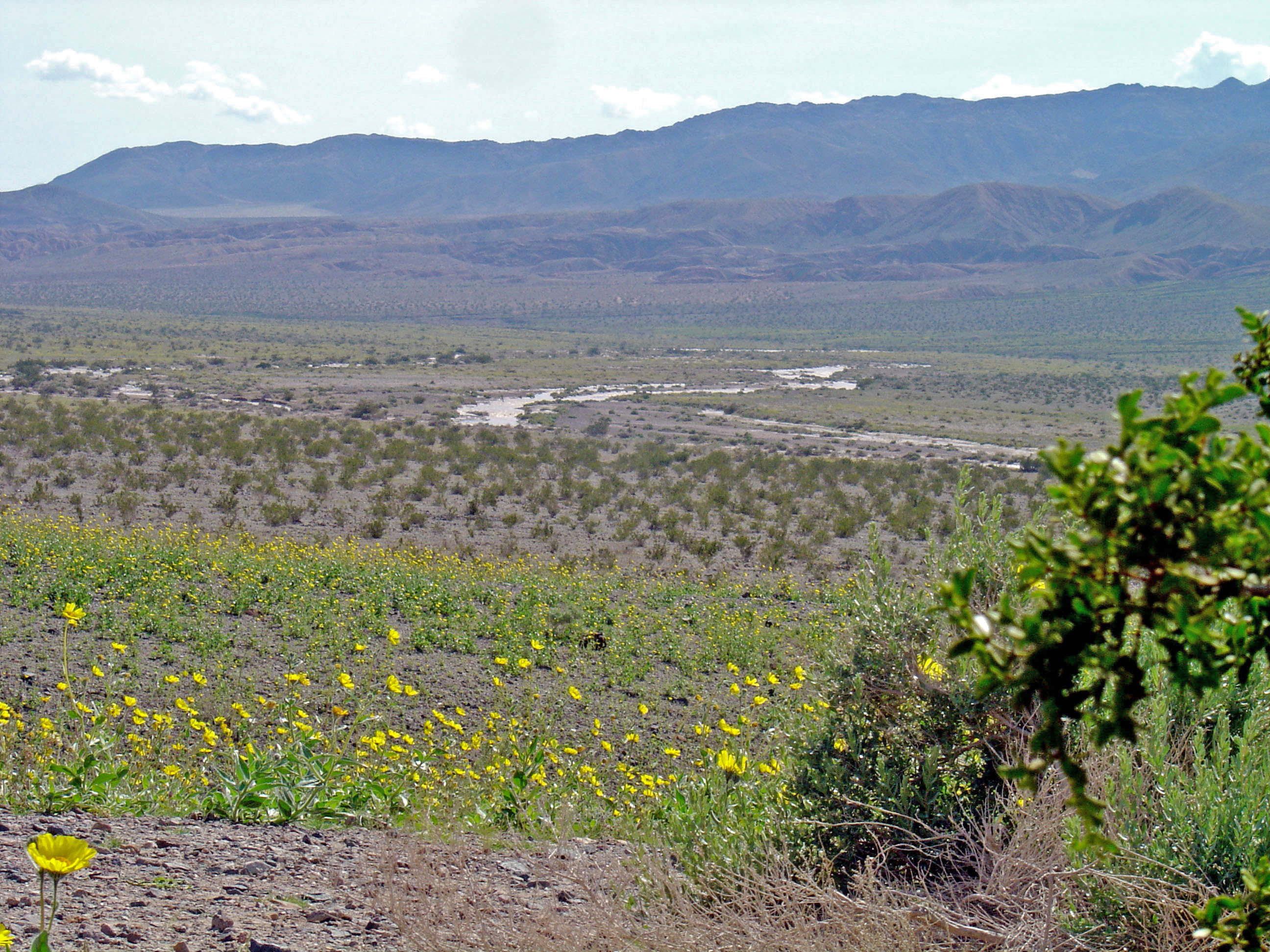
Life at the Edge
Despite its name, Death Valley teems with life adapted to extremes. Desert bighorn sheep navigate the mountains, descending to springs that dot the park. Over 350 bird species have been recorded. Most remarkable are the pupfish - tiny iridescent fish that survived the drying of ancient Lake Manly by evolving to tolerate conditions that would kill most aquatic life. The Devils Hole pupfish lives only in a single limestone cavern pool, the most restricted habitat of any vertebrate species on Earth. Creosote bushes space themselves precisely to share scarce water. Kangaroo rats never drink, extracting all moisture from seeds. After rare wet winters, wildflowers carpet the valley floor in March and April, a riot of color that proves life's determination to flourish even in Earth's harshest desert.
Mining's Ghost Towns
The valley's human history is written in abandoned mines and ghost towns. Borax mining made the region famous - twenty-mule-team wagons hauled the white mineral 165 miles to the railroad, a ten-day journey across brutal terrain. The Harmony Borax Works ruins still stand near Furnace Creek. Gold and silver strikes brought prospectors who built towns that thrived briefly and died when ore ran out: Rhyolite, near the park's eastern boundary, grew to 10,000 residents by 1908 and was essentially abandoned by 1920. Its ruins - a bank, a jail, a train station, a house built entirely of bottles - now serve as monuments to boom-and-bust optimism. Scotty's Castle, a Spanish-style mansion built in the 1920s, tells a different story: a con man convinced a Chicago millionaire to fund a gold mine that never produced, but the resulting estate became a desert landmark.
Surviving the Valley
The name serves as warning. Unprepared visitors die here every year, and the park makes no effort to soften its reality. Summer temperatures routinely exceed 120 degrees; touching a dark car surface can cause burns. Winter brings mild days but freezing nights at higher elevations. Flash floods roar down canyons during rare storms, sweeping away anything in their path. Cell phone service barely exists. The park covers 3.4 million acres - larger than Connecticut - with few paved roads and vast areas accessible only by high-clearance four-wheel-drive. Those who come prepared discover a landscape of profound silence and stark beauty, where the stars blaze undimmed by light pollution and the geology stretches back billions of years. Just bring more water than you think you'll need, and then bring more.
From the Air
Located at 36.45°N, 117.09°W on the California-Nevada border. The valley is visible as a long north-south trough between the Panamint Range to the west and the Amargosa Range to the east. Badwater Basin appears as a white salt flat at the valley's lowest point. The park covers 3.4 million acres - larger than Yellowstone. Las Vegas (KLAS) is the nearest major airport, 2 hours east. Small airstrips exist at Furnace Creek and Stovepipe Wells. The dramatic elevation contrast between valley floor (below sea level) and surrounding peaks (above 11,000 feet) is visible from altitude. Sand dunes near Stovepipe Wells are prominent features.