Deception Pass State Park
The water below the bridge doesn't behave like water should. It roils and churns, forming whirlpools that spin and collapse, standing waves that appear and vanish as the tide forces its way between islands. Deception Pass is a narrow, violent strait where Puget Sound's tidal flow squeezes through a gap barely wide enough for ships to navigate, the current reaching eight knots at peak flow. Above this chaos, the Deception Pass Bridge arches 180 feet in the air, connecting Whidbey Island to Fidalgo Island and the mainland beyond. Two million visitors cross each year, most pausing to stare at the spectacle below, some hiking down to the water's edge to feel the power of a tide that seems almost alive.
The Treacherous Strait
Captain George Vancouver felt deceived. In 1792, his expedition explored what appeared to be another inlet in Puget Sound's maze of waterways, only to discover it was a strait separating an island from the mainland - and a dangerous one at that. He named it Deception Pass, and the name has stuck for over two centuries. The passage is narrow, bounded by cliffs, swept by currents that change direction with the tide.
Boaters still wait for slack water before attempting the pass. The current creates standing waves during strong tides, upwellings that can swamp small craft, eddies that spin boats like toys. Kayakers sometimes shoot the rapids intentionally, riding the chaos like a whitewater river. But this is saltwater wilderness, unpredictable and powerful, demanding respect from everyone who enters. The bridge above offers the safest view - a grandstand seat for nature's hydraulic theater.
The Iconic Bridge
Before 1935, ferries shuttled between Whidbey and Fidalgo Islands, their captains timing crossings to avoid the worst of the current. The Deception Pass Bridge changed everything - two steel arch spans connected by Pass Island, carrying State Route 20 over the void. The bridge was a Depression-era public works project, built by the Civilian Conservation Corps with Art Deco styling that has aged into timeless elegance.
Walking across is both exhilarating and vertiginous. The pedestrian walkway hugs the edge, separated from the water below by a railing that feels impossibly low. Wind whips through the steel structure. Below, the current swirls past the cliffs. On clear days, Mount Baker floats on the northern horizon, its glaciers catching morning light. The bridge has become one of the most photographed structures in Washington - a human achievement perfectly framed by natural drama.
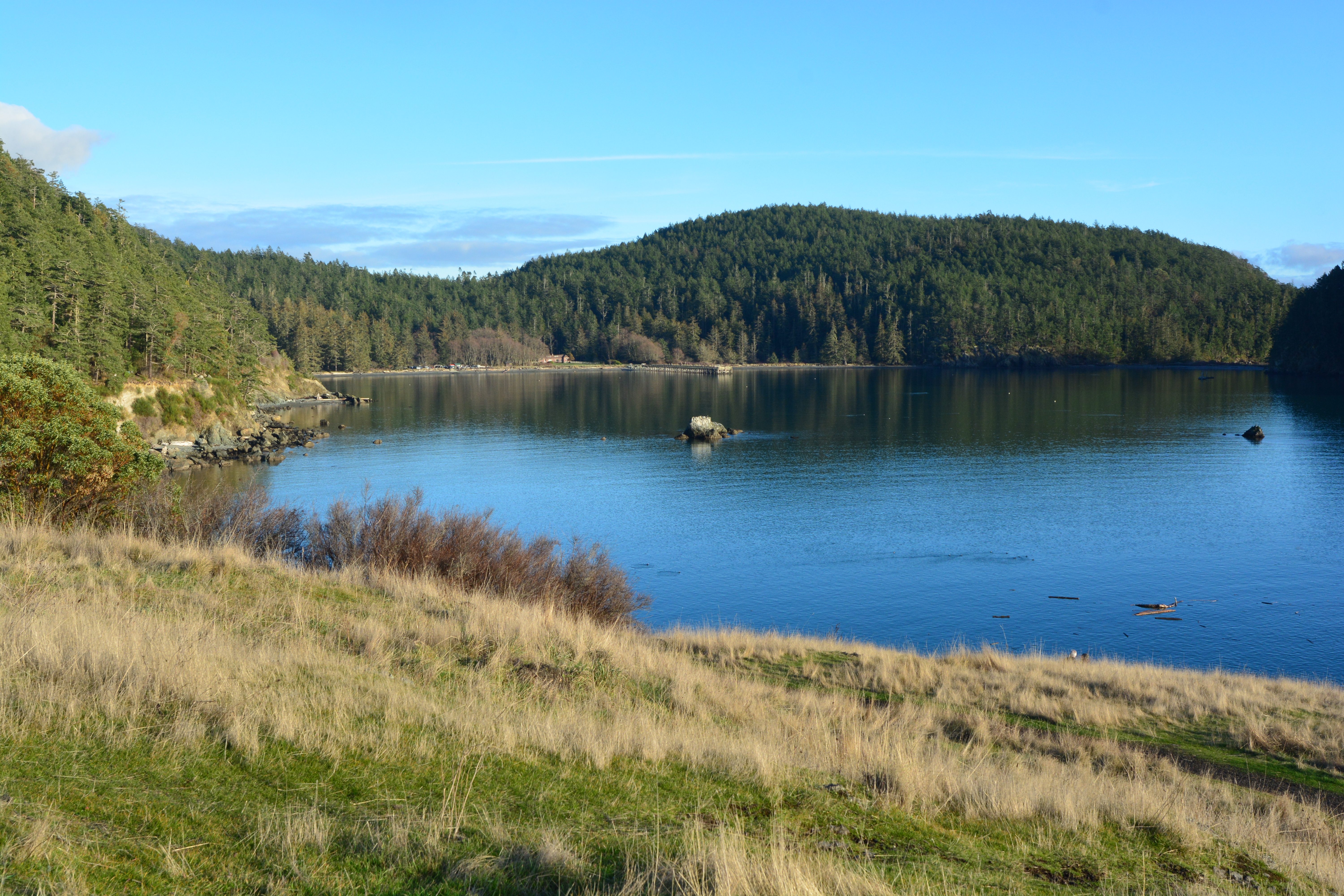
Two Islands, One Park
Deception Pass State Park spans both sides of the strait, encompassing nearly 4,000 acres of forest, beach, and rocky coastline. The Whidbey Island section holds most of the campgrounds and the expansive West Beach, a crescent of sand facing the Strait of Juan de Fuca. The Fidalgo Island section offers rocky shores, tide pools, and trails through old-growth forest to viewpoints overlooking the San Juan Islands.
Each side has its character. Whidbey's beaches draw families and sunset watchers, the sand stretching toward distant Olympics. Fidalgo's rocky points attract tide-poolers and marine wildlife watchers - seals haul out on offshore rocks, and orcas occasionally cruise the strait's entrance. The transition between sides takes only minutes by car, but the landscapes feel remarkably different: pastoral and open on Whidbey, rugged and forested on Fidalgo.
The Underwater Realm
The same currents that make Deception Pass treacherous for boats make it spectacular for marine life. The constant flow brings nutrients from the deep, supporting an ecosystem that thrives in the turbulence. Divers who brave the conditions report walls covered in colorful invertebrates - orange and white plumose anemones, purple and pink soft corals, giant barnacles the size of golf balls. Lingcod and rockfish patrol the rocky outcrops.
Diving the pass is not for beginners. The window of safe conditions is narrow - a few minutes at slack tide before the current reasserts itself. Divers must time their entry precisely, knowing that the flood will return with force. But those who make the dive report some of the most vibrant underwater scenery in the Pacific Northwest, a reef ecosystem hidden beneath waters that look too turbulent to support life.
Ancient Forests
Away from the water's edge, the park protects stands of old-growth forest that escaped the logging that stripped most of Puget Sound's shores. Douglas firs tower overhead, their trunks five feet in diameter, their lower branches long since shaded out. Western red cedars spread their drooping foliage in the understory. Madrones - those distinctively Pacific Northwest trees with peeling red bark and twisting trunks - cling to rocky outcrops where the forest thins.
The trail system winds through these forests, connecting viewpoints and beaches, offering loop hikes of various lengths. Goose Rock rises 484 feet from the Whidbey side, its summit accessible via a trail that climbs through forest to open rock with panoramic views. On a clear day, you can see from Mount Baker to the Olympics, the San Juan Islands scattered across the water below, the bridge tracing its elegant arc across the gap.
From the Air
Located at 48.41°N, 122.64°W. The park straddles the narrow strait between Whidbey Island (south) and Fidalgo Island (north). The Deception Pass Bridge is clearly visible - a distinctive double-span steel arch structure crossing the waterway via Pass Island. Look for the turbulent water patterns in the strait during tidal changes. West Beach appears as a prominent sandy crescent on Whidbey's north shore. Cranberry Lake is visible inland. The park's forests appear dark green against the surrounding water. Mount Baker (10,781 ft) is visible to the northeast. Nearest airports: Anacortes (74S), Whidbey Island NAS (KNUW), Bellingham International (KBLI) 25nm north. The strait can generate significant turbulence at low altitudes.