Delta National Wildlife Refuge
There is no road to Delta National Wildlife Refuge. No parking lot, no visitor center, no paved trail. To reach this 49,000-acre expanse of marsh and open water east of Venice, Louisiana, you go by boat or you do not go at all. That inaccessibility is the point. Established in 1935 at the very mouth of the Mississippi River, the refuge exists for creatures that arrive on wings rather than wheels. During peak winter months, surveyors have counted more than 400,000 ducks and geese crowding its shallow waters and mudflats, drawn to one of the most productive wetland ecosystems on the Gulf Coast.
A Landscape Built by Catastrophe
The land beneath Delta National Wildlife Refuge did not exist before 1862. That year, the Mississippi River punched through its own natural levee roughly downstream of New Orleans, unleashing a torrent of sediment-rich water into the shallow Gulf. Over the following decades, that sediment settled, accumulated, and hardened into new ground. Fresh marsh formed closest to the river's tributaries, covering roughly 60 percent of what would become the refuge. Brackish marsh filled in closer to the Gulf of Mexico. The result is a landscape defined by tidal fluctuation, where water levels shift inches to a foot with each cycle, nourishing soils so fertile they support a dense carpet of delta duck potato, roseau cane, wild millet, and elephant ear. It is a place still being made, still shifting, still dissolving at its edges.
The Great Flyway Crossroads
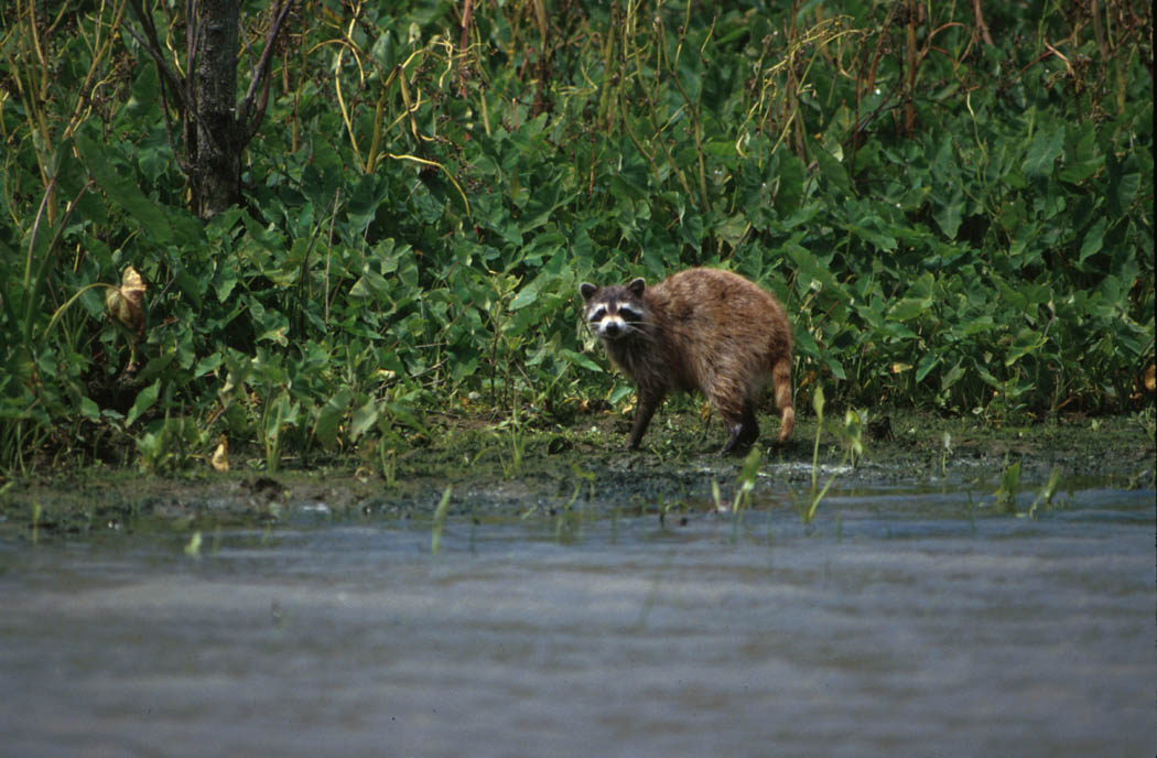
Delta NWR sits at a critical juncture of the Mississippi Flyway, and the diversity of birdlife passing through reflects that geography. Tens of thousands of shorebirds use the refuge as a staging area during spring and fall migrations, including greater and lesser yellowlegs, long-billed dowitchers, dunlins, western sandpipers, and willets. Raptors patrol the marshes year-round: American kestrels, northern harriers, and red-tailed hawks are the regulars, while ospreys arrive as common winter visitors. During migration season, enormous numbers of passerine songbirds descend on the refuge to rest and refuel. Wading birds nest among the reeds in large colonies, and deer pick their way along natural pass banks and spoil banks. Beneath the surface, the waters serve as a nursery for both freshwater and saltwater species, from speckled trout and redfish to catfish and largemouth bass. The most abundant furbearer on the refuge is the nutria, the invasive South American rodent that has become a permanent fixture of Louisiana's marshes.
Shelter for the Threatened
Beneath the refuge's seemingly uniform expanse of waving grasses, a quiet conservation drama plays out. Delta NWR provides critical habitat for several endangered and threatened species, including the American alligator, the brown pelican, the Arctic peregrine falcon, and the piping plover. The refuge's two marsh zones, fresh and brackish, create overlapping habitats that support an unusually wide range of organisms. Blue crabs and shrimp inhabit the saltwater margins. Various sunfish species populate freshwater pockets closer to the river's distributaries. This mosaic of salinity and vegetation makes the refuge an irreplaceable nursery, a place where the next generation of Gulf marine life gets its start in sheltered, nutrient-dense shallows.
Storms, Spills, and Survival
Delta NWR has absorbed blows that would have erased a less resilient landscape. Hurricane Katrina struck the refuge head-on, severely damaging the sub-headquarters in Venice, eroding marsh and beach areas, toppling trees, and driving saltwater deep into freshwater zones. Oil spills and a grounded barge compounded the storm damage. Debris scattered across the refuge took years to clear. Then in 2010, the oil slick from the Deepwater Horizon explosion, the largest accidental marine oil spill in history, surpassing even the Exxon Valdez disaster in volume, reached the refuge's waters. Camping is no longer allowed on the refuge. Yet the marshes persist. The tides still rise and fall, the sediment still settles, and each autumn the sky darkens with arriving waterfowl. The delta continues to do what it has done since that levee breach in 1862: build, erode, and rebuild.
Where River Meets Gulf
Flying over the refuge, the geometry of the Mississippi's final reach becomes unmistakable. The river splits into branching distributaries that finger outward into open water, each channel fringed with emerald marsh that fades to brown at its seaward edges. The transition from freshwater to saltwater is visible in the changing vegetation below. From altitude, you can trace the plumes of sediment still pushing outward, the same geological process that created this land in the first place. The refuge occupies one of the most dynamic landscapes in North America, a place where continent and ocean negotiate their boundary daily. It is not a monument to preservation so much as a testament to the raw, ongoing power of a river that drains 41 percent of the continental United States.
From the Air
Located at 29.25N, 89.20W at the mouth of the Mississippi River, east of Venice, Louisiana. Best viewed at 2,000-5,000 feet AGL to appreciate the branching distributary pattern and marsh-to-Gulf transition. The nearest airport is Venice Heliport (LA34). New Orleans Lakefront Airport (KNEW) and Louis Armstrong New Orleans International (KMSY) are the nearest major fields, approximately 75 nm northwest. Expect low-lying terrain with no vertical landmarks; navigation relies on the river channel and coastline. Weather can include Gulf moisture and sudden fog. The entire area is extremely flat with no obstructions.