Denman Island
Emily St. John Mandel grew up on Denman Island, a 51-square-kilometer sliver of land in British Columbia's Northern Gulf Islands. When she wrote Station Eleven, her celebrated novel about civilization's collapse, she modeled the fictional Delano Island after the place where she had spent her childhood. It is easy to understand why. Denman Island, population 1,391, is the kind of place where the end of the world feels both impossible and imaginable: a single general store, two community halls, a volunteer library named after Dora Drinkwater, and a ferry connection to the rest of the province that could, in theory, simply stop running.
Before the Name
The Pentlatch people called this island PUNCHLATT and lived here for generations, leaving behind middens, gravesites, and oral histories that speak to a long and complex presence. The Sliammon people also inhabited the island. Then in 1862, a smallpox epidemic devastated the Pentlatch population, and the survivors moved to join the K'omoks people in nearby Comox. The island was seen and mapped by Europeans during the 1791 voyage of the Spanish ship Santa Saturnina, under Juan Carrasco and Jose Maria Narvaez. Captain George Henry Richards named it in 1860 for Rear Admiral Joseph Denman, who commanded the Pacific Station from 1864 to 1866. The earliest colonial settlers arrived during the 1870s, drawn partly by the Baynes Sound Coal Mine on the Tsable River across Baynes Sound.
Coal, Families, and a Wetland Claim
Mine construction began in 1873, and coal was shipped by 1876. Several large families migrated from Eastern Canada that same year, including the McFarlanes, Piercys, and Grahams. When the Baynes Sound mine closed just a year later in 1877, the mine surveyor David Pickles moved to Denman Island and preempted a large wetland in the island's interior, a land grab that would shape the island's geography for generations. The brief coal boom left behind families who had already put down roots, and who transformed themselves from miners' neighbors into farmers, fishers, and eventually the artisan community that defines the island today. Potters, weavers, and painters have called Denman home for decades.
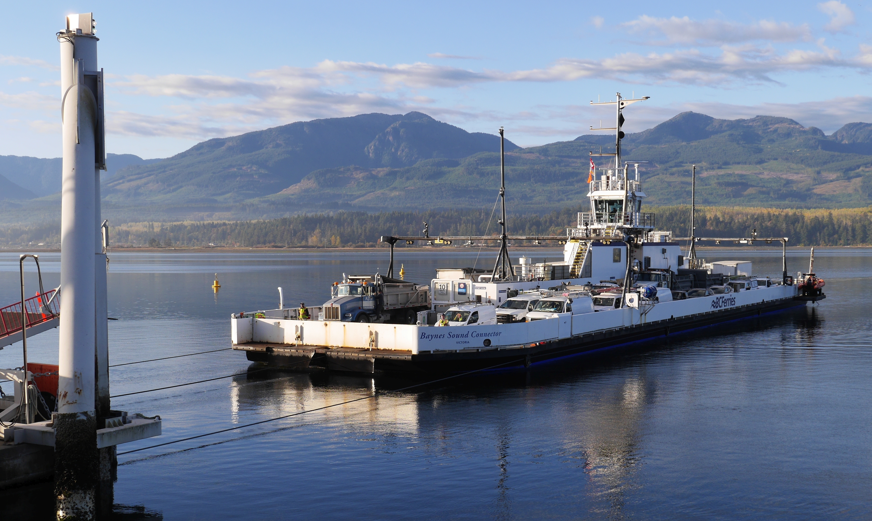
Two Ferries and a Cable
Getting to Denman requires commitment, or at least patience. The MV Baynes Sound Connector, a cable ferry, links the island's west side to Buckley Bay on Vancouver Island. From Gravelly Bay on the east side, another ferry runs to Hornby Island. The village center consists of the general store with its post office, the Abraxas bookshop and coffee shop, a hardware store, a craft shop, a health centre, a community school, and an Anglican church. There are no traffic lights, no fast food outlets, and no sense of hurry. The island publishes a monthly artistic journal called the Flagstone and a weekly advertising circular called the Grapevine, which together constitute the media landscape.
The Disease That Bears Its Name
Denman Island is known for more than its arts scene. In 1960, an infectious disease among Pacific oysters was first identified in the waters off the island. Denman Island Disease, as it came to be known, causes visible yellow-green pustules on the body and adductor muscles of oysters, reducing their marketability and threatening the shellfish industry in Baynes Sound. The causative agent was eventually identified as Mikrocytos mackini, a microcell parasite. The disease has since been found elsewhere in the Pacific Northwest, but the island's name remains permanently attached to it. On land, the western forests of Douglas fir, western hemlock, and western red cedar grow on deep glacial soils, while the eastern shore features arbutus trees leaning over sandy loam toward the sea.
From the Air
Located at 49.546N, 124.792W in the Northern Gulf Islands of British Columbia. Denman Island is a clearly visible elongated island oriented northwest-southeast in Baynes Sound, between Vancouver Island and Hornby Island. The cable ferry crossing to Buckley Bay is visible on the west side. Sandy Island Marine Provincial Park sits off the northern tip. Nearest airport is Comox Valley Airport (CYQQ), approximately 15 km to the northwest. Recommended viewing altitude 3,000-5,000 ft AGL to see the island in full with both ferry routes visible.