Desolation Sound Marine Provincial Park
Captain George Vancouver arrived here in 1792 and saw emptiness. The Native settlements appeared abandoned. The weather was gloomy. The land looked barren. He named the place Desolation Sound and sailed on. What Vancouver had actually encountered was a landscape temporarily vacated: a smallpox epidemic had recently devastated the population, seasonal patterns had drawn people inland to hunt and gather, and Lekwiltok raiding parties from the north made coastal camps dangerous. The name stuck, but the desolation was an illusion born of bad timing and European cultural assumptions. For ten millennia, the waters at the confluence of Malaspina Inlet and Homfray Channel had been one of the richest marine food sources north of Baja California, sustaining the Sliammon and Klahoose peoples with mussels, oysters, and salmon in waters warm enough to nurture extraordinary shellfish beds.
The Misnaming
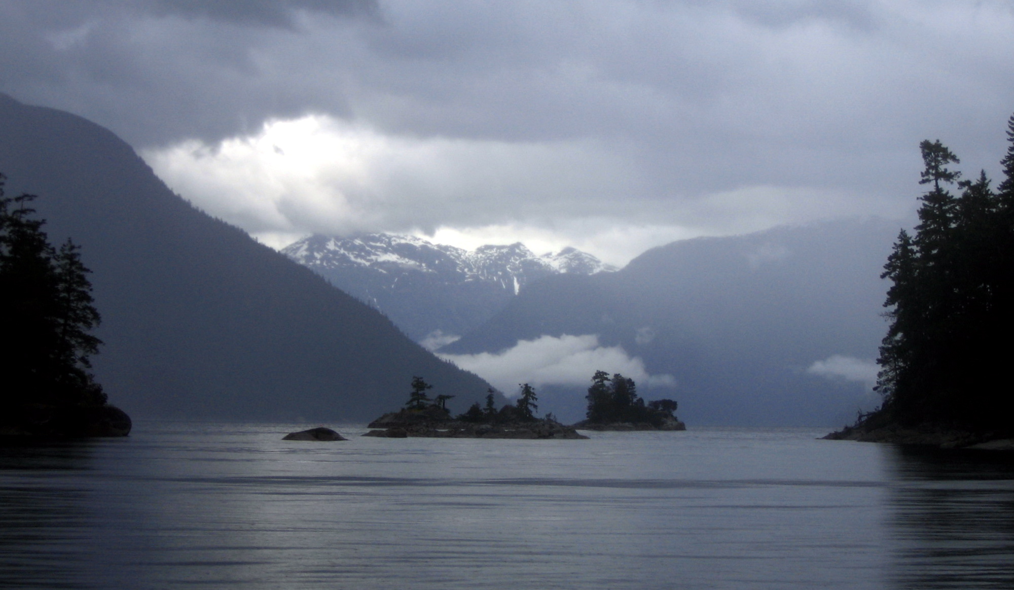
Vancouver's journals reveal a man measuring landscape against English countryside and finding it wanting. The steep forested slopes falling into dark water, the silence of temporarily empty villages, the overcast skies of a coastal British Columbia summer: none of it matched the aesthetic framework he carried from Europe. But his name became the official one, and it has proved remarkably durable for a label so thoroughly wrong. The waters Vancouver dismissed are among the warmest on the BC coast, sheltered by the Discovery Islands and the mountainous mainland from the open Pacific swells. Glaciated peaks rise directly from the shore, feeding waterfalls that cascade into saltwater. The inlets, islets, coves, and bays that Vancouver's crew charted without enthusiasm have since become one of the premier cruising destinations in the Pacific Northwest. In peak summer, a hundred boats may share a single anchorage. Desolation Sound is anything but desolate.
A Ten-Thousand-Year Pantry
The Sliammon and Klahoose peoples did not merely live near these waters. Their identities were integrated with the marine environment in ways that European observers, focused on agriculture and settlement as markers of civilization, could not recognize. For millennia, the sheltered coves and warm shallow bays produced mussels, mollusks, and oysters in quantities that supported permanent communities. Salmon runs through the inlets provided the protein backbone of the regional diet. The relationship between people and place was not extractive in the industrial sense but reciprocal, shaped by seasonal knowledge refined over hundreds of generations. That reciprocal relationship began to fracture long before the park was established in 1973. The government leased Sliammon gathering spots to oyster farmers. Settlers claimed shoreline. The very act of creating a protected park, seemingly benevolent, further restricted Indigenous access to traditional food sources that had sustained their communities since the glaciers retreated.
Paradise Polluted
The park that bears Vancouver's dismissive name has become a case study in the tensions between recreation and conservation. Despite being designated a no-dumping zone, hundreds of yachts concentrating in small coves have poisoned several of the marine park's waters with untreated sewage. The contamination is not abstract: it has severely affected the local shellfish, the same shellfish that Sliammon families relied upon for food. Many Sliammon people are now reluctant to eat traditional foods gathered from waters near the park. Accidental fuel leaks from boats and shoreline homes compound the problem. Jonathan Clapperton, writing in the journal article Desolate Viewscapes, has argued that BC Parks gauges the park's success by adding amenities and increasing visitor numbers, a metric that sometimes means placing campgrounds on environmentally sensitive land or tolerating the anchor damage and sewage that hundreds of yachts inflict on fragile coves. The park's popularity is simultaneously its achievement and its crisis.
What the Water Remembers
In 2008, both the Sliammon and Klahoose First Nations entered treaty negotiations with senior levels of government, seeking formal recognition of their relationship to these waters. The negotiations reflect a broader reckoning across the British Columbia coast: that parks created to protect natural beauty often displaced the people who had maintained that beauty for thousands of years, and that managing a marine environment effectively requires the knowledge of those who have observed it longest. Climate change adds urgency. Ocean acidification, rising sea levels, and shifting species distributions threaten the ecological foundations that make Desolation Sound productive. The BC government has acknowledged that nature-based solutions and collaboration with First Nations are essential to building resilience. What Captain Vancouver named for emptiness is in fact a place overflowing with competing claims: Indigenous food sovereignty, recreational tourism, ecological conservation, and the deep-time knowledge that comes from ten thousand years of paying attention to the same water.
From the Air
Desolation Sound Marine Provincial Park is centered at approximately 50.11N, 124.69W at the confluence of Malaspina Inlet and Homfray Channel. From the air, the park appears as a complex network of deep blue inlets, forested islands, and sheltered coves backed by glaciated Coast Mountains. In summer, white dots of anchored sailboats are visible in the larger anchorages. Best viewed at 3,000-5,000 feet AGL to appreciate the interplay of water and mountain terrain. Nearest airport is Powell River (CYPW), approximately 30 km to the southwest. The Copeland Islands and Lund harbour are visible to the south.