Devil's Millhopper Geological State Park
The bones at the bottom gave it its name. Early settlers peering into the vast funnel-shaped pit in northwest Gainesville found animal remains scattered across its floor, as though some infernal mechanism had been grinding creatures down into the earth. The shape reminded them of a mill's hopper, and the bones suggested the devil himself was doing the milling. Devil's Millhopper is 120 feet deep and 500 feet wide, a sinkhole so enormous that it contains its own weather, its own ecosystems, and millions of years of exposed geological history in a single vertiginous cross-section of the Florida platform.
When the Floor Gave Way
The Millhopper formed through a process both simple and relentless. Acidic groundwater, seeping through the porous limestone bedrock that underlies most of Florida, slowly dissolved the rock over immense spans of time. Eventually the ceiling of the underground cavity could no longer support its own weight. The collapse created a bowl-shaped depression that has been deepening and widening ever since. What makes Devil's Millhopper exceptional in Florida is its scale. The exposed rock layers along its walls reveal geological strata spanning millions of years, an open textbook of deep time carved into the earth just minutes from the University of Florida campus. The formation earned designation as a National Natural Landmark in 1974, and was added to the National Register of Historic Places in 2017, in part for its surviving Civilian Conservation Corps infrastructure.
Three Worlds in One Hole
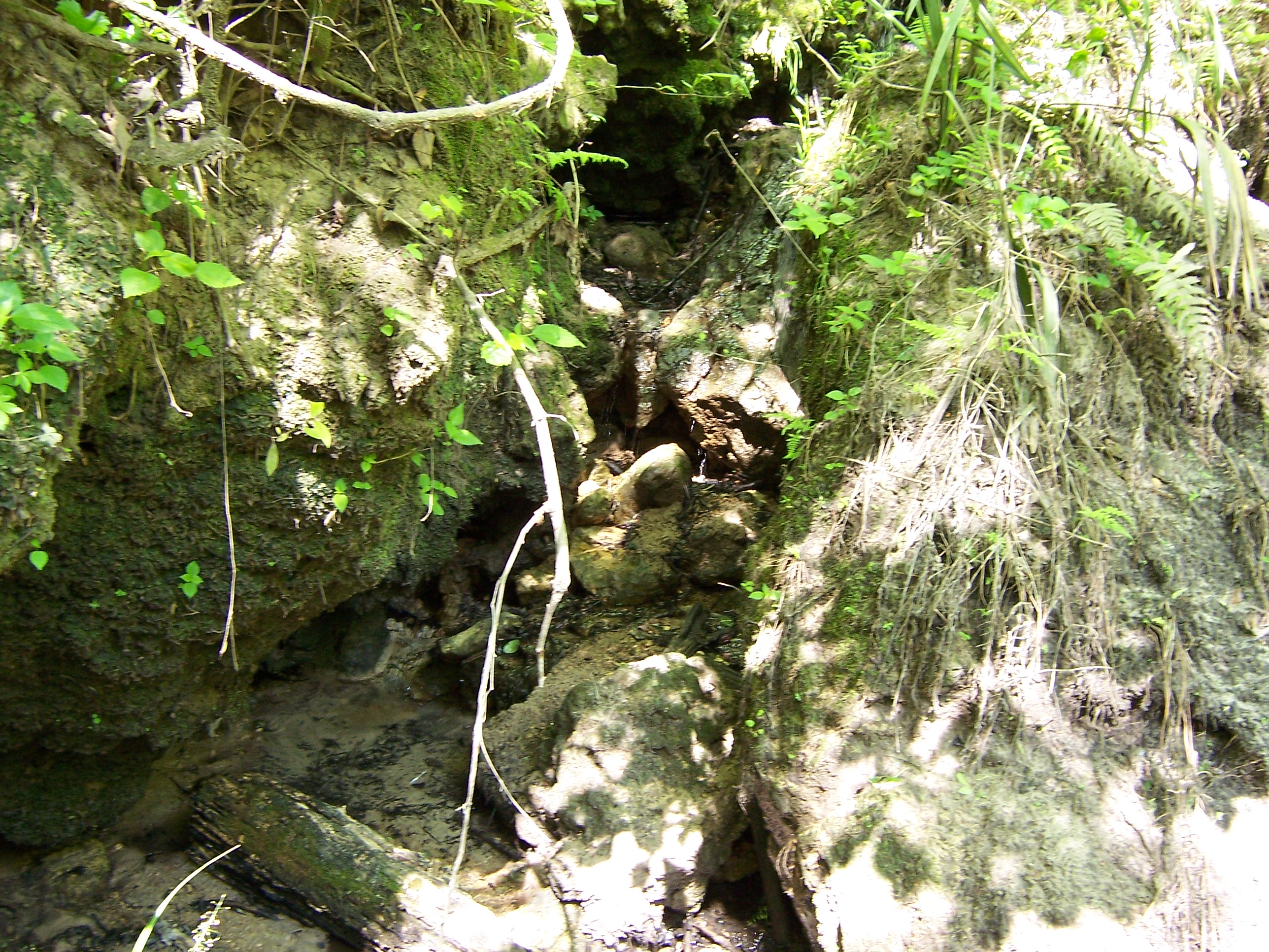
Despite the park's modest size, three distinct ecological environments coexist within its boundaries, stacked vertically according to their relationship with sun, fire, and water. At the rim, the sandhill environment dominates. Sandy soil and periodic natural fires keep the landscape open, favoring longleaf pines that tower overhead with their characteristic long-needled crowns. Step onto the boardwalk and descend, and the sandhill yields to hardwood hammock. Here the moist, sheltered soils support broadleaf trees and dense understory vegetation, a cooler, shadier world just yards from the sun-baked rim above. At the bottom, swamp conditions prevail. Standing water, dripping seeps, and saturated ground support only flora and fauna adapted to year-round wetness. The temperature can drop noticeably as you descend, and ferns cling to limestone walls that glisten with moisture.
From Party Spot to State Park
Before it became a protected landmark, Devil's Millhopper had an unlikely career as a college hangout. The University of Florida's science department once owned the site and used it for field research, but students discovered that a 120-foot hole in the ground also made a dramatic setting for socializing. Parties brought litter. Foot traffic accelerated erosion on the fragile slopes. The ecosystem that made the sinkhole scientifically invaluable was being loved to death by undergraduates. The state purchased the site in 1974, and by 1976 a set of 236 wooden steps, boardwalks, and an observation deck at the bottom gave visitors a way to experience the Millhopper without further damaging its slopes. Hurricane Irma battered the boardwalk in September 2017, closing it for nearly two years. The replacement structure, with 132 steps, reopened on June 5, 2019, though it ends higher in the sinkhole than its predecessor.
The View from the Edge
Standing at the rim of Devil's Millhopper, the flat suburban sprawl of northwest Gainesville stretches in every direction. Nothing about the surrounding landscape hints at what lies below. Then the ground drops away. The canopy of the surrounding pines gives way to the crowns of hardwoods growing from the sinkhole's slopes, their tops level with the parking lot. Birds call from a depth that makes their songs echo. The boardwalk descends through bands of geological time, each layer a chapter in the story of a peninsula that was once entirely underwater. At the bottom, springs seep through the limestone, feeding the miniature swamp that has colonized the pit floor. The park sits adjacent to San Felasco County Park and near San Felasco Hammock Preserve State Park, anchoring a corridor of protected natural land on the growing edge of a university city.
From the Air
Located at 29.71°N, 82.40°W in northwest Gainesville, Florida. The sinkhole is 500 feet wide and can be spotted from low altitude as a dark, densely vegetated depression surrounded by suburban development and pine flatwoods. Best viewed below 2,000 feet AGL. Nearest major airport is Gainesville Regional Airport (KGNV), approximately 8 nm to the southeast. The University of Florida campus is visible to the southeast as a large cluster of buildings.