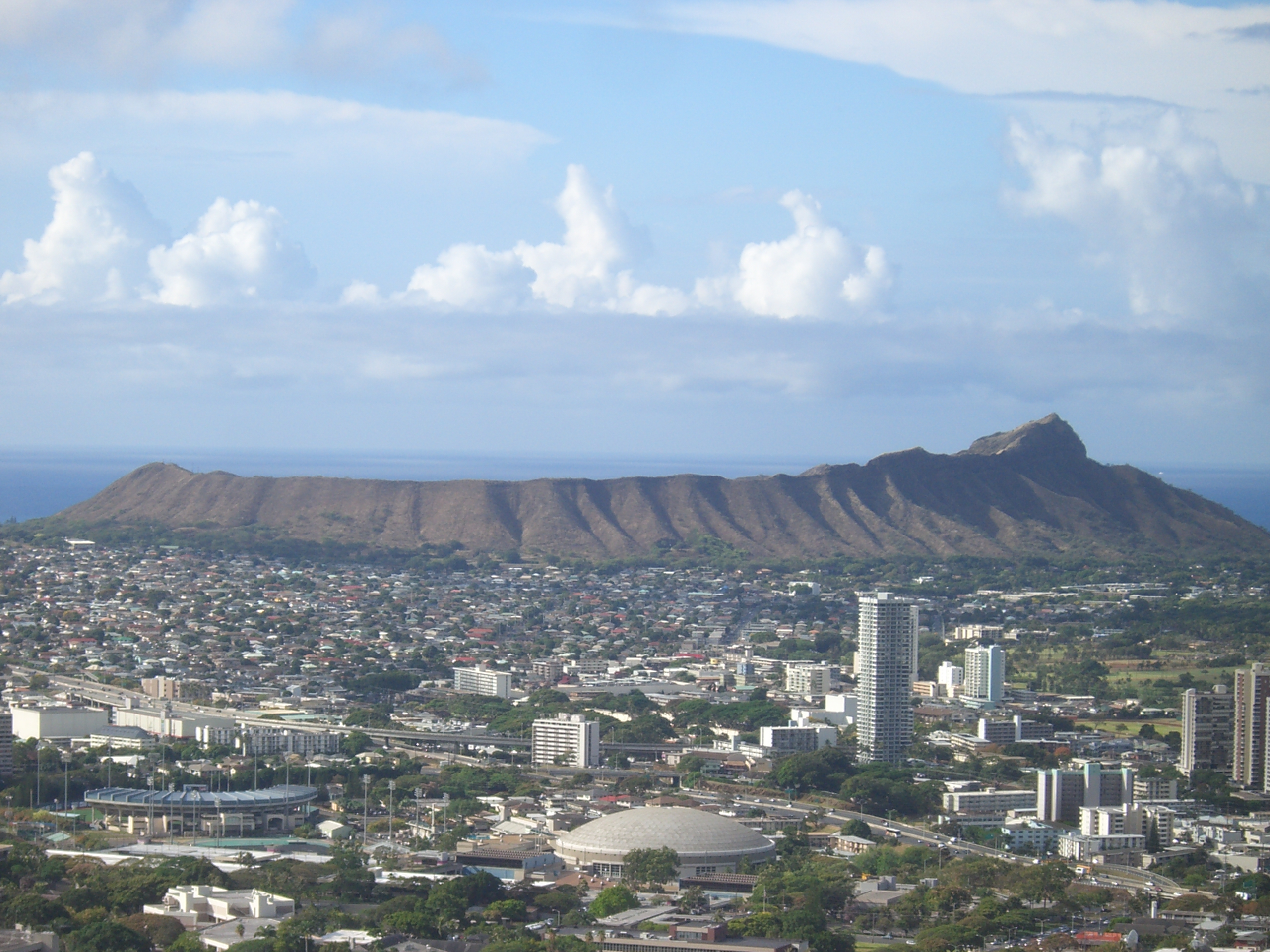
Diamond Head
British sailors made a lot of mistakes on these shores, but the one that stuck was geological. In 1825, they spotted sparkling crystals in the sand near a massive tuff cone on Oahu's southeastern coast and declared them diamonds. The crystals were volcanic calcite, worthless by any jeweler's measure, but the name Diamond Head endured. The Hawaiians had their own name for the landmark: Leahi, derived from lae (browridge or promontory) and ahi (tuna), because the ridgeline traces the same clean arc as a yellowfin's dorsal fin. Stand on Waikiki Beach and look east, and you will see it immediately. The silhouette is unmistakable, a profile that has become shorthand for Hawaii itself.
Fire and Ash, 400,000 Years Ago
Diamond Head belongs to the Honolulu Volcanic Series, a chain of eruptions that sculpted southeastern Oahu long after the Koolau Volcano had gone quiet. The Koolau Range is roughly 2.6 million years old; Diamond Head, by contrast, is an adolescent at 400,000 to 500,000 years. The eruption that built it was brief and violent, a steam-driven explosion where rising magma met groundwater and blasted ash and debris into a ring. That ring of consolidated ash, or tuff, hardened into the crater visible today. The same volcanic episode created Hanauma Bay, Punchbowl Crater, Koko Head, and Manana Island, all of them part of the same geological family scattered along Oahu's coast.
Guns in the Crater
The U.S. military recognized what the Hawaiians had always known: the crater commands the coastline. Fort Ruger, established on Diamond Head's slopes, became the first American military reservation in Hawaii. In 1908, the Army built a trail from the crater floor to the summit as part of its Coastal Defense System, threading the path through tunnels blasted into the tuff and up steep concrete staircases. At the top, bunkers served as fire control stations, directing artillery in the event of attack. The trail climbs 560 feet, and the military infrastructure remains embedded in the rock like fossils of a different kind of eruption. Battery 407 and Birkhimer Tunnel still serve the National Guard and Hawaii's Emergency Management Agency.
Hawaii's Woodstock
On New Year's Day 1969, the crater floor became a concert venue. The Diamond Head Crater Festivals, nicknamed Hawaii's Woodstock, drew over 75,000 people for daylong celebrations featuring the Grateful Dead, Santana, Journey, Styx, and War alongside Hawaiian artists like Cecilio and Kapono and the Mackey Feary Band. Equipment had to be airlifted in and out by helicopter. By 1976 the one-day festivals had expanded to two-day events, but the Department of Land and Natural Resources shut them down after complaints about noise and environmental damage to the crater. For a brief window, though, Diamond Head was as much about rock and roll as it was about rock and lava.
The Climb Today
Diamond Head was declared a National Natural Landmark in 1968 and remains a State Monument. The 0.8-mile trail to the summit is one of the most popular hikes on Oahu, requiring advance online reservations for non-residents and a small fee. The path follows the original 1908 military route through dark tunnels and up uneven stairs, emerging at the summit bunkers where the view opens in every direction. Waikiki's towers press against the shoreline to the west, Koko Head rises to the east, and the Pacific stretches to the horizon. The Diamond Head Lighthouse, built in 1917, stands just below the crater's seaward slopes. From above, the crater is a near-perfect bowl of dry grass and ironwood trees, an extinct volcano doing quiet duty as one of the most photographed landmarks in the Pacific.
From the Air
Diamond Head sits at 21.26N, 157.81W on the southeastern tip of Waikiki, Oahu. The tuff cone is unmistakable from the air at any altitude, rising 760 feet. The crater bowl is clearly visible. Best approached from the south for the classic Waikiki-with-Diamond-Head view. Nearest airport: PHNL (Daniel K. Inouye International Airport), approximately 8 nm northwest. The Diamond Head Lighthouse is visible on the seaward slope.