Diemerpark
There is a rule for visitors to Diemerpark, posted on small signs at the entrances and easy to miss: do not dig. Do not stake a tent. Do not let your dog dig either. The park is twice the size of the famous Vondelpark and full of joggers and cyclists and field hockey teams - ninety hectares of grassland and reed marsh and small beach on the IJmeer - and beneath it all sits a sealed envelope of bentonite clay and plastic sheeting holding down decades of chemical waste. The park is, in the most literal sense, a roof garden over a poison.
Before the Dump
The land east of Amsterdam used to flood. In the 12th century, locals built a low earthen wall called the Diemerzeedijk to hold back the Zuiderzee, the inland sea that ate Dutch coastline almost as a matter of habit. The dike burst more times than its builders cared to count. Then in 1932 the Afsluitdijk closed off the Zuiderzee entirely - sealed it from the North Sea, turned it into the placid IJsselmeer - and the marshy land along the old dike became, for the first time in its history, dry and stable. Reeds came in. Birds came in. For a few decades it was simply nature, a wet undeveloped corner on the edge of a growing city.
The Worst Address in the Netherlands
Then Amsterdam needed somewhere to put its garbage. From the 1960s onward, household waste, industrial waste, and chemical waste were dumped along the Diemerzeedijk, often illegally. For more than a decade chemicals were burned on site, sending plumes across the new IJburg horizon. By the time the landfill was permanently closed in 1984 - eleven years after the chemical burning officially stopped - the Diemerzeedijk was one of the most polluted places in the country. Soil samples returned readings that made remediation experts wince. The municipality of Amsterdam ultimately settled with the Dutch state in a procedure called a schikking, paying 100,000 euros and avoiding criminal prosecution. The bill, in real environmental terms, was much larger and not yet paid.
Nature, Stubbornly
And then something strange happened. With no humans around and no further dumping, the closed landfill began to grow into one of the richest urban ecosystems in the Netherlands. Birds nested in the reeds - bluethroats, kingfishers, nightingales - around two hundred species in total. Two hundred more species of plants moved in. Grass snakes, harmless to humans, threaded through the grass. Stoats came back. Deer turned up. Researchers studying the site found that the surface vegetation was healthy and that the buried pollution, while real, was not migrating in dangerous ways. By the 1990s an unintended consequence had emerged: the most polluted site in the Netherlands had become one of its most biodiverse.
Wrapping the Poison
The plan to build the new island neighborhood of IJburg next door forced a decision. Either dig the entire dump out - prohibitively expensive and dangerous - or seal it in place. Amsterdam chose to seal. From 1998 to 2001, engineers drove sheet piles around the perimeter of the site, in effect building underground walls. Over the top they laid a waterproof skin of bentonite clay - a swelling natural mineral that closes itself off when wet - and plastic foil. On top of that they laid soil, and on top of the soil they laid a park. The groundwater inside the wrapped zone is continuously pumped out and treated. Manhole covers across the park carry brief inscriptions describing the landfill below. Most visitors never read them.
The Rules of the Roof Garden
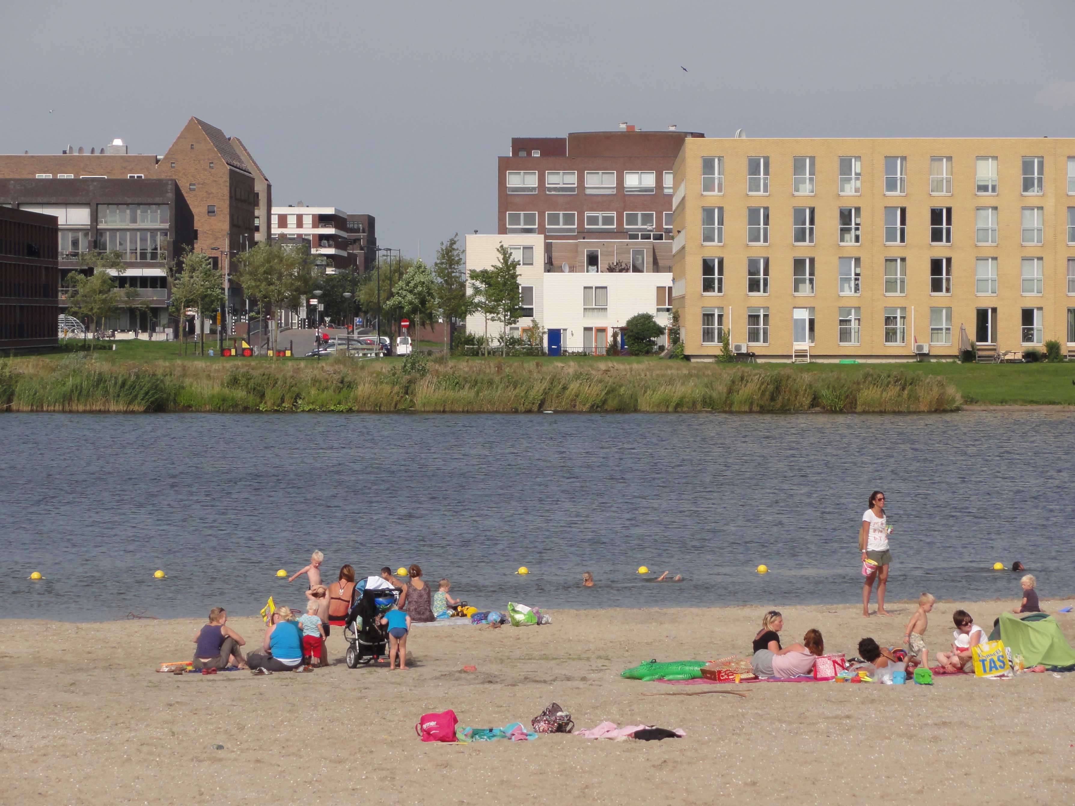
Diemerpark opened to visitors in 2004. Three football pitches and three field hockey fields sit on the west side. A small beach on the IJmeer draws swimmers in summer. The Nescio Bridge - a long elegant white footbridge across the Amsterdam-Rhine Canal - delivers cyclists into the park from the south. The southeastern corner is closed off as swamp, partly because the engineers wanted somewhere the waterproof seal could flex without people walking on it. Trees on the site are limited to shallow-rooted species under five meters tall, because anything deeper might puncture the membrane below. The compromise has held. Two decades after opening, Diemerpark functions as a park, as a nature reserve, and as a piece of industrial-scale environmental engineering, all at once - a way to live with a problem that could not be fully solved, by quietly building a garden on top of it.
From the Air
Diemerpark sits at approximately 52.35 N, 4.99 E, on a narrow tongue of land between the Amsterdam-Rhine Canal to the south and the IJmeer to the north. From the air the park reads as an irregular green patch east of the IJburg islands, with the white arc of the Nescio Bridge crossing the canal at its southern edge. Amsterdam Schiphol (EHAM) lies about 14 nautical miles southwest; Lelystad (EHLE) is 18 nm northeast. Just to the north the IJmeer opens out toward Markermeer; the IJburg residential islands are clearly visible to the west across the small inlet.