Dinosaur National Monument
Paleontologist Earl Douglass came to Utah in 1909 searching for mammal fossils. What he found instead would make headlines worldwide: eight vertebrae of an Apatosaurus jutting from a sandstone ridge on the southeast flank of the Uinta Mountains. That single discovery opened a window into the Jurassic Period, revealing one of the richest dinosaur graveyards ever found. President Woodrow Wilson protected the site in 1915, and today the bones still emerge from the rock exactly where ancient rivers deposited them 150 million years ago.
The Ancient River's Gift
The rock layer that holds these treasures is the Morrison Formation, a sandstone and conglomerate bed from the Jurassic Period. One hundred fifty million years ago, a river system wound through this landscape, carrying the carcasses of dinosaurs and other creatures to their final resting place. The bodies accumulated on sandbars and in eddies, bones piling upon bones. Sediment buried them, time compressed them, and the same mountain-building forces that raised the Uinta Mountains tilted these beds to their present 67-degree angle. What was once flat is now a wall, and the erosion that exposed Douglass's first vertebrae continues to reveal new specimens each year.
Layers of Human Story
Long before paleontologists arrived, the Yampa and Green Rivers sustained human life in this arid country for at least 10,000 years. The Fremont people lived in these canyons from roughly 200 to 1300 AD, leaving petroglyphs and pictographs on the canyon walls. They sheltered under rock overhangs and in shallow caves, eating pine nuts, berries, and cactus fruits alongside wild game. The Ute and Shoshone followed, and they remain connected to this land today. Early European settlers scratched out homesteads wherever rivers offered water, their remains now standing alongside the indigenous rock art of earlier centuries.
A Land of Extremes
Straddling the Utah-Colorado border, Dinosaur National Monument spans 210,000 acres of proposed wilderness where the Green and Yampa Rivers converge. Elevations range from 4,700 to 9,000 feet, and the climate swings between summer temperatures exceeding 100 degrees Fahrenheit and winter lows well below zero. The rivers cut sinuous canyons through rocky desert, offering Class III and IV rapids to those who venture onto the water. Summer thunderstorms unleash flash floods that rage through canyons one moment and leave parched soil untouched a mile away. Roads turn to impassable clay when wet, no matter what vehicle you drive.
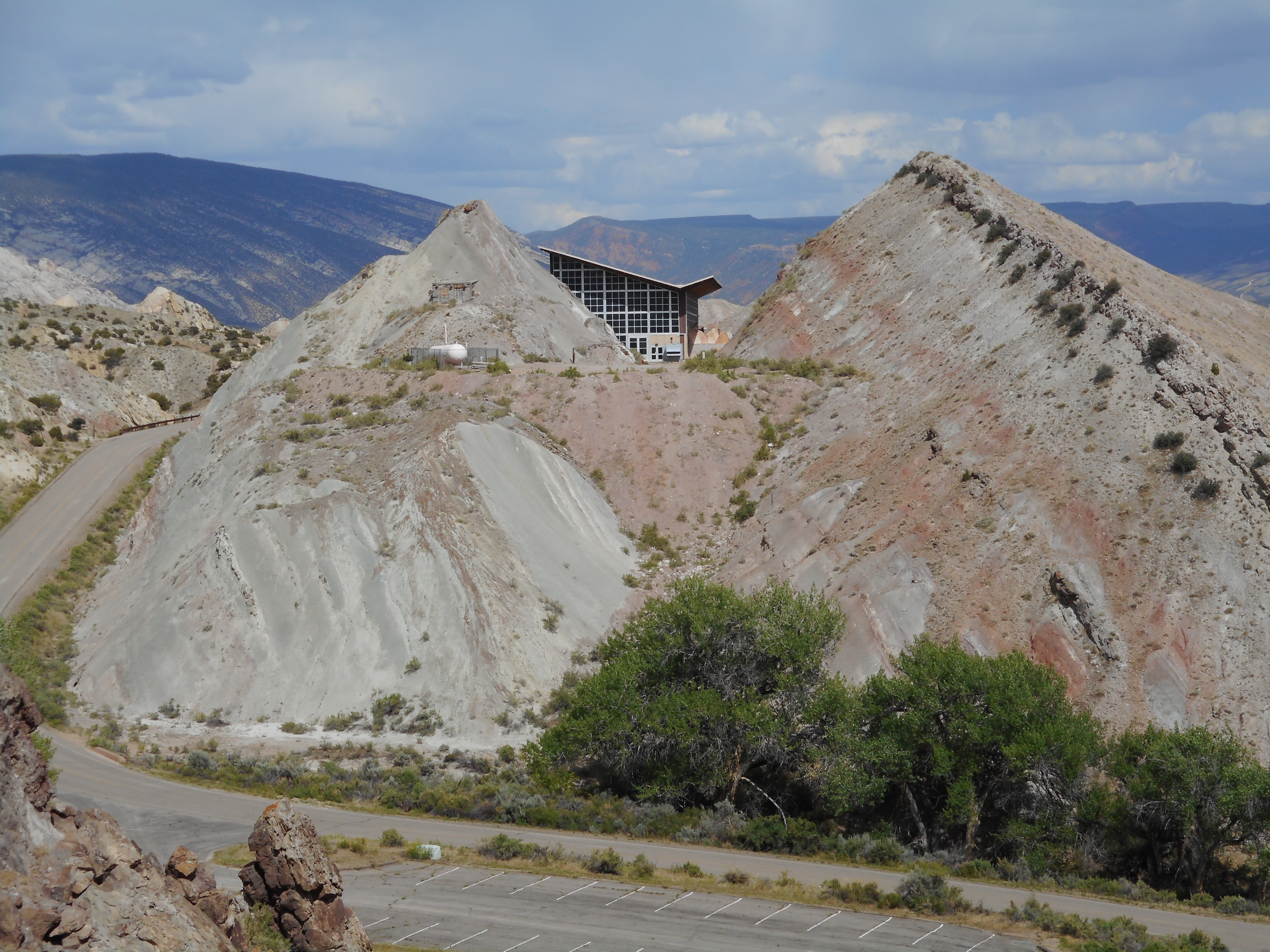
The Wall of Bones
The quarry that made this monument famous remains its centerpiece. The "Wall of Bones" displays thousands of fossils still embedded in their original positions, tilted at that dramatic 67-degree angle. Douglass and his Carnegie Museum crews excavated specimens from 1909 to 1922, shipping them to Pittsburgh for study. The Depression-era Works Progress Administration resumed work, and the distinctive quarry building went up in the 1950s. When structural problems forced its closure in 2006, the Park Service rebuilt the exhibit hall on 70-foot steel columns reaching down to bedrock. The quarry reopened in 2011, and visitors can once again watch technicians reveal bones that have waited 150 million years to see light.
Protecting a Wilderness
The monument almost lost its wildest reaches. In the 1950s, the proposed Echo Park Dam would have flooded the river canyons that give Dinosaur its second identity. Conservationists fought back, and the Colorado River Storage Project Act of 1956 explicitly stated that no dam or reservoir could be built within any National Park or Monument. Today, most of the monument's acreage remains proposed wilderness, accessible to those willing to plan carefully and carry their own water. The Josie Bassett Morris homestead still stands at the end of the Tour of the Tilted Rocks, and the view from Harpers Corner stretches across deep canyons unchanged since the rivers first carved them.
From the Air
Located at 40.53N, 108.98W on the Utah-Colorado border. The quarry area sits in the western district near Jensen, Utah, while the canyon country extends east into Colorado. From the air, look for the distinctive green ribbon of the Yampa and Green Rivers cutting through desert terrain. Nearest airports: Vernal Regional Airport (VEL), about 20 miles southwest. Best viewing altitude: 8,000-10,000 feet AGL for canyon perspective. Watch for mountain weather building over the Uinta Mountains to the north.