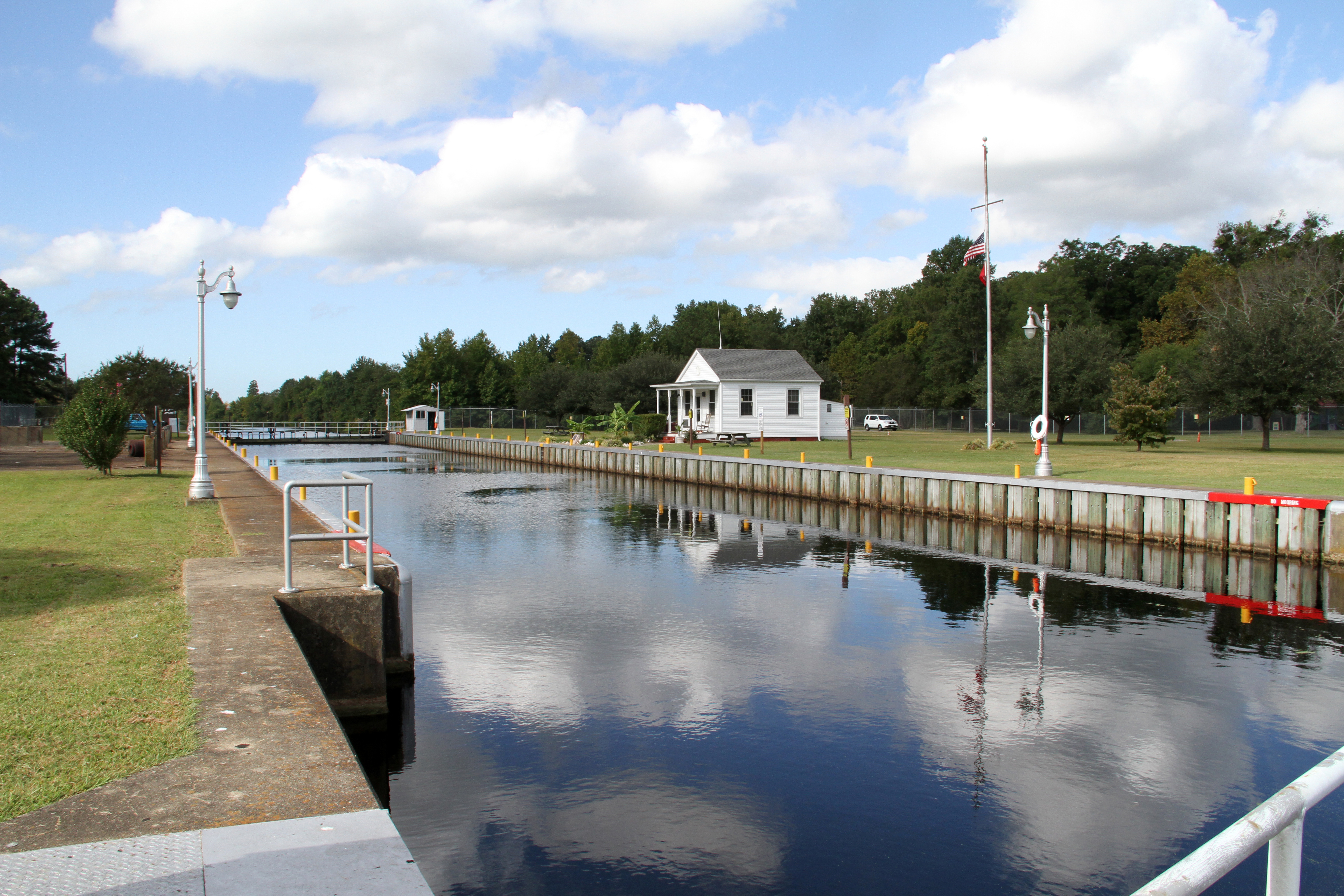
Dismal Swamp Canal
The hotel straddled the state line. If the sheriff from Virginia walked through the door, gamblers simply slid their chips to the North Carolina side of the salon. If a duel was fought and the loser fell dead, the winner rarely faced arrest -- the corpse and the crime lay in a different jurisdiction. The Dismal Swamp Hotel, built around 1805 on the western bank of a brand-new canal, was a place where the absurdities of borders became entertainment. No trace of it remains today, but the waterway it served still runs: the Dismal Swamp Canal, a 22-mile channel carved by hand through one of the darkest and most forbidding landscapes on the East Coast. Opened in 1805, it is the oldest continually operating man-made canal in the United States.
Washington's Ditch
In May 1763, a young George Washington rode into the Great Dismal Swamp and saw not a wasteland but an opportunity. He proposed draining the swamp and cutting a north-south canal through it, connecting the waters of the Chesapeake Bay in Virginia to the Albemarle Sound in North Carolina. The colonial communities around the landlocked Carolina sounds were entirely dependent on shipping across poor overland tracks or along the treacherous Atlantic coast to reach markets through Norfolk. A canal would change everything. Washington would eventually agree with Virginia governor Patrick Henry that canals were the surest path to efficient internal transportation. In 1784, the Dismal Swamp Canal Company was formed. Work began in 1793. The canal was dug entirely by hand, and most of the labor was performed by enslaved people rented from nearby landowners. Twelve years of brutal toil through swamp, muck, and stifling heat followed before the 22-mile waterway finally opened in 1805.
The Battle Nobody Won
During the Civil War, the Dismal Swamp Canal occupied a dangerous strategic position between Union and Confederate forces. In April 1862, word reached Union General Ambrose Burnside that the Confederates might use the canal to move an ironclad warship from Hampton Roads to the Albemarle Sound. Burnside dispatched General Jesse Reno with 3,000 troops from Roanoke Island to destroy the Culpepper Locks near South Mills. Reno's men disembarked near Elizabeth City on April 18 and began an exhausting overland march. At South Mills, they met Confederate Colonel Ambrose Wright and his 900 defenders, who held the road to town. Four hours of determined fighting ended when the Confederate artillery commander, Captain W. W. McComas, was killed and Wright fell back two miles to Joy's Creek. But Reno, bloodied and spent, did not pursue. Hearing rumors of Confederate reinforcements arriving from Norfolk, he ordered a silent nighttime retreat to the transports. The Battle of South Mills cost an estimated 114 Union and 25 Confederate casualties -- the only battle fought near the canal, and one that changed nothing.
A Path Through the Darkness
The Great Dismal Swamp and its canal carried a meaning far beyond commerce. The swamp's dense, nearly impenetrable thickets became a sanctuary for people escaping slavery. Freedom seekers fled into the swamp's interior, some living there for years in maroon communities hidden from pursuers. The canal itself, running through the heart of this wilderness, served as a corridor along the Underground Railroad. Today, the canal and the surrounding Great Dismal Swamp are officially recognized as part of the Underground Railroad, a designation acknowledging the courage of those who found freedom through a landscape that most white settlers considered fit only for draining. The irony is sharp: the canal that George Washington envisioned as an instrument of commerce, built by the labor of enslaved people, became a lifeline for those seeking to escape the very institution that built it.
Decline, Duckweed, and Resurrection
After the Civil War left the canal in disrepair, the Lake Drummond Canal and Water Company launched restoration efforts in 1892. Vessels carrying lumber, shingles, farm products, and passengers soon made the canal a bustling interstate thoroughfare again. But by the 1920s, railroads and highways had overtaken water transport, and commercial traffic dwindled. In 1929, the federal government purchased the canal for $500,000. The waterway found new purpose in the mid-twentieth century as recreational boating surged and the canal became part of the Intracoastal Waterway, offering shelter from the brutal Atlantic coast. Hurricane Matthew dealt another blow in October 2016, filling the canal with silt and sand. Even after dredging was completed in November 2017, an invasion of duckweed -- a tiny floating plant that chokes boat engine intakes -- forced another closure. The U.S. Army Corps of Engineers finally reopened the canal in March 2018. Today, about 2,000 recreational boaters transit it each year.
Still Waters, Long Memory
The Dismal Swamp Canal is now listed on the National Register of Historic Places and designated a National Historic Civil Engineering Landmark. The East Coast Greenway, a 3,000-mile trail system connecting Maine to Florida, runs along part of the canal trail. The Dismal Swamp Canal Visitor Center, located in Camden County, North Carolina, on US Highway 17 just south of the Virginia border, holds the distinction of being the only visitor center in the continental United States that greets visitors arriving by both a major highway and a historic waterway. The canal remains one of two inland routes connecting the Chesapeake Bay to the Albemarle Sound. Its waters are still and dark, stained the color of tea by juniper and cypress tannins leaching from the swamp. It is a quiet place now, but the canal remembers everything: Washington's ambition, the enslaved hands that dug it, the soldiers who fought over it, and the people who followed its dark corridor to freedom.
From the Air
The Dismal Swamp Canal runs roughly north-south at 36.557N, 76.381W along the eastern edge of the Great Dismal Swamp, straddling the Virginia-North Carolina border. From altitude, look for the perfectly straight, narrow channel cutting through dense swamp forest -- it is unmistakable against the dark green canopy. The canal connects Deep Creek (Chesapeake, VA) to the north with the Albemarle Sound to the south. US Highway 17 runs parallel to the southern portion. Nearest airports include Chesapeake Regional Airport (KCPK) to the north and Currituck County Regional Airport (KONX) to the southeast. Coast Guard Air Station Elizabeth City (KECG) lies approximately 20 nm to the south. Best viewed at 3,000-5,000 feet AGL to appreciate the canal's full 22-mile length through the swamp.