Djerba
Homer may have sent Odysseus here. The identification is speculative, debated by scholars for centuries, but the notion persists that Djerba, the largest island in North Africa at 514 square kilometers, was the land of the lotus-eaters, where sailors ate the intoxicating fruit and forgot their desire to return home. Whether or not the Homeric legend holds, the island in the Gulf of Gabes has been drawing people in and keeping them for at least three thousand years. In 2023, UNESCO recognized what the Phoenicians, Romans, Arabs, Normans, Ottomans, and French had all understood: Djerba is a place where civilizations settle, layer upon layer, and refuse to leave.
Empires Like Geological Strata
Phoenician traders from Tyre and Sidon arrived in the twelfth century BCE, bringing olive trees and the art of purple dye production. The dye made here rivaled Tyre's own, commanding the highest prices in the Mediterranean market. Romans followed, and the island prospered under their rule, leaving urban remains that are still visible today. Then came the Vandals under Gaiseric in the fifth century, the Arab conquest in 665, and centuries of dynastic jockeying among Aghlabids, Fatimids, and Zirids. Roger II of Sicily conquered the island in 1135 in retaliation for Mediterranean piracy, sending its women and children to Sicily. The Normans held it until the Almohad Caliphate reclaimed it in 1159. The Hafsid dynasty took control in the thirteenth century. Each conquest deposited another stratum of architecture, language, and custom onto the island's already dense cultural bedrock.
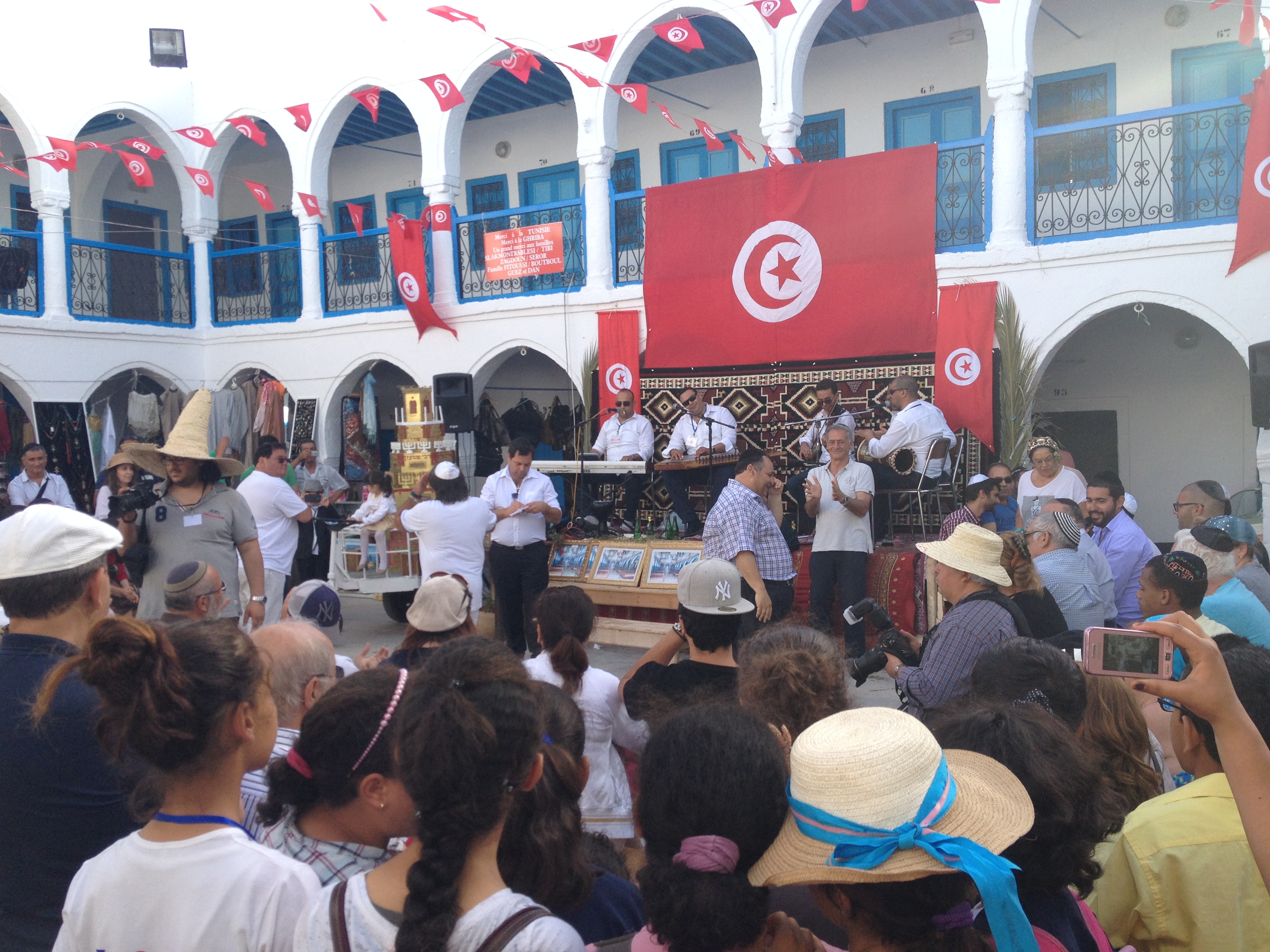
The Island of the Kohanim
The Jewish community of Djerba claims continuous residence for more than 2,500 years, tracing their origins to priests who fled the destruction of Solomon's Temple in 586 BCE. Genetic testing has lent credibility to the oral tradition: the vast majority of male Jews on Djerba who claim the priestly family status of Cohen carry the Cohen modal haplotype, matching Jewish priestly lineages from across Europe and the Middle East. The community organized itself into two quarters: the Hara Kabira, which identified with Spain and Morocco, and the Hara Saghira, which identified with Israel. This dual identity reflected successive waves of arrival, including refugees from the Spanish Inquisition. A Jewish leader once described the relationship with Muslim neighbors simply: "We live together. We visit our friends on their religious holidays. We work together. Our children play together."
Between Empires, Between Eras
The Ottoman period brought Djerba into a vast imperial system, though the island maintained a degree of autonomy that frustrated successive governors. When Bismarck told the French ambassador in 1879 that "the Tunisian pear has ripened and it is time for you to pick it," Djerba was swept up in the colonial project that followed. French rule from 1881 to 1956 reshaped the island's economy and political life, but the people of Djerba contributed significantly to the Tunisian independence movement. After independence, the island reinvented itself as a tourist destination, its warm desert climate, flat sandy landscape, and deep cultural history attracting visitors from across Europe and beyond. The designation as a UNESCO World Heritage Site in 2023 recognized not a single monument but an entire settlement pattern, the way human communities had arranged themselves on this island territory across millennia.
Flyway and Refuge
Beyond its human story, Djerba serves as a critical node in the natural world. The wetland of Djerba Bin El Ouedian, designated a Ramsar site in 2007, provides habitat for migratory birds crossing the Mediterranean. The island's hot desert climate, classified as BWh on the Koppen scale and bordering on hot semi-arid, creates a landscape of palms and saltbushes where flamingos and spoonbills rest during their long journeys between continents. The flat terrain, rising barely above sea level, makes Djerba uniquely vulnerable to the rising seas that climate change promises. An island that has survived Phoenicians, Vandals, Normans, and colonial powers now faces a threat that cannot be repelled by walls or treaties.
From the Air
Located at 33.78°N, 10.88°E in the Gulf of Gabes, southern Tunisia. Djerba is clearly visible from altitude as a large, flat island connected to the mainland by a causeway to the south. Djerba-Zarzis International Airport (DTTJ) sits on the island's northwest coast. The island is exceptionally flat, never rising more than a few meters above sea level. Approach from the north or east at 3,000-5,000 ft AGL for excellent views of the island's outline and the surrounding shallow turquoise waters of the gulf.