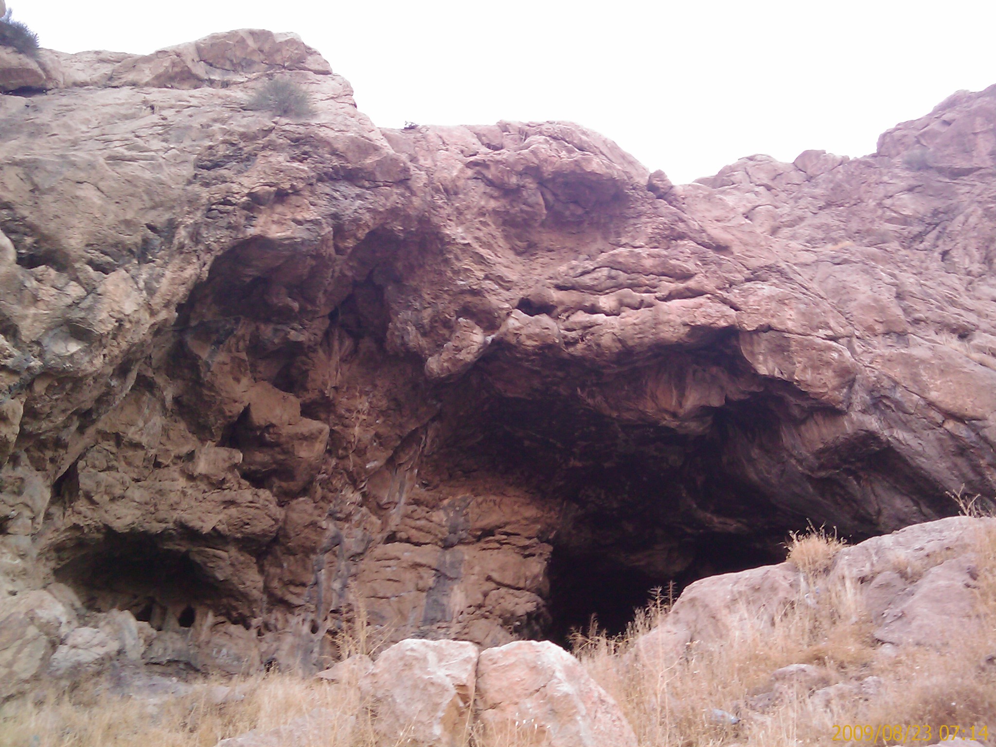
Do-Ashkaft Cave
The entrance faces south, opening onto a view of Kuhestan national park and the city of Kermanshah spread across the plain below. At 1,600 meters above sea level on the slopes of Meywala Mount, Do-Ashkaft Cave sits where the Zagros Mountains begin their serious climbing. Neanderthals chose this spot for the same reasons any practical inhabitant would: shelter from the elements, a commanding view of the valley, and raw material for toolmaking scattered in outcrops around the cave mouth. When Iranian researchers Fereidoun Biglari and Saman Heydari-Guran first visited in 1996, they found exactly what those ancient occupants had left behind -- a rich scatter of Middle Paleolithic stone tools that identified Do-Ashkaft as a Mousterian workshop.
The Workshop on the Mountain
The main chamber stretches 23 meters deep and 15 meters wide -- spacious enough for a working group of toolmakers and their debris. The sediments at the cave entrance yielded a concentrated deposit of animal bones, charcoal fragments, and flint tools. Among the artifacts were side-scrapers and a Mousterian point, tool types characteristic of Neanderthal technology across western Asia and Europe. The Neanderthals who worked here did not import their materials from distant sources. They used local jasper outcrops visible from the cave mouth, knapping tools within sight of where the raw stone was quarried. The efficiency of this arrangement -- shelter, resources, and a view of approaching danger all in one location -- explains why the site saw repeated use.
Bones and Breccia
Water has reshaped the cave's interior over millennia. Large deposits of breccia -- angular rock fragments cemented together by mineral-laden water -- indicate that substantial amounts of sediment were washed through the cave and out again. What survived this natural erosion tells a story of both human and animal presence. Bone fragments from wild goats and sheep of the subfamily Caprinae show signs of human processing -- cut marks and breakage patterns consistent with butchery rather than natural decay. The Neanderthals were not just making tools here. They were bringing prey back to the cave, processing it, and eating it by firelight, as the charcoal deposits confirm.
A Landscape of Caves
Do-Ashkaft is not an isolated site. In 1999, researchers surveyed a seven-square-kilometer area around the cave and identified fourteen caves and rock shelters, several containing Upper Paleolithic and later stone tool assemblages. The Kermanshah plain and its surrounding mountains formed a corridor of habitation stretching across tens of thousands of years. Samples collected by researcher Saman Heydari established a paleo-environmental sequence for the region from the late Middle Pleistocene through the Holocene -- a timeline covering the transition from Neanderthal to modern human occupation. This cluster of sites suggests the Zagros foothills were not a marginal environment but a productive one, supporting populations across multiple periods of prehistory.
Neanderthal Footsteps
The cave gained wider attention when researchers reported evidence of Neanderthal footprints preserved in the cave floor -- a physical trace far more immediate than any stone tool. Footprints are rare in the Paleolithic record, and their discovery at Do-Ashkaft adds a dimension that artifacts alone cannot provide: a sense of movement, of weight, of a living body passing through this space. Combined with the Mousterian toolkit and the butchered animal bones, the footprints complete a picture of Neanderthals using this cave as a functional base camp, returning season after season to a location that offered everything they needed to survive in the Zagros highlands.
Near a Masterpiece
Do-Ashkaft sits near Taq-e Bostan, the famous Sasanian rock reliefs carved more than forty thousand years after the cave's Neanderthal inhabitants departed. The proximity is coincidental but poignant. The same qualities that drew Neanderthals to this mountainside -- its prominence, its shelter, its position above a fertile plain -- later drew Persian kings who carved enormous scenes of royal hunts and investitures into the cliff faces nearby. The landscape invited human presence across every era. From Mousterian stone knappers to Sasanian sculptors, the slopes of Meywala Mount have been a workshop and a canvas for as long as people have inhabited western Iran.
From the Air
Located at 34.40N, 47.13E north of Kermanshah, Iran, near the famous Taq-e Bostan rock reliefs. The cave sits at approximately 1,600 meters elevation on the southern face of Meywala Mount, overlooking Kuhestan national park and the Kermanshah plain. Nearest airport is Kermanshah (OICC), approximately 10 km to the south. The mountainous terrain rises steeply from the plain. Best viewed at 4,000-7,000 feet AGL. The city of Kermanshah is clearly visible to the south from the cave's position.