Domogled-Valea Cernei National Park
The Romans came here for the hot springs. The town at the park's edge, Baile Herculane, takes its name from Hercules, and Roman-era ruins confirm that soldiers soaked in these thermal waters two millennia ago. But the valley of the Cerna River, which feeds those springs, remained wild -- too steep, too forested, too folded in on itself to yield easily to human ambition. Domogled-Valea Cernei National Park protects that wildness. Stretching across the Cerna, Godeanu, Valcan, and Mehedinti mountain ranges in Romania's Southern Carpathians, the park shelters a landscape of cirques, sinkholes, limestone pavements, pit caves, and waterfalls that feels less like a national park and more like a place the modern world simply forgot to reach.
Four Ranges, One River
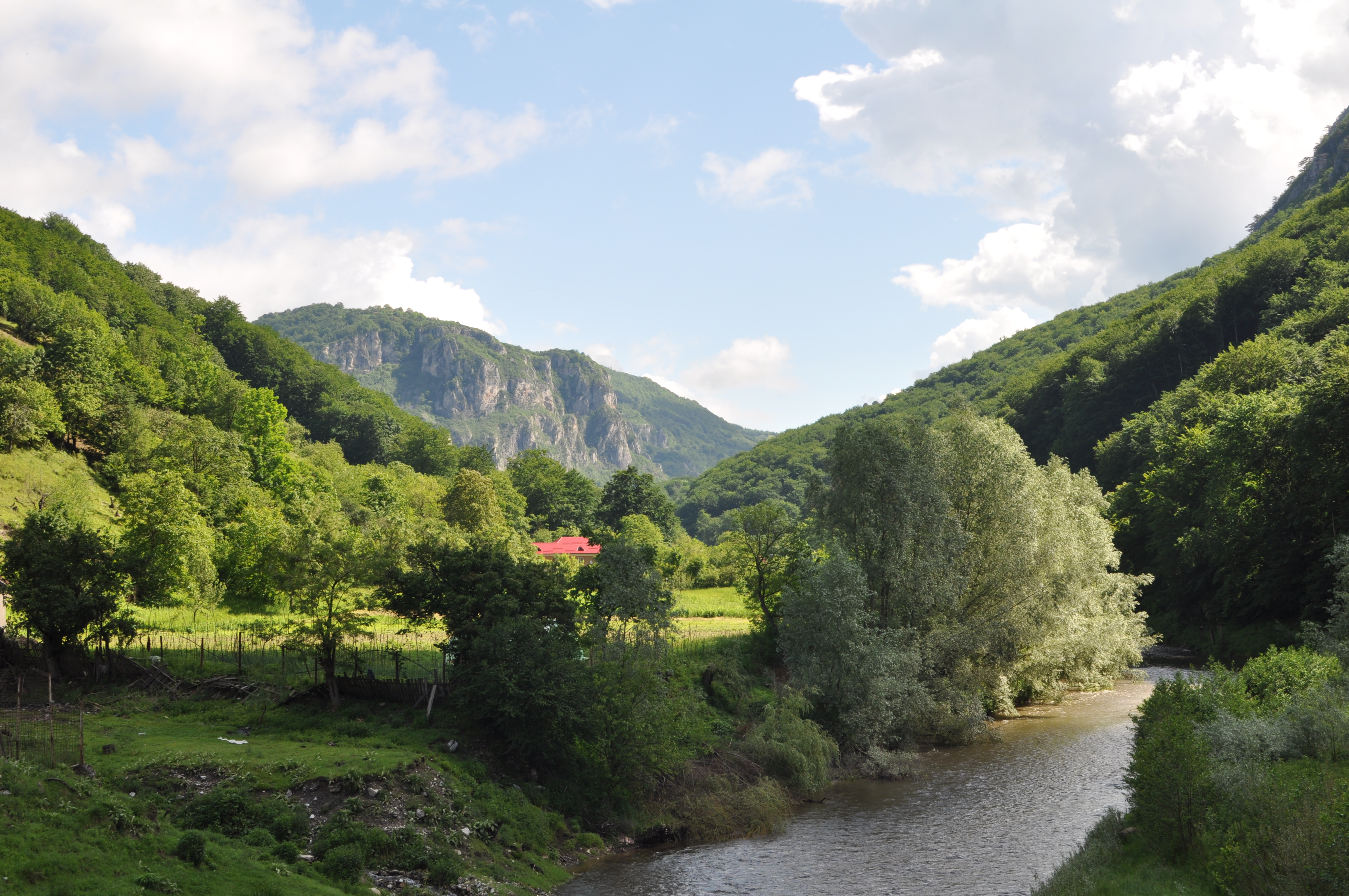
The Cerna River is the thread that stitches the park together. Rising in the Godeanu Mountains and flowing south toward the Danube, the Cerna carved the valley that gives the park half its name. On the right bank rise the Cerna Mountains and the Godeanu range; on the left, the Valcan and Mehedinti mountains. The park spans parts of three Romanian counties -- Caras-Severin, Gorj, and Mehedinti -- a jurisdictional complexity that delayed its protection for decades. The landscape itself does not respect administrative boundaries. Limestone dissolves into caverns and pavements that cross county lines. Glacial cirques scoop into ridgelines that belong to different mountain groups. Water, rock, and time have shaped a terrain indifferent to human cartography.
The Black Pines of Banat
Among the park's most remarkable residents is Pinus nigra subspecies banatica, an endemic black pine found only in this corner of the Carpathians. These trees anchor themselves on rocky slopes in a sub-Mediterranean forest community unlike anything else in Romania. The park's position at the intersection of Central European, Mediterranean, and Balkan climatic influences creates an extraordinary botanical crossroads. Beech forests dominate the mid-elevations -- several types are represented, from Illyrian beech communities to acidophilous spruce forests higher up. Alluvial forests of alder and ash line the riverbanks. Calcareous meadows, petrifying springs that deposit travertine, and rocky slopes with chasmophytic vegetation add layers of diversity. The park was formally declared a protected area by Romanian law on March 6, 2000, though the ecological arguments for its protection had been accumulating for generations.
A Network of Hidden Reserves
Within the park's boundaries lie ten distinct nature reserves, each protecting a specific habitat or geological feature. The largest, Coronini-Bedina in Caras-Severin County, covers 3,865 hectares. The smallest, Barzoni Cave, protects a single cave entrance on just one-tenth of a hectare -- a reminder that conservation sometimes means guarding a single doorway into the earth. Piatra Closanilor in Gorj County spans 1,730 hectares of dramatic limestone terrain. Ciucevele Cernei protects 1,166 hectares of the Cerna River gorges. Together, these reserves function as a mosaic of protection within the larger park, each calibrated to the specific ecological value of its terrain. The approach reflects a European conservation philosophy that layers strict protection over broader landscape management.
Where Limestone Meets Water
Limestone defines the character of this park. It dissolves under acidic rainwater, creating the sinkholes, pavements, and cave systems that riddle the terrain. Pit caves drop vertically into darkness. Springs emerge from cliff faces, depositing travertine -- a form of limestone -- in cascading terraces. This geological cycle of dissolution and deposition has been running for millions of years, and the park preserves it in action. Some caves are closed to the public to protect their fragile ecosystems, but the surface landscape tells the story clearly enough. Walking a limestone pavement in Domogled-Valea Cernei is walking on a surface sculpted entirely by water and time, every groove and channel evidence of rainfall that fell long before humans existed to observe it. The park sits in Romania's Important Bird Area network, and its remoteness ensures that it remains one of the least visited -- and least disturbed -- protected areas in the country.
From the Air
Located at 45.09N, 22.62E in the Southern Carpathians of southwestern Romania. The Cerna River valley runs roughly north-south through the park, with the town of Baile Herculane visible at the southern edge. Best viewed from 5,000-8,000 feet AGL to appreciate the deep valley and surrounding mountain ridgelines. Nearest airport: Timisoara Traian Vuia International (LRTR), approximately 75 nm west. Craiova (LRCV) lies to the southeast. The Danube gorge at the Iron Gates provides a major visual landmark to the southwest.