Drewry's Bluff
On May 15, 1862, five Union warships steamed up the James River toward Richmond, and the fate of the Confederacy hung on a bend in the river. At that bend, a clay bluff rose high above the water on the west bank, crowned with hastily built earthworks and three massive Columbiad cannons. The ironclad Galena took forty-five hits in four hours. Confederate sharpshooters on the banks picked off exposed sailors. By afternoon, the Union flotilla was retreating downriver, and Richmond would remain the Confederate capital for three more years. Drewry's Bluff, named for the local landowner Captain Augustus H. Drewry who gave his property to the cause, became the lock on the river gate to Richmond.
The River Gate to Richmond
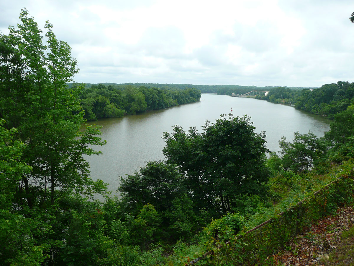
Geography made Drewry's Bluff a natural fortress. At Richmond, where the James River hits the fall line at the head of navigation, the river bends sharply south before turning east again toward the Chesapeake Bay. At this sharp turn in Chesterfield County, the bluff commanded a view of several miles downstream, a clear sightline for any gunner watching for approaching ships. Commander Ebenezer Farrand, who supervised the defenses, recognized the advantage immediately. He ordered ships sunk as obstructions in the river below the bluff, turning the waterway into a gauntlet. Six additional heavy guns occupied pits just upriver from the main fort. The combination of elevation, river obstacles, and concentrated firepower made Drewry's Bluff one of the most formidable defensive positions on any American river during the Civil War.
Sailors on the Bluff
The garrison at Drewry's Bluff was unlike any other in the war. When Norfolk fell to Union forces in May 1862, the crew of the legendary CSS Virginia, the ironclad that had fought the Monitor at Hampton Roads, scuttled their ship at Craney Island rather than let it be captured. Those sailors and marines made their way to the bluff and joined Captain Drewry's Southside Artillery in the earthworks above the James. It was an unusual assembly: experienced naval gunners fighting from fixed land fortifications, aiming down at ships rather than across water at them. After the first battle, Captain Sydney Smith Lee, brother of General Robert E. Lee, took command and transformed the position into a permanent installation. Drewry's Bluff became a training ground for the Confederate States Naval Academy and the Confederate Marine Corps Camp of Instruction, its barracks, chapel, and officers' quarters turning the bluff into a small military community.
Beauregard's Counterpunch
Two years of quiet ended in May 1864 when Union Major General Benjamin F. Butler landed his Army of the James at Bermuda Hundred, a neck of land at the confluence of the James and Appomattox Rivers, just south of Richmond. Butler's forces advanced overland and reached Drewry's Bluff's outer defenses by May 9. Several Union regiments managed to capture the outer line of entrenchments, and for a moment it looked like the approach to Richmond would fall. But delays among Union commanders gave the Confederates time to regroup. General P.G.T. Beauregard cobbled together 18,000 troops to face Butler's 30,000. On the foggy morning of May 16, Confederate General Ransom attacked down the Old Stage Road, rolling up the Union line from right to left until the fog itself halted his advance. Butler, his army demoralized, ordered a retreat to Bermuda Hundred. For the second time, a Union drive on Richmond had been stopped at Drewry's Bluff.
Lincoln Passes the Fort
The garrison held until the very end. When Petersburg and Richmond finally fell in April 1865, the defenders of Drewry's Bluff joined the evacuation, marching westward with Lee's Army of Northern Virginia. Many of the sailors who had manned the bluff's guns served as infantry during the desperate fighting along the retreat, ultimately surrendering at Appomattox Court House. Once the Confederates abandoned the fort, Union engineers quickly cleared the sunken ship obstructions from the river below. On April 4, 1865, just one day after the evacuation, President Abraham Lincoln and his young son Tad passed the silent guns of Drewry's Bluff aboard a riverboat, heading upstream to walk the streets of the fallen Confederate capital.
What Remains on the Bluff
Today Drewry's Bluff is part of the National Park Service's Richmond National Battlefield Park. Visitors can walk through the surviving earthworks and stand where Confederate gunners once aimed down at the James River. The view downstream remains commanding, the same long sightline that made the bluff so effective as a defensive position. After the war, the site became a stop on the Richmond and Petersburg Railroad. The Defense Supply Center, Richmond, now occupies nearby land at Bellwood, Virginia. Two Virginia Historical Highway Markers along the Jefferson Davis Memorial Highway commemorate the battles fought here, recording how a clay bluff above a river bend twice saved the Confederate capital from capture.
From the Air
Drewry's Bluff sits at 37.42N, 77.43W on the west bank of the James River in Chesterfield County, Virginia, about 7 miles south of downtown Richmond. From the air, look for the sharp southward bend in the James River just below Richmond. The bluff is on the outside of this bend, rising steeply above the water. The site is adjacent to I-95 and the Defense Supply Center Richmond (Bellwood). Nearest airports: Richmond International (KRIC) approximately 15 nm east; Chesterfield County Airport (KFCI) approximately 8 nm southwest. Best viewed at 2,000-3,000 ft AGL following the James River corridor south from Richmond.