Dryandra Woodland National Park
One Noongar man, born in 1910, described the ochre pit in Dryandra as "a very spirity place" - somewhere to be avoided at night. The ochre had been used for body decoration and rock art for thousands of years before European settlers arrived, stripped the bark from the mallet trees, and ran seven steam trains through the woodland to service a tannin industry. Both layers of history survive here. Dryandra Woodland National Park, 164 kilometres southeast of Perth and 22 kilometres northwest of Narrogin, is a complex of 17 distinct blocks spread over 50 kilometres of the Wheatbelt, separated by farmland but connected by a shared purpose: to preserve the last large remnant of the open eucalypt woodlands that once blanketed this part of the continent.
Ancient Ground
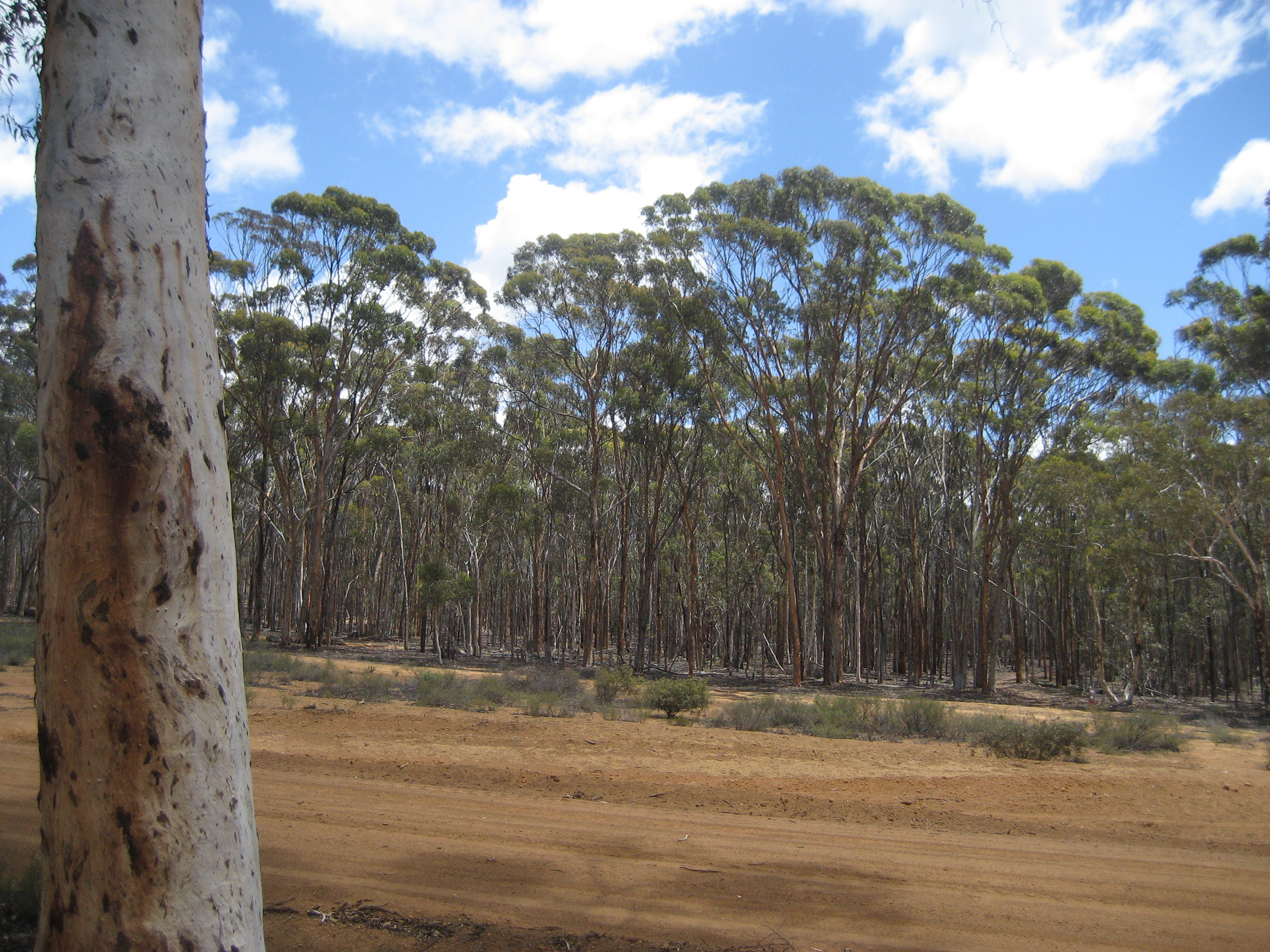
Dryandra sits within the southwestern province of the Yilgarn craton, an ancient plateau composed mainly of granite with intrusions of dolerite and a laterite cap. Weathering has softened the terrain into a gently undulating countryside on the western edge of the Wheatbelt, where land clearing began in the 1890s and consumed most of the native woodland. What survived at Dryandra is transitional: moister jarrah forest to the south gives way to semi-arid wheatbelt flora to the east. The canopy is dominated by wandoo, powderbark wandoo, and salmon white gum, with stands of jarrah and marri providing additional cover. The understorey includes rock sheoak and extensive areas of Banksia ser. Dryandra - the shrub genus that gave the woodland its name until taxonomic reclassification in 2007. Golden dryandra and prickly dryandra persist in the heath between the trees.
The Numbat's Last Stronghold
More than 50 percent of the total known population of numbat lives in Dryandra's woodland blocks. The woodland also supports major populations of two other nationally endangered species: the woylie and the red-tailed phascogale. Additional marsupials include the bilby, mala, boodie, and western barred bandicoot, many reintroduced after predator control made the habitat safe again. Over 800 native flora species have been identified here, including 15 declared priority species. The conservation success is not accidental. It rests on the Western Shield project, which uses sodium fluoroacetate - a naturally occurring toxin in the local poison pea plant (Gastrolobium) - to bait foxes and feral cats. Native mammalian herbivores evolved a high genetic tolerance to the toxin, which is lethal to introduced predators. Within two to three years of the aerial baiting program, mammal populations surged.
Bark, Tannin, and Steam
In the early 1900s, a significant industry grew up around harvesting bark from brown mallet trees (Eucalyptus astringens), which thrive on the laterite soils of the southern Wheatbelt. Bark sent to Germany for analysis was found to contain more than 40 percent high-quality, water-soluble tannins suitable for producing fine leather. Seven steam trains and a sawmill operated within the woodland. Two dams, Lol Gray and Old Mill Dam, supplied water to power the trains and were carted to nearby towns including Narrogin. By 1959, production was in steep decline, undercut by a world glut, rising costs, and competition from synthetic tannins. The industry had effectively collapsed by the early 1960s, leaving behind infrastructure that the woodland slowly absorbed.
Listening to the Bush
Two self-drive tour routes thread through the woodland, and at each of five or six stops, a low-power FM transmitter - concealed and solar-powered - broadcasts a five-minute commentary through the car's radio. Some broadcasts stage conversations between characters describing daily life as a forestry worker in early Dryandra. Others explain the ecology visible from the car window: the poison pea plant and its fluoroacetate chemistry, the wandoo's relationship to salinity, the habits of the numbat at dawn. Adjacent to heritage cottages, the Currawong Complex repurposes Nissen huts acquired from an Air Force base to accommodate groups of up to 60 people. The Lions Village, established by Perth-based Lions clubs in 1972, was built to provide a holiday camp for disadvantaged children - yet another layer in a place where deep time, colonial industry, Aboriginal heritage, and modern conservation overlap in a patch of bush barely an hour from farmland in every direction.
From the Air
Coordinates: 32.78S, 116.97E. Dryandra appears from altitude as scattered dark-green woodland blocks amid the lighter-toned cleared farmland of the Wheatbelt. The 17 separate blocks are separated by agricultural land, giving a distinctive patchwork visible from 5,000-10,000 ft AGL. Located 164 km southeast of Perth. Nearest airports: YNAR (Narrogin), YPJT (Jandakot). The surrounding wheatbelt farmland provides strong visual contrast with the dark woodland.