Du Toitskloof Pass
For more than a century, a former Wurttemberg Hussar named Detlef Siegfried Schonfeldt lobbied the Cape Colony government in vain. Farming on the slopes of Du Toitskloof in the early 1800s, he could see the animal track that threaded through the mountains between the Boland and the interior, and he knew what it could become: a road. The government declined to fund it. Another route, the Bainskloof Pass built by engineer Andrew Geddes Bain in 1845, won out instead. It would take another century and a world war before the Du Toitskloof Pass finally became a road -- one that would itself be superseded within forty years.
A Huguenot's Name on a Mountain
The pass takes its name from Francois Du Toit, a seventeenth-century French Huguenot refugee who fled religious persecution and settled in the foothills of these mountains. The Huguenots who arrived in the Cape Colony in the late 1600s were granted farmland in the fertile valleys around Franschhoek and Paarl, and their family names became permanently inscribed in the landscape. Du Toitskloof -- Du Toit's Rift -- describes the cleft through the mountains that the pass would eventually exploit. Before any road existed, farmers used the track to reach the interior beyond the mountain barrier, driving their wagons and livestock along paths originally worn by game animals.
Wartime Construction
The idea of a proper road over Du Toitskloof surfaced again in 1930 when engineer P.A. de Villiers explored the route's feasibility. The National Roads Board investigated further in 1938, and the route was finalized in 1940. Construction began in the summer of 1941-42, during the thick of World War II. The pass climbed to 820 meters across 48 kilometers of mountain terrain, threading through landscapes where the surrounding peaks often carry a covering of snow in winter. Du Toits Peak, the highest point in the range at 1,995 meters, towers above the road. The project cost R1.25 million and produced a 40-kilometer road that opened in March 1949, when Prime Minister D.F. Malan cut the ribbon on a route that had been imagined for well over a century.
The Pass Becomes the Back Road
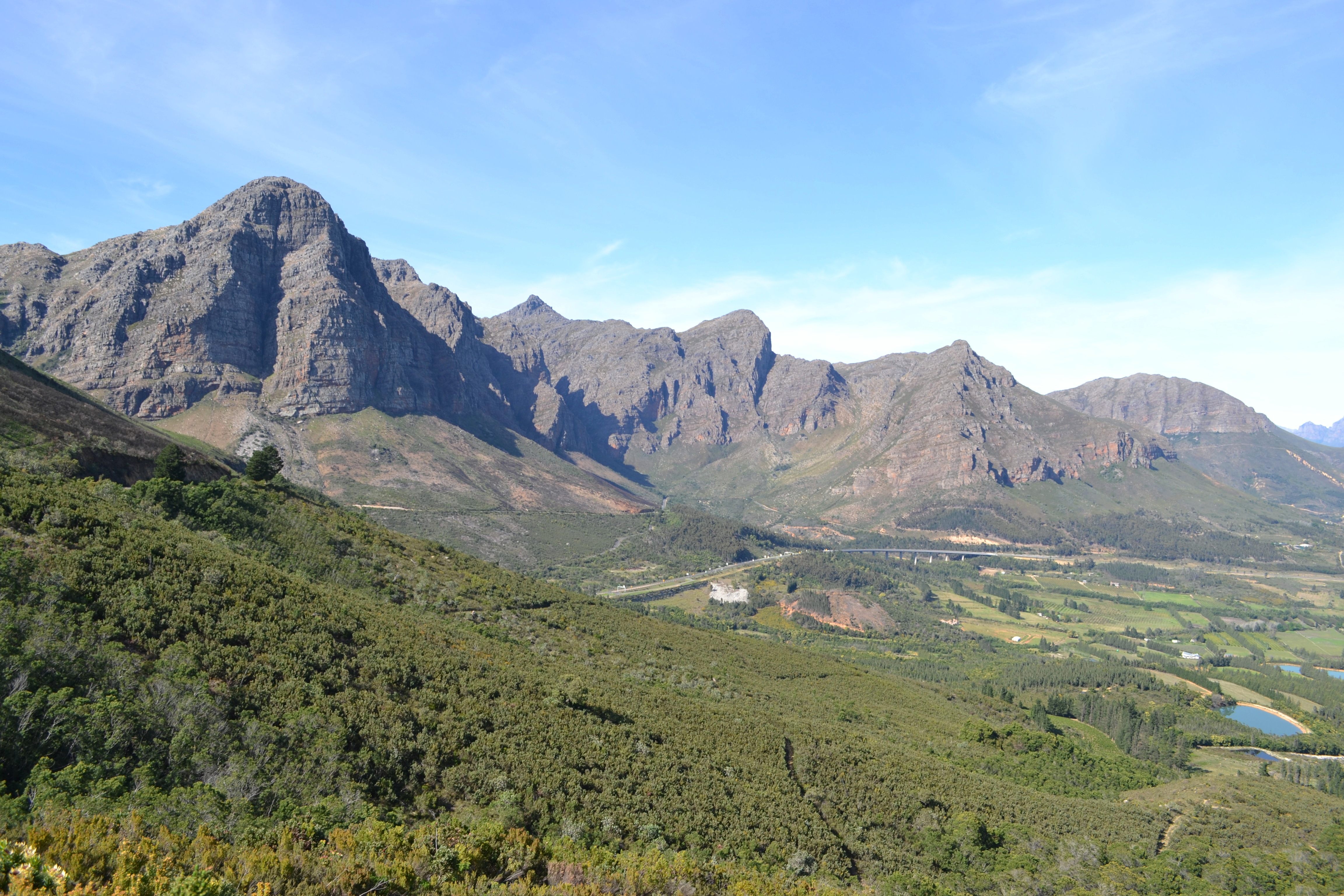
For nearly four decades, the Du Toitskloof Pass carried the N1 national road, the main artery connecting Cape Town to the interior via Paarl and Worcester. Then, in 1988, the Huguenot Tunnel opened -- 3,900 meters of bored rock through the same mountain range, shortening the journey by 11 kilometers and bypassing the pass entirely. The tunnel, described as the largest curved structure in South Africa, relegated Du Toitskloof to regional route R101 status. Traffic that once wound over the mountain shifted underground. But demotion has its advantages: the pass is now a quiet, scenic drive through some of the Western Cape's most dramatic mountain country.
Above the Clouds on R101
Today, Du Toitskloof Pass is a destination rather than a necessity. The Mountain Club of South Africa maintains huts in the surrounding peaks, and hikers traverse ridgelines that were ancient game trails long before any human engineered a road. An impressive viaduct on the Paarl approach side spans a deep valley, offering views that the tunnel's fluorescent-lit interior cannot match. In winter, snow dusts the higher elevations, and mist can reduce visibility to meters. The road itself is a testament to mid-twentieth-century engineering ambition -- tight switchbacks climbing through fynbos and rock, each turn revealing another fold of the Drakenstein range. Where Schonfeldt once saw potential and was refused, and where animals once picked their way through a narrow rift, cars now trace a road built during wartime and preserved by the very tunnel that made it unnecessary.
From the Air
Located at 33.72S, 19.15E in the Du Toitskloof Mountains between Paarl and Worcester, Western Cape. Du Toits Peak (1,995 m) is the dominant summit in the range. The pass is visible from altitude as a winding road threading through the mountain terrain, with the Huguenot Tunnel entrance visible at the base of the mountains on the Paarl side. Cape Town International Airport (FACT) is approximately 70 km to the west-southwest. Worcester airfield (FAWO) lies to the east in the Breede River valley. Mountain weather can change rapidly; be aware of turbulence and reduced visibility near the peaks.