Duluth Ship Canal
The story of the Duluth Ship Canal begins with a grudge. In the 1860s, every ship leaving Duluth's harbor had to sail past Superior, Wisconsin, because the only natural outlet to Lake Superior lay at the far eastern end of the bay, between Minnesota Point and Wisconsin Point. For Duluth merchants watching their commerce pass under their rival's nose, this was intolerable. When an Army engineer recommended cutting a canal straight through the narrow sand spit of Minnesota Point in 1866, the idea was obvious but expensive. The city moved forward in 1870 anyway, and when Wisconsin politicians got wind of the plan and rushed to Washington to obtain a federal injunction to stop construction, Duluth's workers dug faster. The injunction arrived on July 13, 1871. The canal was already open.
The Rivalry That Built a Harbor
The competition between Duluth and Superior was not idle bickering -- it was a fight over the economic future of the western Great Lakes. The construction of the first locks on the St. Marys River in 1855 had opened navigation between the Great Lakes, and Superior Bay offered a natural sheltered harbor. But Duluth sat on the wrong side of a seven-mile-long sandbar. Ships had to round the entire length of Minnesota Point and pass Superior's docks to reach the open lake. An 1865 breakwater harbor built outside the bay was destroyed by a storm in 1871. The canal through Minnesota Point solved the problem permanently, but at a diplomatic cost: the injunction was lifted only after Duluth agreed to build a dike from Rice's Point to Minnesota Point, isolating the canal from the main flow of the Saint Louis River that fed the bay and formed the border between the two cities.
Timber Cribs and Winter Ice
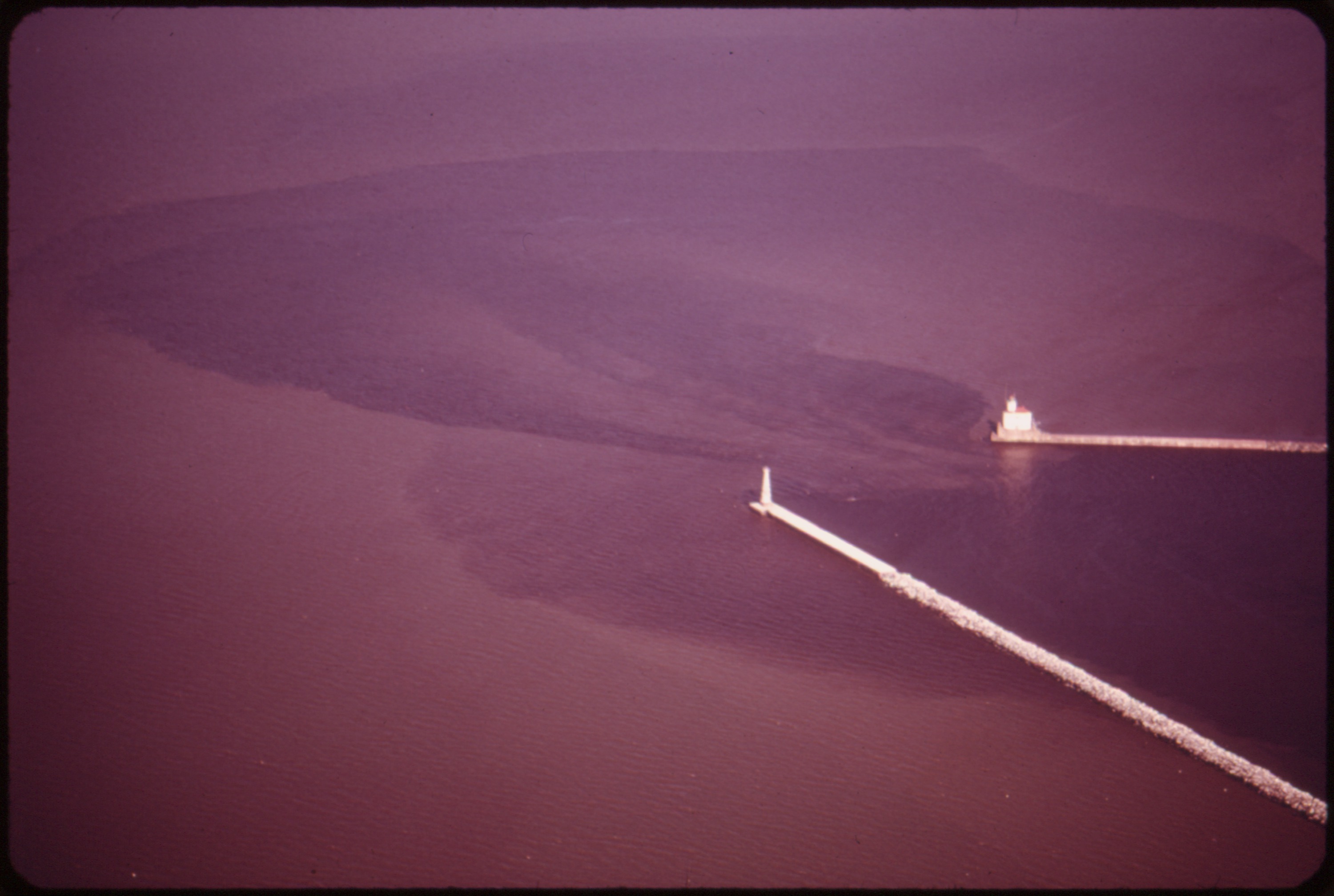
From the beginning, the canal was defined by piers on either side -- timber cribs placed by the city with some federal funding. Lake Superior's winters proved merciless. Ice and storms battered the wooden structures, requiring substantial repairs every few years. The cycle of damage and rebuilding continued until an 1896 reconstruction project gave the piers their permanent form: concrete set on timber and stone cribbing. The new south pier was completed in 1901, the north pier in 1902. Three lighthouses now mark the canal's passage: the Duluth North Pier Light and the Duluth South Breakwater Outer Light guide ships at the lake entrance, while the Duluth South Breakwater Inner Light serves as a range light paired with the outer one. There are no locks. Ships transit the canal under their own power, though tug service stands ready for foul weather.
The Bridge That Lifts
Cutting the canal solved the harbor problem but created a new one: Minnesota Point was now an island, severed from the mainland. In 1905, an aerial transfer bridge was constructed to carry passengers and vehicles across the gap in a suspended gondola car. That original structure was converted in 1929 into the Aerial Lift Bridge that stands today, its road deck rising vertically on counterweighted towers to let ships pass beneath. The bridge has become Duluth's most recognizable landmark, its silhouette printed on everything from postcards to brewery labels. At the harbor end of the canal, a Corps of Engineers administration building completed in 1906 anchors the north side. It was enlarged in the 1940s, and in 1973 the Lake Superior Maritime Visitor Center was added, giving tourists a front-row seat to watch thousand-foot ore carriers glide through the narrow passage.
A Thousand Ships a Year
The Duluth-Superior port remains one of the busiest inland ports in North America, handling roughly a thousand vessel transits through the canal each year. Iron ore from the Mesabi Range, grain from the northern plains, coal, limestone, and other bulk commodities move through this narrow cut in the sand. Ocean-going ships, so-called salties, make the journey from the Atlantic through the St. Lawrence Seaway, through the locks at Sault Ste. Marie, across Lake Superior, and into the canal -- a passage that connects the heart of the continent to the world. The breakwaters that define the canal's entrance extend into the lake, their concrete surfaces weathered by more than a century of Superior's notorious storms. From the water, the view approaching the canal is unmistakable: two parallel walls, three lighthouses, and the Aerial Lift Bridge rising against the Duluth hillside.
From the Air
Located at 46.7794°N, 92.0914°W at the junction of Minnesota Point and Canal Park in Duluth. The ship canal is a highly visible water feature from the air: a narrow cut through the long sandbar of Minnesota Point, flanked by concrete breakwaters extending into Lake Superior. The Aerial Lift Bridge spanning the canal is Duluth's most recognizable landmark from any altitude. Duluth Sky Harbor Airport (KDYT) is located on Minnesota Point itself, roughly 2.5 miles southeast along the sandbar. Duluth International Airport (KDLH) is about 8 miles northwest. The canal is best viewed from 1,500-3,000 feet, where the full geometry of Minnesota Point, the harbor, Superior Bay, and the canal entrance are all visible. Ship traffic is common and can be spotted from altitude. The long thin line of Minnesota Point stretching southeast into Lake Superior is one of the most distinctive geographic features on the western end of the lake.