Dumbarton Bridge
The call came in on October 17, 1989, just after the Loma Prieta earthquake buckled a section of the San Francisco-Oakland Bay Bridge. Traffic engineers needed a solution, and fast. Within hours, crews were on the Dumbarton Bridge, restriping its four lanes into six to absorb the displaced commuters. That improvised fix became permanent, a reminder that this modest crossing at the southern tip of San Francisco Bay has always punched above its weight in regional transportation.
A Scottish Name at the Water's Edge
The name Dumbarton floats across the bay from Scotland, bestowed in 1876 on a point of land near the bridge's eastern terminus. The original bridge opened on January 17, 1927, making it the first vehicular crossing of San Francisco Bay, predating the Golden Gate by a full decade. Built with private capital, that early span was a two-lane drawbridge with a lift section for boats. The state purchased it in 1951 for $2.5 million. A portion of the old drawbridge still extends from the eastern shore as a fishing pier, its concrete pilings weathered by decades of salt air and tidal surges.
The Shortest Crossing
At the bay's narrowest southern reach, the Dumbarton Bridge stretches as the shortest highway crossing of San Francisco Bay. More than 70,000 vehicles traverse it daily, along with roughly 118 cyclists and pedestrians on weekdays and 384 on weekends, using the dedicated path along its southern edge. The current bridge opened in October 1982, a high-level structure built north of its predecessor. Twin steel trapezoidal girders carry the center spans, while pre-stressed lightweight concrete supports the approaches. Power lines run parallel to the roadway, marching across the water like sentries guarding the passage between Fremont and Menlo Park.
Where Silicon Valley Meets the Marshes
The bridge lands in the heart of contrasts. To the west, the tech campuses of Facebook and Oracle sit within commuting distance. To the east, the Don Edwards San Francisco Bay National Wildlife Refuge spreads across salt ponds and levee trails, home to the endangered California clapper rail. The Hetch Hetchy Aqueduct runs between the vehicle bridge and its abandoned rail cousin, emerging from underwater to cross the bay in plain sight. Coyote Hills Regional Park rises north of the eastern terminus, and the Alameda Creek Regional Trail winds from the bay to Niles Canyon, offering escape from the concrete arteries below.
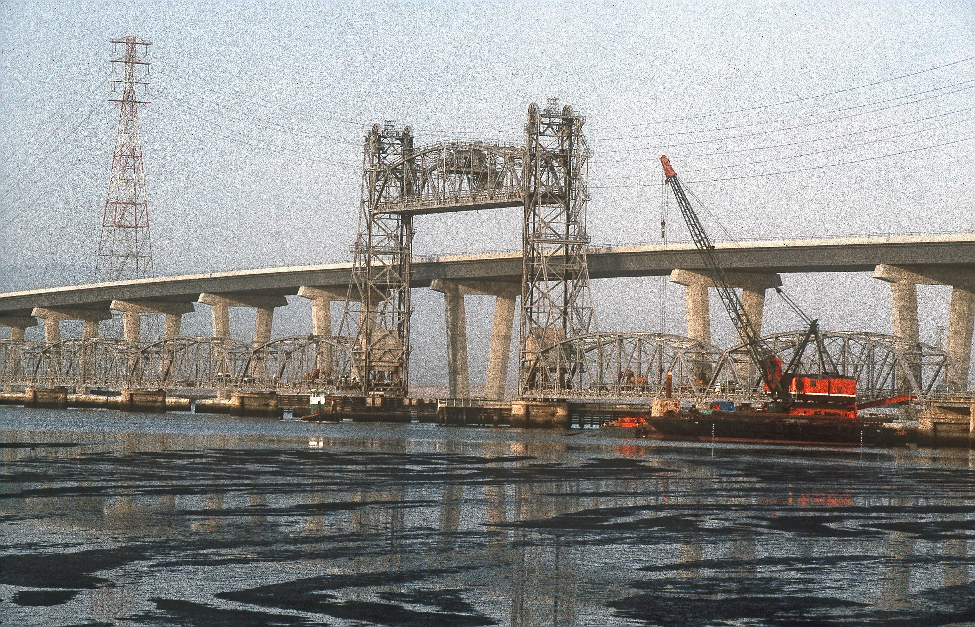
The Forgotten Rail Line
Just south of the highway bridge lies the Dumbarton Rail Bridge, built in 1910 and unused since 1982. Its western approach collapsed in a 1998 fire, and the swing span now rests permanently in the open position, a rusting monument to abandoned ambitions. When trains still ran, boaters would signal the operator, who would start a diesel engine and rotate the bridge on a massive gear. Plans for commuter rail service linking the Peninsula to Fremont have circulated for years, but in 2008, $91 million earmarked for rehabilitation was redirected to the BART Warm Springs extension instead.
A Toll Road Through Time
The original 1927 bridge charged 40 cents per car plus a nickel per passenger. Today, westbound drivers pay $8 at electronic tolling stations, with rates scheduled to climb to $10.50 by 2030. The transformation from human toll collectors to all-electronic payment accelerated during the COVID-19 pandemic in March 2020. The old toll booths stand empty now, awaiting removal to create true open-road tolling. In 1971, the film Harold and Maude captured Maude speeding through the original toll plaza, disobeying a police officer in a scene that preserved a vanished crossing for cinema.
From the Air
Located at 37.51N, 122.12W in the southern San Francisco Bay. The bridge is clearly visible as a straight line crossing the water between Fremont/Newark on the east and Menlo Park on the west. Power lines parallel the bridge and the abandoned rail bridge sits just to the south. Salt ponds and the Don Edwards National Wildlife Refuge are visible on the east side. Nearest airports: San Carlos (KSQL, 8nm NW), Palo Alto (KPAO, 5nm SW), Reid-Hillview (KRHV, 12nm SE). Best viewed at 1,500-3,000 feet AGL for the full bay crossing perspective.