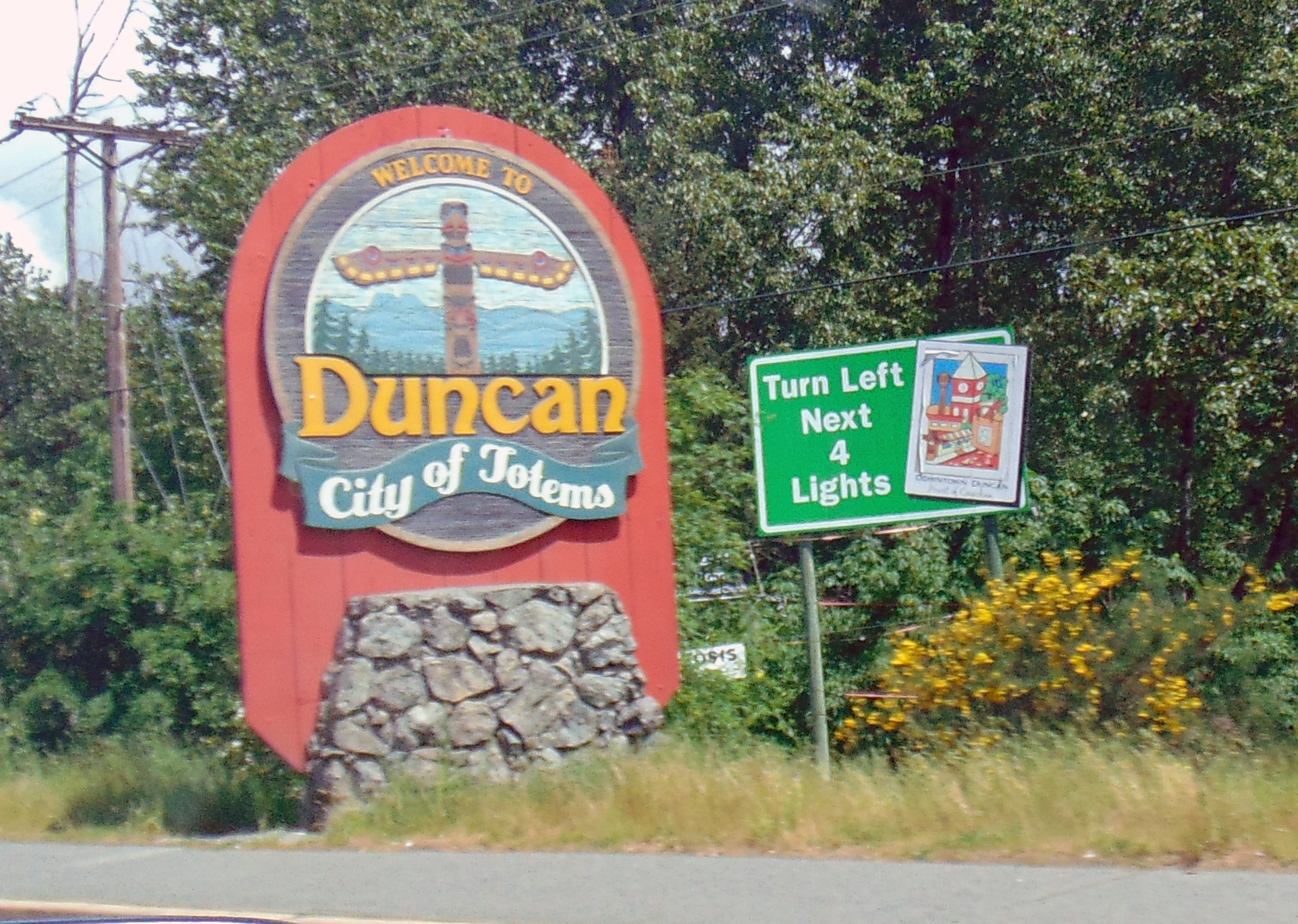
Duncan
Over forty totem poles stand along the streets of Duncan, their carved faces watching traffic pass on the Trans-Canada Highway that runs through this small Vancouver Island city. The poles represent many nations and carving traditions, gathered here as public art that earned Duncan its nickname: the City of Totems. But the Indigenous presence runs deeper than display - this is Quw'utsun' territory, the 'warm land' of the Cowichan people, whose community remains the largest First Nations band among the Coast Salish. The Cowichan Tribes have lived here for millennia, and their artisans still produce the distinctive knit sweaters that carry the Cowichan name around the world.
The Warm Land
The Cowichan Valley lives up to its Halkomelem name. Protected by mountains from the worst Pacific storms, the region enjoys a Mediterranean-influenced climate that distinguishes it from rainier parts of Vancouver Island. Farms spread across the valley floor, producing everything from grapes to lavender, the agricultural diversity reflecting the mild conditions. Vineyards have proliferated in recent decades, the Cowichan Valley emerging as one of British Columbia's newest wine regions.
The Cowichan Tribes have occupied this land since time immemorial, their territory extending from the valley through the surrounding mountains and along the coast. European settlement brought the usual displacement and disruption, but the Cowichan community persisted and remains a vital presence. Today the Cowichan Nations encompass multiple reserves and a population that makes them the largest First Nations band in British Columbia. Their cultural traditions, from weaving to carving, continue through generations of artists who maintain and evolve the Coast Salish artistic heritage.
The Cowichan Sweater
The bulky knit sweaters emerged in the mid-1800s, when Coast Salish women adapted their traditional weaving skills to work with commercial wool. The designs incorporated Indigenous symbols and patterns; the construction used techniques passed down through generations. The result was a distinctive garment - warm, water-resistant, immediately recognizable - that became known worldwide as the Cowichan sweater.
Authentic Cowichan sweaters come only from Cowichan knitters, each one handmade by artisans who learned the craft from mothers and grandmothers. The wool is undyed, creating the natural cream, grey, and brown palette; the weight provides genuine warmth in the wet coastal winters. Mass-produced imitations exist, but the real sweaters remain a living tradition, available directly from Cowichan artisans and at shops throughout the valley. Purchasing one supports both the individual craftsperson and the broader cultural preservation that keeps the tradition alive.
City of Totems
The totem pole project began in the 1980s as an effort to revitalize Duncan's downtown. Commissioned poles from various First Nations artists were installed along the main streets, each one representing different coastal traditions and stories. Free guided tours offered by the Cowichan Historical Society explain the poles' meanings and the nations they represent - these are not generic 'Native art' but specific works by identified artists, carrying specific cultural content.
The poles have become Duncan's signature attraction, drawing visitors who walk the downtown circuit photographing each one. The collection has grown to over forty poles, making it one of the largest public displays of contemporary totem art in the world. For the artists and nations represented, the poles serve as living cultural presence - their stories told in cedar, their traditions visible in a town that might otherwise read as just another highway stop between Victoria and Nanaimo.
Gateway to the Valley
Duncan serves the entire Cowichan Valley, its small-town downtown providing services for a regional population of 84,000. The city proper holds fewer than 5,000 residents, but the surrounding communities use Duncan as their mailing address and commercial center. Highway 1 runs straight through, connecting Victoria forty-five kilometers south to Nanaimo an equal distance north. The location makes Duncan a natural stop for travelers exploring Vancouver Island's length.
From here, ferry connections reach Salt Spring Island through the nearby terminal at Crofton - a short crossing to the largest of the Gulf Islands, with its artist studios, farms, and Saturday market. Seaplanes land at Maple Bay, offering direct flights from Vancouver International Airport. The BC Forest Discovery Centre preserves logging heritage; wineries welcome visitors along vineyard routes through the valley. It's a functional small city that happens to sit in one of Vancouver Island's most pleasant regions, the Cowichan warmth extending to both climate and community.
From the Air
Located at 48.80N, 123.70W on southeastern Vancouver Island, British Columbia. Duncan sits in the Cowichan Valley between the coastal mountains and the Strait of Georgia. Highway 1 (Trans-Canada) is visible running through town. The Cowichan River flows southeast of downtown. Maple Bay and seaplane facilities are 9 km east; the ferry terminal at Crofton is 13 km northeast, with routes to Salt Spring Island. Victoria is 45 km south; Nanaimo 45 km north. The forested slopes of the Vancouver Island ranges rise to the west. Look for the totem poles along downtown streets.