Dunedin
The statue of Robbie Burns stands in the Octagon with its back to the church and its face to the pub. Locals will tell you this says everything worth knowing about Dunedin. Named for Edinburgh -- Dun Eideann in Scottish Gaelic -- this South Island city was founded by Scottish Presbyterians in 1848, and the heritage runs deep: street names borrowed from the Scottish capital, Victorian and Edwardian architecture bankrolled by gold, and a stubborn cultural independence that has outlasted the prosperity that built it. But Dunedin is not a museum piece. It is a university town of 130,000, compact and walkable, perched between harbour and hills at the head of a peninsula teeming with wildlife.
Before the Scots
Long before William Cargill led his Free Church settlers ashore, Maori hunters had known this place. Archaeological evidence puts their presence in the area from about 1280, drawn by the rich marine resources of the coast and harbour. They called it Otepoti. European seal hunters appeared around 1790, followed by whalers who worked the coast until the 1820s. But it was the planned Scottish settlement of 1848 that created the city. Cargill and the lay leader of the Free Church envisioned a new Edinburgh at the bottom of the world, orderly and Presbyterian. Within two decades, the Otago gold rush would transform their modest settlement into something they never planned: the largest and most prosperous city in New Zealand.
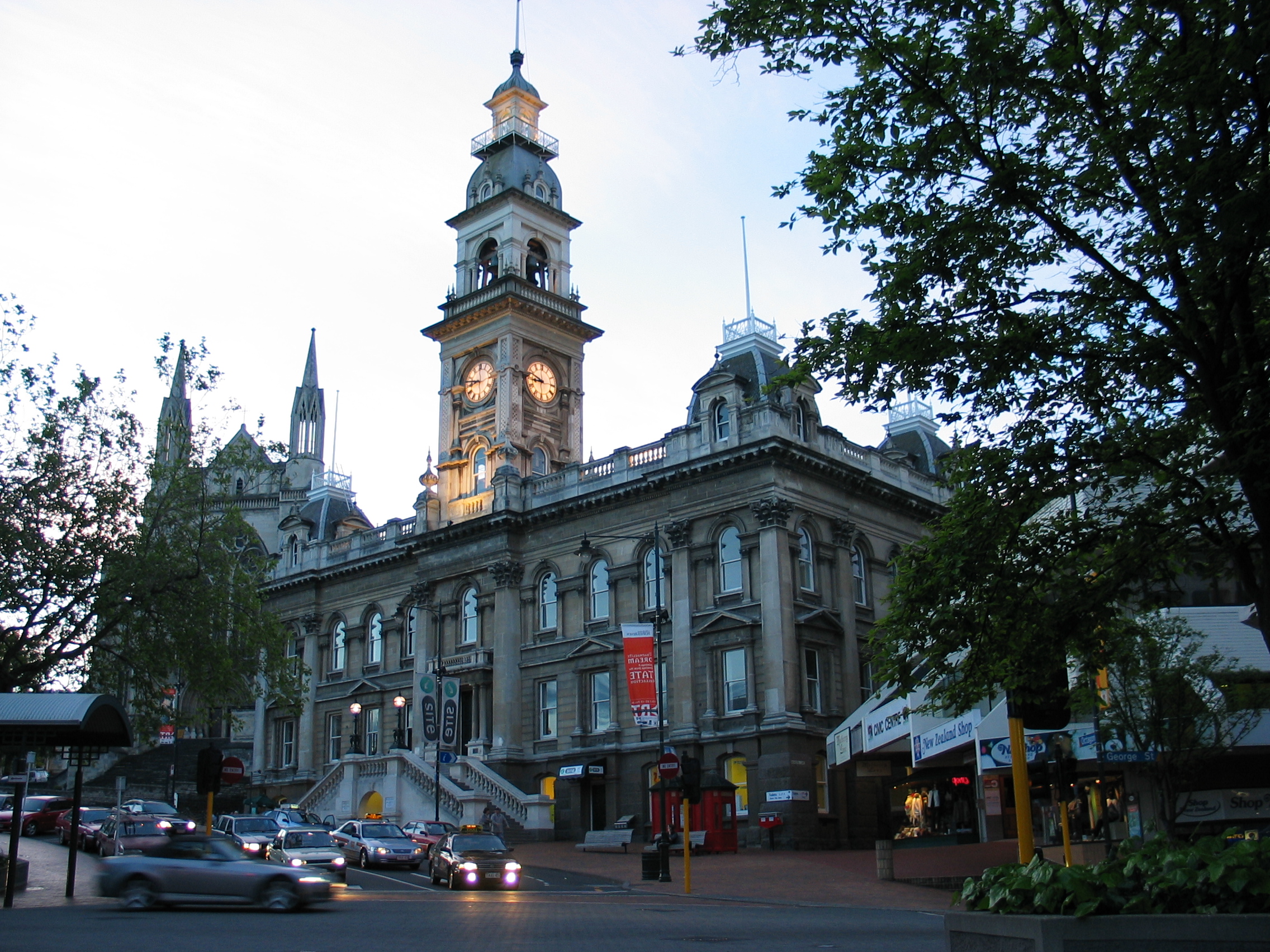
Gold Rush Capital
From 1865 to 1900, Dunedin was New Zealand's pre-eminent city. Gold pouring out of central Otago funded grand public buildings, banks, warehouses, and churches -- many of which still stand. The Dunedin Railway Station, completed in 1906, is among the most photographed buildings in the country, its Flemish Renaissance facade decorated with Royal Doulton tiles. The wealth attracted immigrants from across the world, including Cantonese miners who arrived in the 1860s and whose descendants remain part of the city's fabric. When the gold thinned and economic gravity shifted north to Auckland, Dunedin's population plateaued, but the architecture survived. The city is now considered New Zealand's fourth major centre -- behind Auckland, Wellington, and Christchurch -- despite ranking seventh in population, a gap that reflects influence built on history rather than headcount.
The Steepest Street and the Wildest Peninsula
Baldwin Street climbs at a maximum gradient of 35 percent, earning it recognition as one of the steepest residential streets in the world. It has become a tourist attraction in its own right, drawing visitors who photograph themselves at the top and occasionally roll things down it for charity. But Dunedin's real geographic drama lies to the east, along the Otago Peninsula. This narrow finger of land separates the harbour from the open Pacific, and its coastline shelters colonies of royal albatross, yellow-eyed penguins, and New Zealand fur seals. At Taiaroa Head, the world's only mainland breeding colony of northern royal albatross nests on the clifftop -- a three-metre wingspan unfolding against the wind, visible from the viewing platform without binoculars.
Scarfies, Breweries, and Saturday Mornings
The University of Otago, founded in 1869 as New Zealand's first university, shapes the rhythm of the city. Its students -- known locally as 'scarfies' -- fill the flat-bottomed streets of North Dunedin in term time, and their energy keeps Dunedin younger and livelier than its size might suggest. The city's food scene punches above its weight: the Saturday morning farmers' market at the railway station is a Dunedin institution, stacked with local organic produce, artisan bread, and cheese from surrounding Otago farms. Speight's brewery, established in 1876, still operates from its original Rattray Street site, offering tours and a public tap that draws spring water from deep beneath the building. For a city at 46 degrees south, often cold and sometimes iced over in winter, Dunedin compensates with a warmth that is cultural rather than climatic.
A City That Outgrew Its Plan
Dunedin sits in a natural amphitheatre of hills around the head of Otago Harbour, its suburbs climbing steeply in every direction from the flat city centre. The Octagon -- an eight-sided plaza that functions as the civic heart -- is flanked by the Town Hall, St Paul's Cathedral, and the public art gallery. From here, the city fans out into neighbourhoods with distinct characters: the student quarter to the north, the heritage precinct around the Exchange to the south, the coastal suburbs of St Clair and St Kilda to the west. It is a city built for a population it never quite reached, which gives it a spaciousness unusual in urban New Zealand. The streets are wide, the parks generous, and the buildings -- Victorian, Edwardian, art deco -- stand with the confidence of a place that once believed it would be the country's capital.
From the Air
Located at 45.87°S, 170.50°E at the head of Otago Harbour on New Zealand's South Island. Best approached from the east over the Otago Peninsula, where the harbour, city, and surrounding hills form a dramatic amphitheatre. The Dunedin Railway Station and Octagon are visible landmarks in the city centre. Baldwin Street is in the North East Valley suburb. The Otago Peninsula extends northeast with Taiaroa Head at its tip. Nearest airport: NZDN (Dunedin International), approximately 25 km southwest of the city centre. Expect variable weather; the city is often overcast with occasional snow in winter.