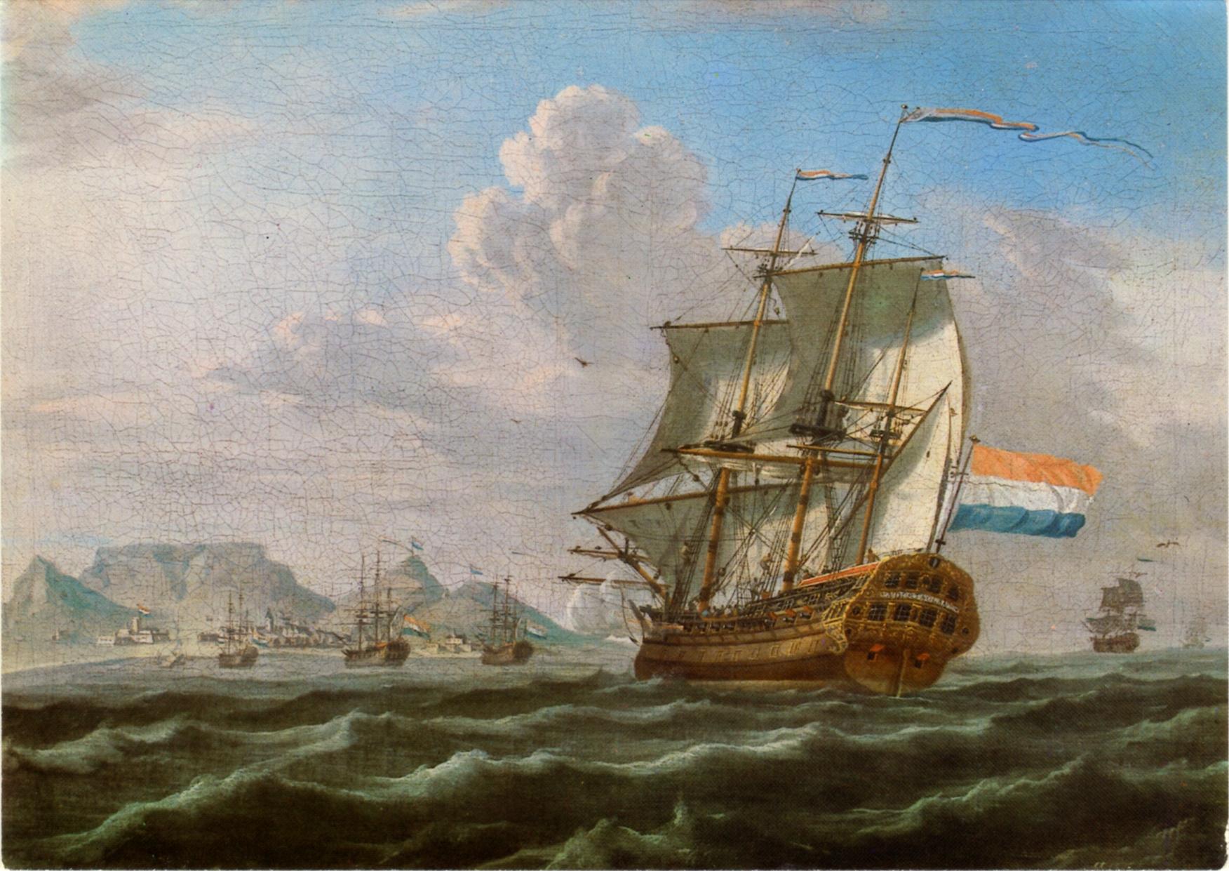
Dutch Cape Colony
The Dutch East India Company's shareholders did not want a colony. They wanted a gas station -- a place where ships sailing between Amsterdam and the spice islands of Asia could take on fresh water, vegetables, and meat. When Jan van Riebeeck stepped ashore at the Cape of Good Hope in 1652 with orders to establish exactly that, nobody planned for what came next: Free Burghers demanding farmland, enslaved people shipped in from three continents, indigenous Khoi and San communities pushed off their grazing lands, and a creole language that would eventually be called Afrikaans. The shareholders' waystation became a colony that lasted 154 years and left marks that South Africa is still reckoning with.
Free Burghers and Forced Labor
By 1657, the Company was already losing control of its own experiment. Employees petitioned to be discharged so they could farm independently, and van Riebeeck allocated two plots near the Liesbeek River -- named Groeneveld and Dutch Garden -- to the first nine Free Burghers. These men became subjects rather than servants of the Company, required to sell their crops to the VOC at fixed prices. But farming the Cape was labor-intensive, and the Burghers' answer was enslaved labor. People were brought from Madagascar, Mozambique, the Dutch East Indies, and Ceylon. The first school in South Africa was established not for the colonists' children but for enslaved people rescued from a Portuguese slave ship that arrived aboard the Amersfoort in 1658. The school taught Dutch, which became the dominant language of commerce, displacing indigenous languages and even French among the Huguenot settlers who arrived later.
A Landscape Remade
The arrival of European agriculture fundamentally altered the lives of the Khoi and Tuu-speaking peoples who had lived at the Cape for millennia. Nomadic pastoralists who followed seasonal grazing patterns found their routes blocked by fenced farms producing food at fixed locations. Some became laborers for the colonists, working as shepherds and herdsmen -- doing the same work they had always done, but now on someone else's terms. As the settlement grew, Trekboeren -- nomadic European livestock farmers -- pushed deeper into the interior, competing with Khoe-speaking cattle herders for the best grazing lands. By 1672, the permanent indigenous population at the Cape had grown substantially, but they were increasingly marginalized on their own land.
Kitchen Dutch and Arabic Letters
The Cape Colony's diversity produced one of its most lasting legacies: the Afrikaans language. It began as a Dutch pidgin, a simplified trade language used between colonists, enslaved people, and indigenous communities. Over time it creolized, absorbing Malay, Portuguese, Khoi, and other influences. Enslaved people and servants spoke what the colonists dismissively called "Kitchen Dutch." But it was Cape Muslims who first made it a written language, using Arabic script -- a form known as Arabic Afrikaans. This was a language born from the collision of worlds: European commerce, Asian exile, African displacement, and the daily negotiations of survival in a colony where power was defined by the color of your skin and the faith you practiced.
Conquest Upon Conquest
In 1795, France occupied the Dutch Republic, and Britain -- at war with France -- seized the Cape to control the sea route to India. The British fleet anchored at Simon's Town, defeated the Dutch militia at the Battle of Muizenberg, and took control. When peace briefly returned in 1803 under the Treaty of Amiens, Britain returned the colony to the Batavian Republic, the French-aligned successor to the old Dutch state. But the peace lasted barely a year. In 1806, British forces returned and won the Battle of Blaauwberg, capturing the Cape permanently. The Dutch government formally ceded sovereignty in 1814 under the Convention of London. For the indigenous peoples and the enslaved, the change of colonial master was a change of flag, not a change of circumstance. The sociopolitical foundations that the Dutch had laid -- settler land claims, enslaved labor, racial hierarchy -- would persist and deepen under British rule and far beyond.
From the Air
Located at 33.92S, 18.42E, centered on Cape Town at the tip of the Cape Peninsula. The Cape of Good Hope is visible to the south, with Table Mountain dominating the city center. The Liesbeek River valley where the first Free Burgher farms were established runs through the southern suburbs. Cape Town International (FACT) lies 18 km southeast. The entire Cape Flats and surrounding mountains are visible from 5,000 ft AGL, giving a sense of the geography that shaped the colony's expansion.