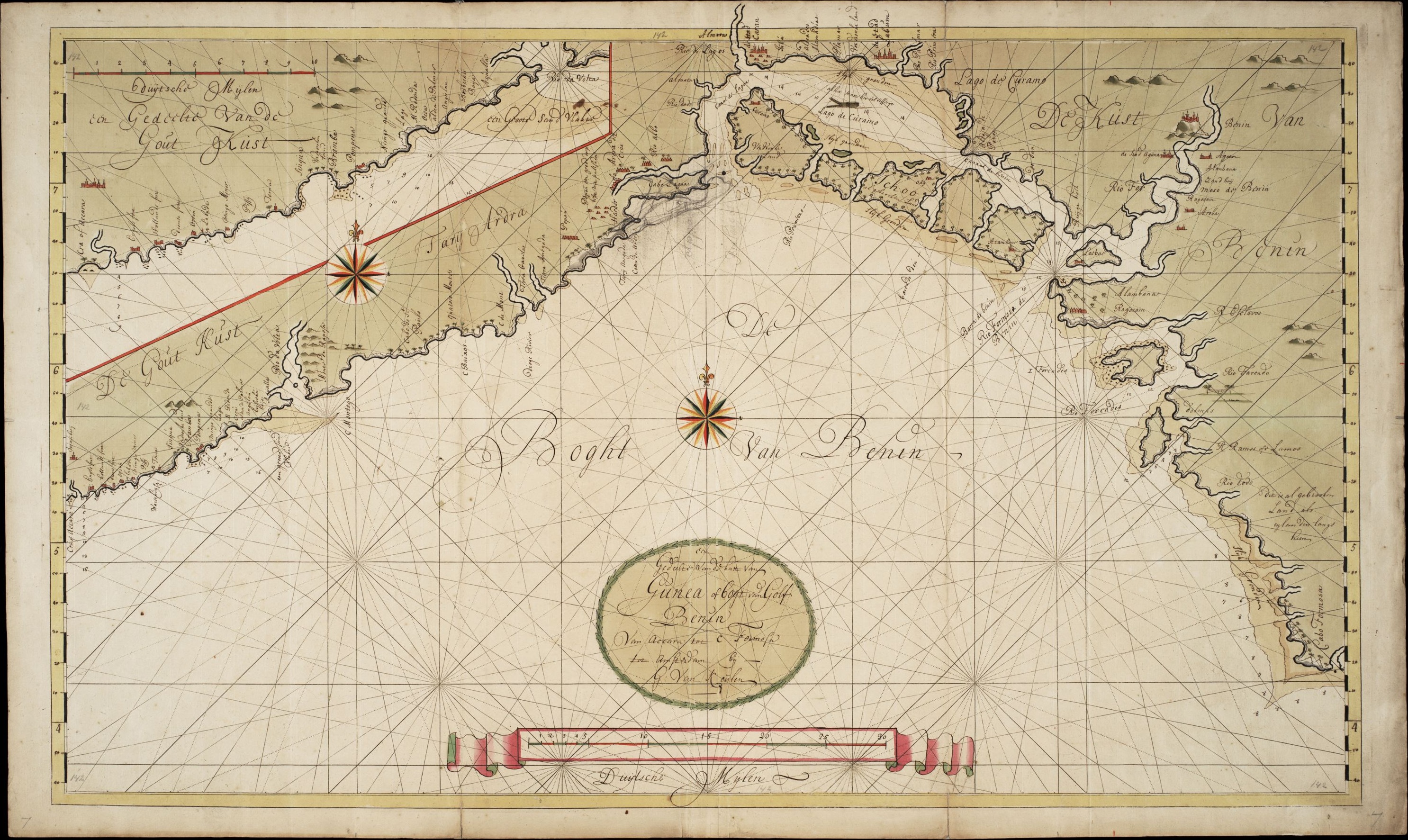
Dutch Slave Coast
Writing in the 1690s, the Dutch merchant Willem Bosman described the slave market at Fida with chilling precision: "Markets of men are here kept in the same manner as those of beasts are with us." He was not horrified. He was reporting a business operation. The Dutch West India Company's trading posts along what Europeans called the Slave Coast -- stretching across the shores of present-day Ghana, Togo, Benin, and Nigeria -- existed for one primary purpose: to supply enslaved human beings to Dutch plantations in the Americas. From 1660 to 1760, these posts formed one link in a chain of suffering that reshaped four continents.
The Business of Human Beings
Dutch interest in the Slave Coast grew from colonial ambition in the Americas. After seizing northern Brazil from the Portuguese in the 1630s, the Dutch needed labor for sugar and tobacco plantations -- and they needed it in enormous quantities. The Dutch West India Company began sending agents to the Ajaland capital of Allada from around 1640. By 1660, permanent trading posts had been established at Allada and Offra, with additional outposts at Benin City, Grand-Popo, and Savi. Offra quickly became the most important Dutch office on the coast. A 1670 report recorded that 2,500 to 3,000 enslaved people were transported from Offra to the Americas annually. Each of those numbers represented an individual -- someone seized in a raid or sold through networks of war and debt, held in coastal holding areas, then forced onto ships for a crossing that killed roughly one in eight of those who endured it.
Entangled in African Politics
The Dutch did not operate in a vacuum. They were embedded in complex local power struggles that they exploited but could not control. The Company allied with the Aja king of Allada, whose authority extended over the coastal trade, and this alliance made the Dutch dependent on his stability. When conflict erupted in 1688 between the Aja king and the coastal peoples, the supply of enslaved people slowed. The Company chose the king's side -- a political bet that backfired catastrophically in 1692, when opposing forces destroyed the Offra trading post. Dutch involvement on the Slave Coast effectively collapsed. A decade later, the Company tried again, sending Jacob van den Broucke as head merchant to Ouidah in 1703, where the English and French also operated trading posts. But political unrest drove the Dutch from Ouidah in 1725. They relocated eastward to Jaquim, building Fort Zeelandia, only to abandon it too. By 1760, the Dutch had withdrawn entirely from the region.
The Scale of Suffering
Historian Patrick Manning estimates that approximately 12 million enslaved people entered the Atlantic trade between the 16th and 19th centuries. About 1.5 million died during the Middle Passage -- the weeks-long ocean crossing in conditions of filth, starvation, and despair. An estimated 10.5 million arrived in the Americas, the largest share destined for Brazil and the Caribbean. But these numbers capture only part of the devastation. Manning estimates that four million more died inside Africa after capture -- during forced marches to the coast, in holding facilities, from disease and violence. The Dutch Slave Coast was one node in this system, connected to the Dutch Gold Coast headquarters at Elmina and feeding Dutch colonial economies from Suriname to Curacao. The human toll extended beyond the individuals enslaved. Entire communities were destabilized by raids. Cultures were fractured. Families were permanently severed.
The Ledger That Cannot Be Closed
The Dutch Slave Coast left few physical traces. Unlike the stone fortresses at Elmina or Cape Coast, most of the trading posts along this stretch of coast were modest structures -- warehouses and holding areas built for commerce, not permanence. Fort Zeelandia at Jaquim was the exception, but it too fell into disuse after 1760. What remains is the documentary record: shipping logs, company reports, Bosman's detailed account, and the Atlas of Mutual Heritage, which catalogs Dutch colonial sites across the region. The trading posts are gone, but their consequences endure. Historian Ana Lucia Araujo has documented how the process of enslavement shaped not only the lives of those who were taken but the societies they were forced into -- their trajectories determined by where they disembarked, what labor they performed, their age, gender, language, and faith. The Dutch Slave Coast was active for a century. Its legacy is measured in generations.
From the Air
The Dutch Slave Coast encompassed the coastal region around 6.0N, 2.0E, stretching across present-day Ghana, Togo, Benin, and Nigeria along the Gulf of Guinea. Key locations include Offra (near modern Ouidah), Allada (inland from the coast), and Jaquim (site of Fort Zeelandia). From 5,000-10,000 feet AGL, the flat coastal plain, lagoon systems, and river estuaries that defined the region's geography are clearly visible. The coastline runs roughly east-west. Nearby airports include Lome-Tokoin (DXXX) in Togo and Cotonou Cadjehoun (DBBB) in Benin. The Dutch Gold Coast headquarters at Elmina lies further west along the coast. Visibility is generally good but tropical haze and convective clouds are common, especially during the wet season.