Eastern Docklands
The Eastern Docklands have the names of places the ships sailed to. KNSM for the Royal Dutch Steamboat Company that ran the routes. Java for the colony. Borneo. Sporenburg. By the late twentieth century the ships were gone - too big for the docks, replaced by container terminals further west - and the four peninsulas just east of Amsterdam's center were a derelict moonscape of empty warehouses and weeds. In the 1990s the city decided to put 17,000 people there, at densities approaching those of Manhattan, in buildings that architecture students still travel to see. The result is one of the most studied residential developments in modern European urbanism, and a neighborhood that still feels, twenty years on, like a place out of the near future.
Why the Docks Were Built
Amsterdam's medieval harbor opened directly onto the IJ - the inlet of what was then the Zuiderzee - and for centuries that was enough. In the 1860s the Dutch government decided to build the country's first national railway network, and Amsterdam Centraal needed somewhere to sit. The site chosen was the open harbor front itself. The city protested; the station was built anyway, between 1882 and 1889, on three artificial islands filled in across the IJ. The quays it replaced had to be rebuilt somewhere else. City engineer Jacobus van Niftrik drew up plans for a new quay to the east: the Oostelijke Handelskade, the Eastern Trade Quay. Warehouses named Europa, Asia, and Africa rose in 1883. The North Sea Canal, dug starting in 1876, gave Amsterdam a deep-water port for the first time in its history. The Eastern Docklands were the working face of that ambition.
The Four Peninsulas
The Zuiderzee was a problem from the start. Waves rolled in from the open water and slammed the new quays. The city tried a breakwater, which failed. In 1890 they planned a proper dam - and the dam, packed with dredge spoil from the North Sea Canal, became the foundation for two of the four peninsulas: KNSM Island and Java Island. Borneo and Sporenburg came later, named after the East Indies destinations of the ships that loaded there. Each peninsula had its specialty. KNSM was company territory, named for the Koninklijke Nederlandsche Stoomboot-Maatschappij - the Royal Dutch Steamboat Company - whose Asian routes ran from these wharves. Java handled passengers and mail. Borneo and Sporenburg were industrial workhorses. For seventy years the cranes ran day and night.
The Slow Death of the Harbor
By the 1960s, the cranes were stopping. Containerization changed everything - one big ship needed a much larger berth and far fewer dockworkers than the older break-bulk operation. The Eastern Docklands could not accommodate the new ships, and the new ships were not interested anyway. Even when a few new industries arrived, like the Mobil oil terminal, the trend was one direction. Warehouses closed. The Oostelijke Handelskade quieted. In the 1980s the city briefly proposed filling the harbors back in and starting over with new land. They decided instead to keep the water - to make the harbors themselves the central feature of a new residential district. By the early 1990s the planners were ready, the architects were lined up, and the world was about to learn what dense Dutch urbanism could really do.
Borneo, Sporenburg, and West 8
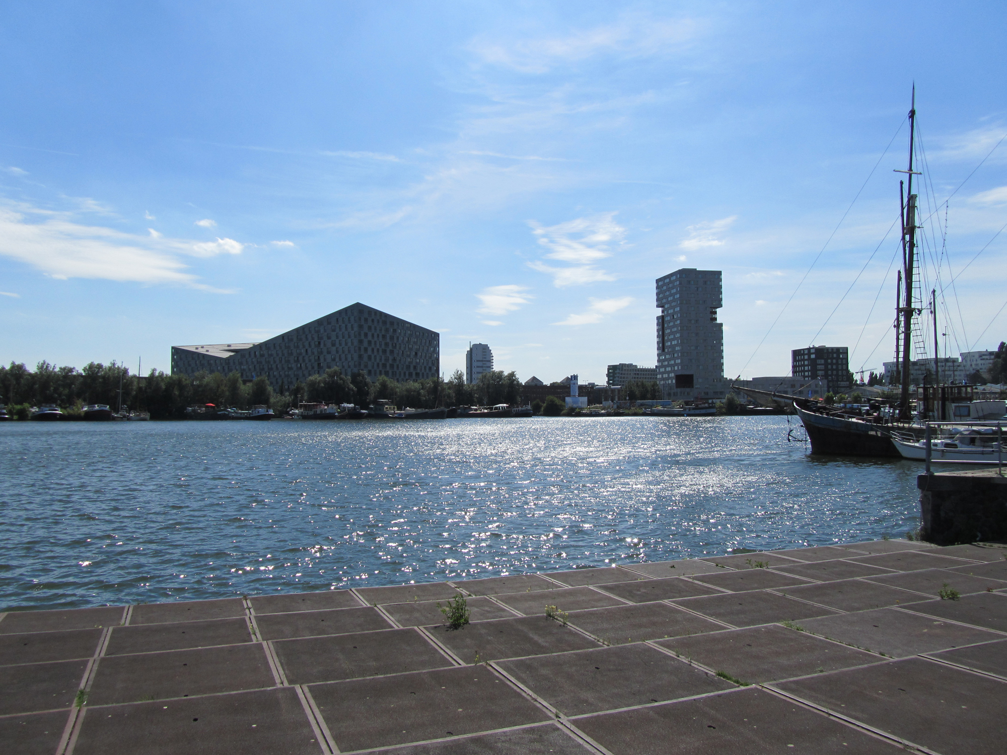
The transformation was the largest post-World War II building project Amsterdam had undertaken. Borneo-Sporenburg got the most attention. The landscape firm West 8, led by Adriaan Geuze, planned the two peninsulas as low-rise high-density housing - mostly three-story row houses, packed at roughly 100 dwellings per hectare, with each ground-floor unit having direct access to the water or a patio. Then individual architects were turned loose on individual lots. The result is two long peninsulas of houses, no two quite alike, occasionally interrupted by huge sculptural apartment blocks - The Whale on Sporenburg, with its dramatic upturned ends, is the most famous. In 2002 the project won the Veronica Rudge Green Prize in Urban Design from Harvard. People still take ferries across just to walk it.
Lloyd Hotel and the New Quay
On the Oostelijke Handelskade itself, the renovation went differently. The Lloyd Hotel - built in 1921 by Evert Breman as temporary housing for emigrants bound for Latin America, mostly from Eastern Europe - had been a German prison during World War II, then a Dutch prison, then a youth detention center, then empty. In 1996 the city held a competition to convert it. The architect Otto Nan won; the new Lloyd Hotel opened in 2004 with 120 rooms of varying eccentricity. By then the rest of the Handelskade was filling in - the Muziekgebouw concert hall, cruise ship terminals, restaurants in converted warehouses. The IJtram has connected the area to Amsterdam Centraal since 2005. Today some 17,000 people live in the Eastern Docklands, in some of the highest population densities in the Netherlands, on land that was open water in 1850. It is, in a small and very Dutch way, a complete reinvention.
From the Air
The Eastern Docklands lie immediately east of Amsterdam Centraal station at 52.3737°N, 4.9353°E, on the south bank of the IJ. From altitude, look for four distinct peninsulas: KNSM Island (the easternmost), Java Island (joined to KNSM as one long peninsula), Borneo Island, and Sporenburg. The Jan Schaefer Bridge connects to Java Island; the Piet Hein Tunnel runs under the harbor. Nearest airports: Amsterdam Schiphol (EHAM), 14 km southwest; Lelystad (EHLE), 50 km east. Recommended viewing altitude 1,500-3,500 ft AGL for the distinctive peninsular geometry.