Eastern Ghats
The word ghat itself is a clue. In Tamil, kattu means a mountain ridge. In Kannada, gatta means a mountain, gatte a shore. In Telugu, gattu means embankment. Linguist Thomas Burrow traced the word through these Dravidian languages, and the etymology reveals something important about the Eastern Ghats: they are not one thing. They are a broken chain, a discontinuous series of ridges and plateaus that runs along India's eastern coast from the Mahanadi River in Odisha to the Vaigai River in Tamil Nadu, crossing five states and defying the neat categorization that their more famous western counterpart enjoys.
Born Before the Continents Had Names
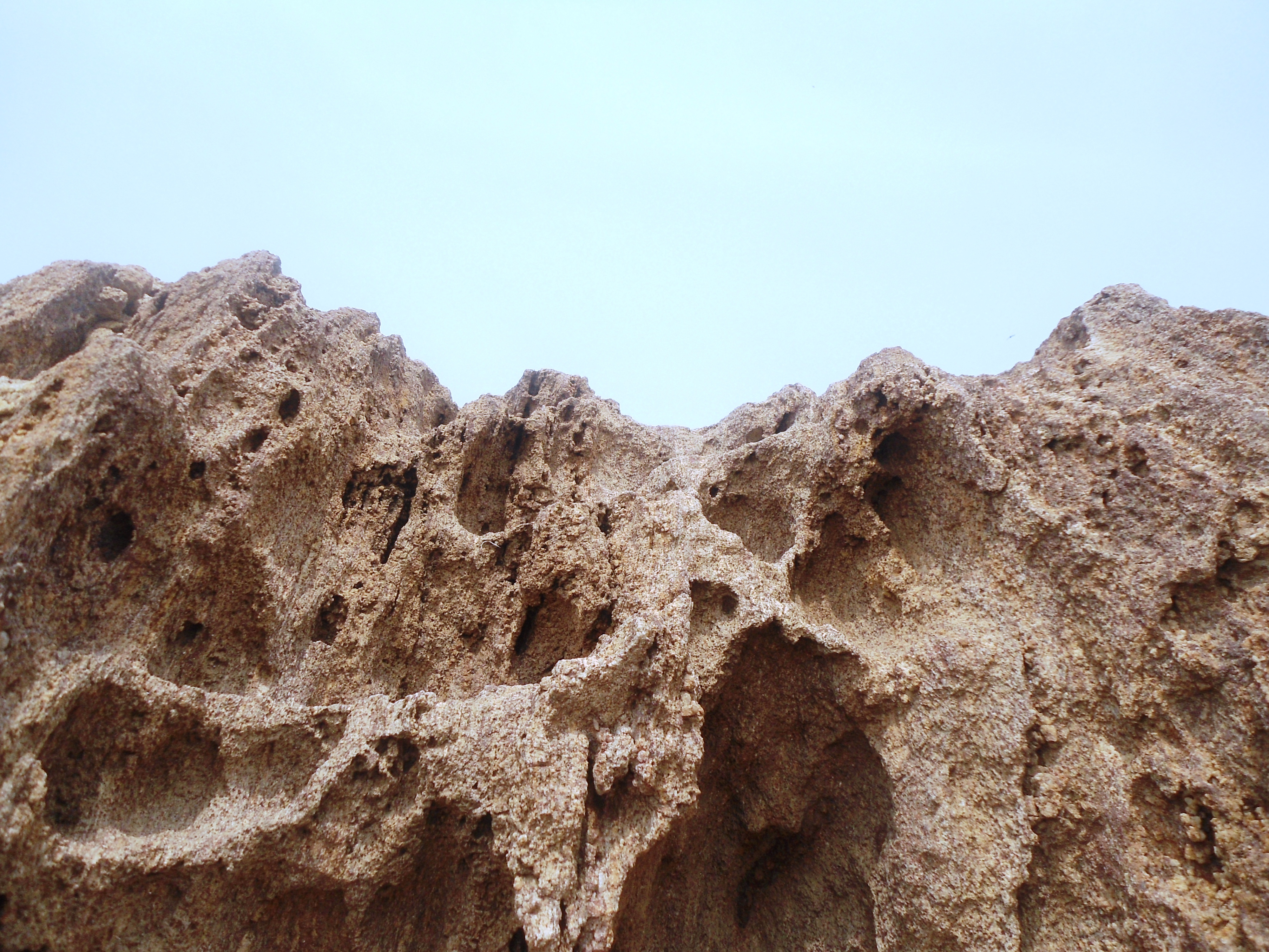
The Eastern Ghats are ancient in a way that makes most mountain ranges seem like new construction. Geologic evidence dates their formation to the Archaean era, when crustal rocks collided to build an orogenic belt that would eventually become part of the Indian subcontinent. These mountains existed before Rodinia, the supercontinent that assembled roughly a billion years ago, broke apart. They survived the creation of Gondwana and the slow drift of the Indian plate northward into Asia. The rock layers were largely formed during the mid-Proterozoic era from accumulated silt, carbonates, and basalt, later metamorphosed into khondalite and calcium silicate. The major rock types found today, charnockite, granite, khondalite, and quartzite, read like a geological autobiography spanning hundreds of millions of years.
The Broken Spine
Unlike the Western Ghats, which form a near-continuous wall along India's western coast, the Eastern Ghats are fragmented. The range divides roughly into three sections. The northern section rises in Odisha, stretching from the Similipal hills southward to the Andhra Pradesh border, with elevations reaching 1,672 meters at Deomali. The middle section runs to the Penna River as two parallel ranges. At the southern end, the chain dissolves into smaller hills like the Sirumalai before meeting the Western Ghats at the Nilgiris. Across their full length, the Eastern Ghats traverse Odisha, Telangana, Andhra Pradesh, Karnataka, and Tamil Nadu. The highest point in the entire range is Arma Konda. This fragmentation has consequences: the Eastern Ghats exert far less influence on India's weather patterns than the Western Ghats, though orographic studies show they still play a role in channeling rainfall to the eastern coastal areas.
Rivers That Cut Through Stone
The Eastern Ghats form one of India's major watersheds, but they do so in a way that seems almost passive. Because the Deccan Plateau tilts eastward, most of peninsular India's great rivers, the Godavari, the Krishna, the Mahanadi, the Kaveri, originate in the Western Ghats and flow eastward, cutting clean through the Eastern Ghats on their way to the Bay of Bengal. The mountains are not the source but the obstacle, and the rivers have been carving their passages for millennia. Between the Eastern Ghats and the coast lie the Eastern Coastal Plains, a wide, fertile region that has supported some of India's oldest civilizations. The rivers that breach the Ghats deposit alluvial soil across these plains, making them among the most productive agricultural lands on the subcontinent.
Nine Forests, One Range
The discontinuous geography creates remarkable biological diversity. Nine distinct forest types occur within the Eastern Ghats, from tropical evergreen to dry deciduous to thorn scrub. Endemic plant species cluster in isolated pockets where the fragmented mountain chain has created what biologists call sky islands, high-altitude habitats separated from one another by lowland gaps. The Botanical Survey of India has documented flowering plants endemic to the region that exist nowhere else on Earth. Reptile surveys in the Araku Valley have recorded species previously unknown to science. Critically endangered vultures have been sighted in the ranges near Raichur and in Adilabad district. Climate change and land-use conversion threaten this diversity: a 2020 Mongabay report warned that shifting conditions may accelerate plant species loss across the Eastern Ghats.
The Tirumala Unconformity
In the Tirumala Hills, where millions of pilgrims ascend each year to the Venkateswara Temple at Tirupati, the road cuts through a geological feature of global significance. The Eparchaean Unconformity is a major stratigraphic discontinuity representing an extensive period of erosion and non-deposition, visible in the steep natural slopes and ravines along the ghat road. Sedimentary rocks deposited along the western edge of the range, products of ancient volcanic activity, later formed schist belts. Beneath the forests and temples lie reserves of bauxite, iron ore, and limestone. The soils, red, black, laterite, and alluvial, vary with the underlying geology. It is a landscape where deep time lies exposed, where the forces that built and broke a supercontinent are written in every road cut and riverbank.
From the Air
The Eastern Ghats (centered approximately 18.39N, 82.89E) stretch discontinuously along India's eastern coast from Odisha to Tamil Nadu, a distance of over 1,500 km. From cruising altitude, the range appears as fragmented hill chains running parallel to the Bay of Bengal coast, significantly less prominent than the Western Ghats. Deomali peak in Odisha reaches 1,672 m; Arma Konda is the overall highest point. The Eastern Coastal Plains are visible between the hills and the sea. Nearest major airports include Visakhapatnam (VEVZ), Bhubaneswar (VEBS), and Chennai (VOMM). Visibility is generally good except during monsoon season (June-September).