Eduardo Avaroa Andean Fauna National Reserve
The lagoons come in colors that seem designed to test the limits of photography. Laguna Colorada runs blood-red from algae and sediment. Laguna Verde glows turquoise against the flank of Licancabur volcano. Laguna Blanca sits white and still beside it. Together, they anchor the Eduardo Avaroa Andean Fauna National Reserve, a 714,745-hectare expanse of high-altitude desert in southwestern Bolivia where the Andes make their final push toward the sky and the landscape looks less like Earth than like a dress rehearsal for Mars. Established in December 1973 and named after Eduardo Abaroa, a Bolivian hero of the War of the Pacific, this reserve drew approximately 153,000 visitors in 2018 -- making it the most visited protected area in the country.
Where the Earth Still Steams
At Sol de Manana, the ground is not finished forming. Geysers blast columns of steam into the thin air at altitudes above 4,800 meters. Fumaroles hiss from cracks in the earth, and mud pots bubble with the sulfurous heat of magma that lies uncomfortably close to the surface. The geothermal activity here has drawn comparisons to Yellowstone, though the setting could not be more different -- this is not forested wilderness but bare, wind-scoured desert at the edge of the habitable world. The reserve sits within the Central Andean dry puna ecoregion, where rainfall is so scarce that water exists only as lakes, salt flats, and the occasional hot spring. Temperatures average low across the year, with the coldest months -- May, June, and July -- capable of plunging well below freezing. The dryness and the cold conspire to preserve everything: rock formations, volcanic cones, and the crystalline air that makes distant mountains appear close enough to touch.
Volcanoes at the Borders
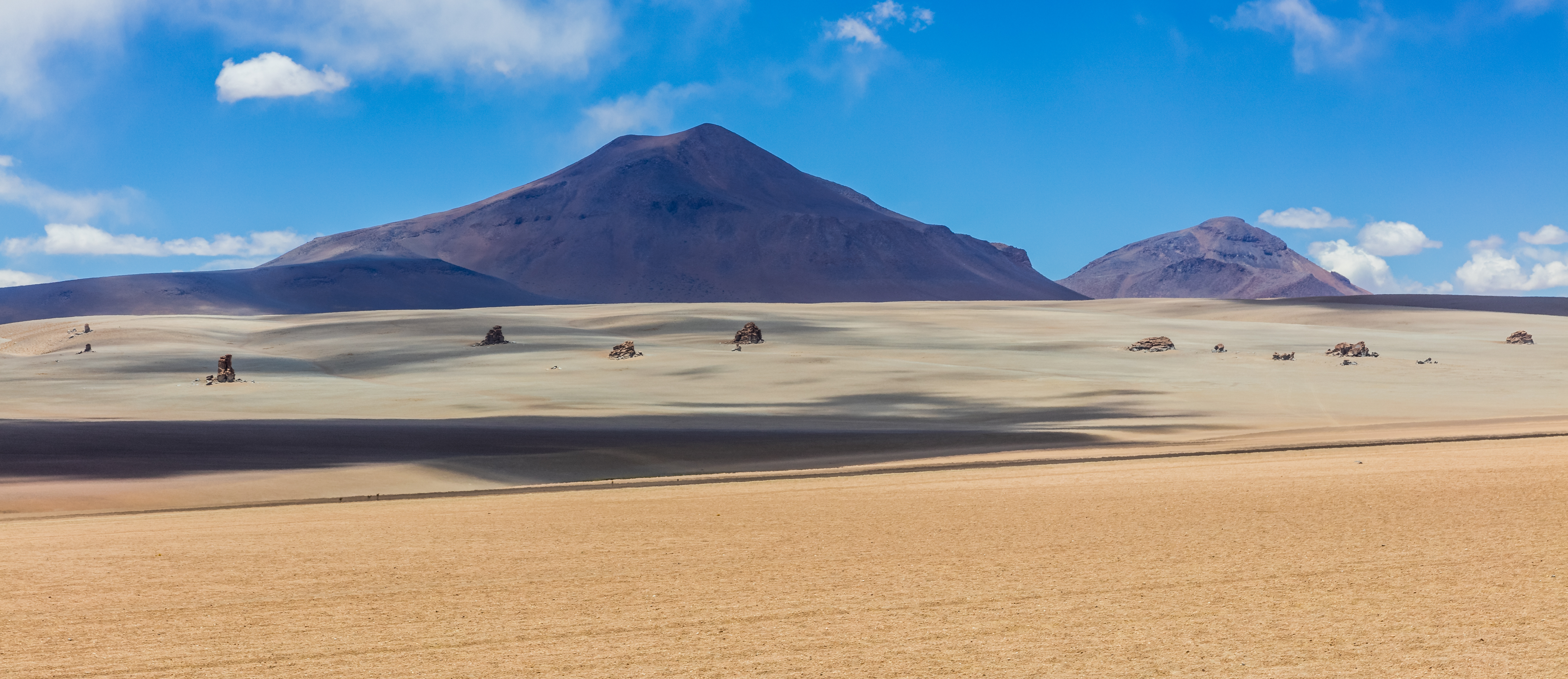
The reserve contains some of the highest peaks in southwestern Bolivia, many of them straddling international borders. Sairecabur reaches 5,971 meters on the Chilean frontier. Licancabur, the iconic cone that frames Laguna Verde, rises to 5,916 meters. Juriques tops 5,704 meters. To the south, Wilama and Zapaleri mark the borders with Argentina, the latter sitting precisely at the tripoint where Bolivia, Argentina, and Chile meet at 5,090 meters. In total, the reserve harbors more than 40 named peaks above 4,800 meters, creating a skyline of volcanic cones and ridgelines that extends unbroken in every direction. The geology is active -- these are not extinct relics but part of a volcanic arc that continues to shape the landscape through eruption, erosion, and the geothermal systems that feed Sol de Manana.
Flamingos in the Shallows
The reserve was established under IUCN Category IV, a designation focused specifically on protecting the birds that inhabit its lagoons. The most celebrated are the James's flamingos -- one of the world's rarest flamingo species -- which feed on the pink algae that thrive in the shallow, mineral-rich waters of Laguna Colorada. The lake is so shallow that the flamingos can walk across it, their pink plumage echoing the red of the water beneath their feet. Approximately 40 bird species depend on the reserve's various lagoons and wetlands. Before the reserve's establishment, local communities collected flamingo eggs for sale, a practice now restricted. That restriction has created tension: the communities of Quetena Chico (population 520) and Quetena Grande (population 180), both of Quechua descent, have had to adapt their livelihoods as conservation rules eliminated traditional income sources.
The Stone Tree and the Dali Desert
North of Laguna Colorada, a seven-meter rock formation rises from the sand dunes of Siloli like a stunted tree frozen in stone. This is the Arbol de Piedra, a ventifact -- a rock sculpted entirely by wind-blown sand over millennia. It has become one of the most photographed features in Bolivia, a natural sculpture that would look at home in a gallery. Nearby, the landscape known as the Salvador Dali Desert earned its name because visitors thought the surrealist painter must have seen it. He almost certainly did not, but the comparison holds: bizarre rock shapes, muted desert colors, and a stillness so complete that the wind itself sounds like an intrusion. The 61 mining concessions operating in and around the reserve -- extracting lead, zinc, silver, sulfur, and ulexite -- are a reminder that this landscape exists within an economy, not apart from it. Bolivia's conservation agency SERNAP works with the nonprofit TROPICO to enforce environmental regulations and manage the tension between extraction and preservation.
Life at the Edge of the Habitable
Quetena Chico and Quetena Grande are the only permanent communities within the reserve, both founded in the 1920s. Despite their Quechua heritage, residents speak primarily Spanish. Healthcare and schooling were unavailable until the 1990s; electricity and potable water did not arrive until at least 2005. The primary livelihood has long been camelid farming -- selling llama wool and meat -- though the reserve's restrictions on fox hunting have complicated this, since foxes are the main predators of llamas and their populations have grown. Some residents pan for gold in the Rio Quetena. Others work in the growing tourist trade, guiding visitors through a landscape that defies easy description. At the archaeological site of Atulcha, mummies rest in a cave on the slopes of Tunupa Volcano -- evidence that people have found reasons to live at these extreme altitudes for a very long time.
From the Air
Located at 22.54S, 67.65W in the Sud Lipez province of Potosi Department, southwestern Bolivia. The reserve sprawls across 714,745 hectares of high altiplano at altitudes ranging from approximately 4,200 to nearly 6,000 meters. From the air, Laguna Colorada's distinctive red coloration and Laguna Verde's turquoise hue are prominent visual landmarks. The volcanic peaks of Licancabur (5,920 m) and Sairecabur (5,971 m) mark the Chilean border. The terrain is extreme desert with no significant vegetation. Nearest airports include Juana Azurduy de Padilla Airport (SLSU) in Sucre and El Alto International Airport (SLLP) in La Paz, both several hundred kilometers distant. The Salvador Dali Desert and Arbol de Piedra formation are visible from low altitude.