Ekel (Norden)
Ask a resident of Norden where Ekel ends and the town center begins, and you will get an honest answer wrapped in a shrug. Ekel has no formal boundary. It never has. The place is a memory of a fortified house that stood 800 metres northeast of the big market place, a memory of an oak grove that grew there once, and now it is a name in everyday speech that locals apply to streets, houses and a primary school catchment area that nobody has ever bothered to make official.
Acorns and Oak Groves
The name Ekel traces back to a Low German word that means either acorn - Eichel in standard German - or oak grove, Eichengehölz. The trees are long gone. What remained when the Wikipedia entry was written was the name itself, transferred from forest to building when somebody in the medieval period constructed a Wehrhaus, a fortified house, on the spot where the oaks had grown. That stone house was one of about fifteen such structures that ringed Norden in a loose defensive cordon. Most of them are gone. The Ekel Outwork - a 16th-century survivor along the Langer Pfad - is one of the few that still stands, a squat brick witness to a town that once felt the need to defend itself.
The Quarter That Forgot to Become Official
Ekel was never an independent municipality. It was never even a formally defined town quarter. It was simply a name people used. A piece of land in the agricultural ring around Norden, anchored by an estate and named for the oaks that gave the estate its address. In 1919 the area was absorbed into the borough of Norden without much ceremony. The streets named after the place - Ekeler Weg, Ekeler Land - sprawled outward through the 20th century onto land that the original estate never owned, blurring the geography further. By the time anyone tried to draw a map, the name had already wandered.
Boundaries by Consensus
If you press for an answer, locals will sketch one. The Norder Tief stream marks the southeast. The B 72 federal highway closes off the northeast. The railway line cuts through to the southwest. To the northwest, the boundary follows the geest ridge along the very old road called Ekeler Gaste, with the medieval houses Barenbusch and Wirde marking the outer edge. But the most reliable boundary - the one residents actually use - is the catchment area of the Ekel Primary School. If your child walks to that school, you live in Ekel. The schoolhouse, not the surveyor, draws the line.
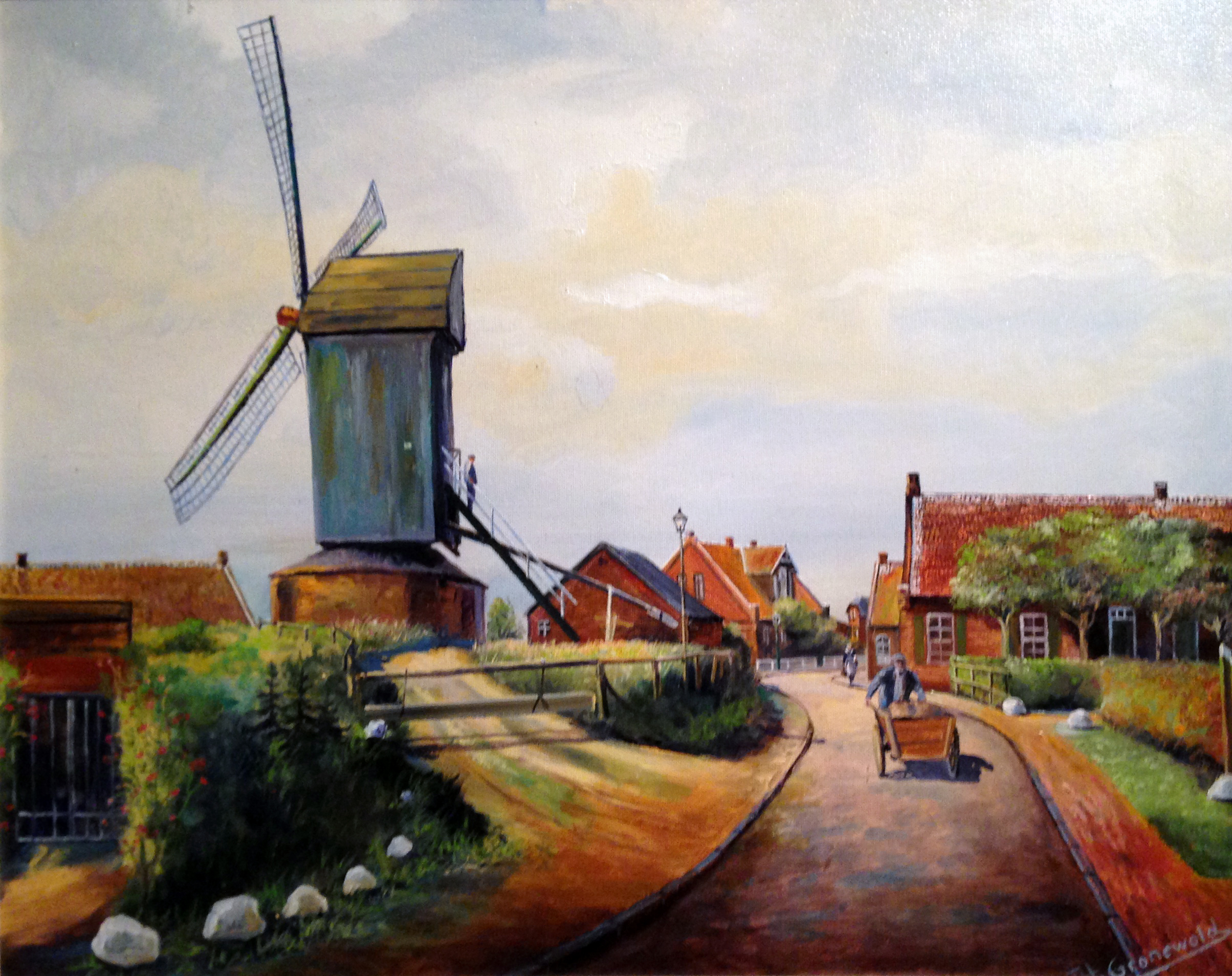
A Painting of a Mill
An old oil painting of the Ekel Mill survives in the local archives, showing a windmill standing among low brick farm buildings in East Frisian Norden. The mill itself is gone. The Ekel Outwork still stands. The school still teaches. The streets still carry the name. What you have, walking through Ekel today, is a quarter held together not by walls or signs but by a shared agreement that here is here and elsewhere is elsewhere. Geography by handshake.
From the Air
Located at 53.60°N, 7.22°E on the eastern edge of Norden's town centre in East Frisia. From the air, look for the Norder Tief stream tracing the quarter's southern flank and the B 72 federal highway bordering its northeast. Nearest airfield: Norden-Norddeich (EDWS) about 5 km to the northwest. Best viewed from 1,500-3,000 ft on clear days, when the geest ridge running through the town remains visible as a subtle rise above the marshland.