El Capitan Dam
When San Diego hired Hiram Savage to design a dam on the San Diego River, he chose a site in what is now Mission Trails Regional Park and refused to consider anywhere else. The city disagreed. They wanted El Capitan — thirty miles further upstream, set in a narrow granite gorge where a deeper, more efficient reservoir could be carved from the rock. Savage refused. The city fired him in 1923. Then they built the dam exactly where they wanted it.
A Dispossession Written Into Law
Before engineers could pour a drop of concrete, the city had to move the people already there. The Capitan Grande Reservation occupied part of the land that would be flooded. Native families opposed the project and demanded title to replacement lands before allowing their ancestors' graves to be relocated. In 1919, Congress passed the El Capitan Act, transferring the tribe's water rights and lands to the city of San Diego in exchange for resettlement and a payment of $361,420. It was a transaction that followed the long American pattern: Indigenous land, once wanted badly enough, became available. The act was later extended to cover much of the watershed above El Capitan, ensuring the city controlled the water quality for generations to come.
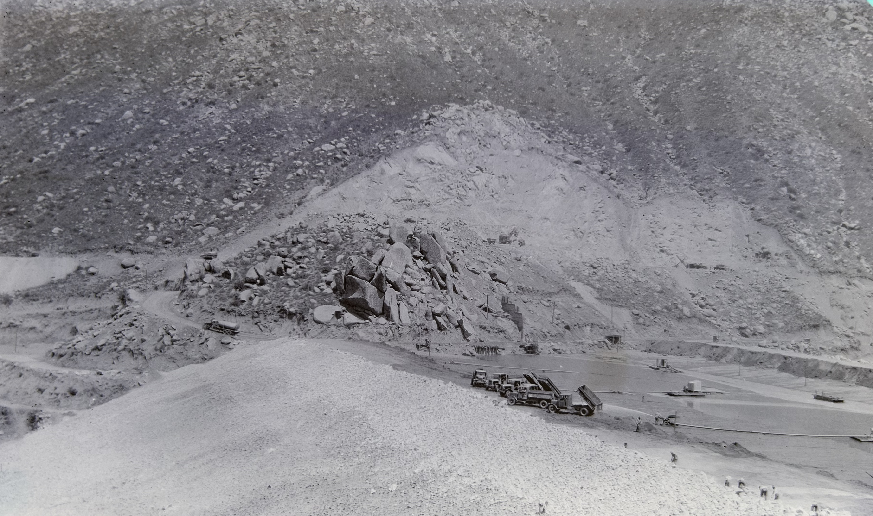
Building with Liquid Earth
El Capitan Dam is not a concrete structure — it is an embankment dam built by a process called hydraulic fill, a technique that was both ingenious and rare. Inspection engineer Harry Newcomb documented the construction in photographs discovered by his grandson nearly a century later. Workers first built earthen levees on each side of the gorge, then pumped a slurry of water and excavated material from nearby hillsides into the space between them. The mixture sorted itself as it settled: coarse gravel against the levees for structural support, finer sand in the middle, and the finest silts and muds collecting in the center to form an impervious clay core. That core is what stops leaks. The entire dam — 237 feet high from foundation, 1,170 feet long at the crest — contains nearly 2.7 million cubic yards of material assembled this way. An opening ceremony was held in 1934, though the reservoir wouldn't fill to capacity until storms soaked Southern California in 1938.
The Geometry of Drought
The argument for El Capitan over Mission Gorge was ultimately about efficiency. A wide, shallow reservoir loses proportionally more water to evaporation than a narrow, deep one. El Capitan's granite gorge would create exactly the latter. The reservoir holds 112,800 acre-feet at capacity — making it San Diego's second-largest water supply facility, after San Vicente Dam. In practice, the reservoir rarely fills. Its capacity is so large relative to the average annual inflow of about 31,600 acre-feet that the water level is deliberately kept at two-thirds capacity or less through winter and spring. One reason is operational: prevent uncontrolled spills. Another is sobering — since 2019, California regulators have downgraded four of San Diego's water supply dams from fair to poor condition, citing earthquake vulnerability. El Capitan sits 30 miles from the city it serves, connected by pipeline. If it were to fail, the consequences would cascade far beyond the reservoir.
What the Gorge Holds
From the air, El Capitan Reservoir appears as an elongated blue tongue pressed into the dry chaparral hills east of the city. The San Diego River feeds it from the east; Conejos Creek joins just below the dam face. The surrounding terrain is steep and rocky, more reminiscent of the backcountry mountains than the coastal mesas twenty miles to the west. Hikers and anglers have access to the shoreline, and the quiet of the reservoir — no motorized boats, no development — preserves something of what the canyon must have felt like before the water rose. On a clear day, the granite walls hold both the water and the silence, and it is possible to stand at the dam crest and understand why two engineers, nearly a century apart, found this place worth fighting over.
From the Air
El Capitan Reservoir is visible at coordinates 32.8839°N, 116.809°W in the eastern foothills of San Diego County. The elongated reservoir is easily identified from altitude against the surrounding chaparral. Recommended viewing altitude 5,000–8,000 ft MSL. Nearby airports: KSEE (Gillespie Field, ~15 nm west), KMYF (Montgomery-Gibbs Executive, ~20 nm west). The narrow gorge and dam structure are visible at lower altitudes in clear conditions.