El Imposible National Park
The name is a warning. In the early twentieth century, coffee growers in the mountains of western El Salvador faced a brutal problem: a deep gorge stood between their plantations and the Pacific shipping ports. Pack mules slipped on the steep trails, loads of beans tumbled into the canyon, and the passage claimed lives with enough regularity that locals simply called it "El Imposible" -- the impossible crossing. In 1968, the government finally built a bridge sturdy enough to make the route survivable. Eleven years later, in 1979, the gorge and the dense forest surrounding it became a national park. What had been an obstacle became a sanctuary.
The Last Forest Standing
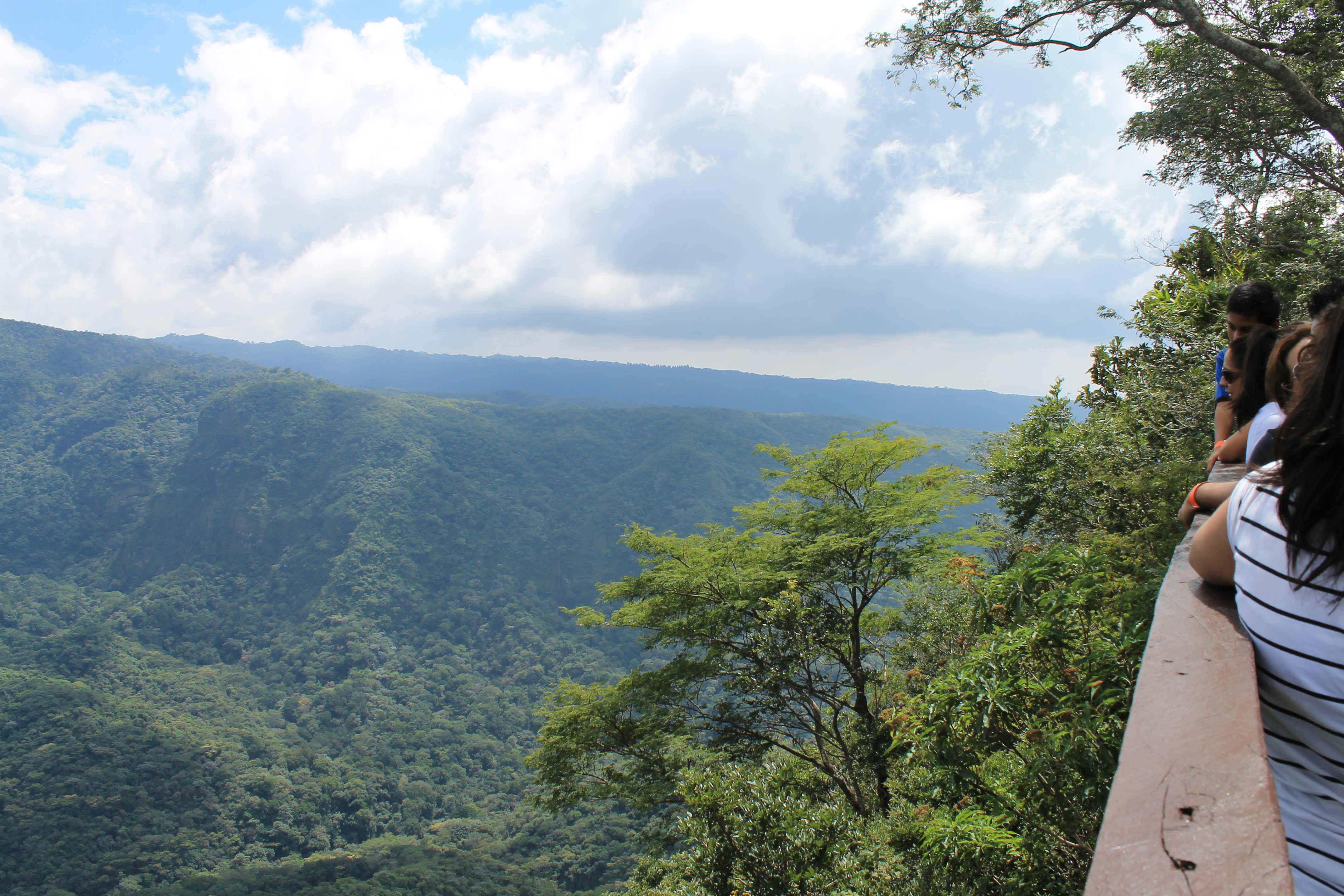
El Imposible is the largest national park in El Salvador, covering 5,000 hectares of dry tropical rainforest along the Guatemalan border. In a country where deforestation has claimed the vast majority of original forest cover, this park protects one of the last significant remnants. The terrain is punishing -- elevations range from 250 to 1,500 meters, with slopes so steep that the only way to see most of the park is on foot. Several well-marked trails, most between seven and eight kilometers long, thread through the forest. Popular routes include Cerro Leon, Piedra Sellada, and Los Enganches. The park was created explicitly to protect one of the world's most endangered ecosystems, and walking its trails, surrounded by trees that once covered the entire Pacific slope of Central America, you understand why the effort matters.
Stones That Remember
Eight archaeological sites have been identified within the park's boundaries, but only one is open to visitors. Piedra Sellada -- "sealed stone" -- is a collection of more than 100 carved stones thought to be over a thousand years old. Some depict recognizable forms: the sun, butterflies, animals. Others are more abstract, their meanings lost to the centuries that separate us from their makers. The petroglyphs predate the Spanish arrival by hundreds of years, connecting the forest to a human presence far older than the coffee trade or the colonial era. At Piedra Sellada, natural pools fed by the park's clean streams invite visitors to swim among the carvings, an experience that collapses the distance between ancient and present in a way few archaeological sites can match.
Pumas, Bats, and a Fussy Fish
More than 500 plant species have been cataloged in El Imposible, along with over 100 species of mammals, 53 species of amphibians and reptiles, and 285 species of birds. Pumas and jaguars still roam the deeper sections of the forest. Butterflies fill the daylight hours in extraordinary diversity, and at dusk, bats take over the sky -- including vampire bats, which lend the evenings a certain atmosphere. Among the park's most telling residents is the Tepemechin, a freshwater fish so sensitive to pollution that its presence serves as a living water-quality test. Where the Tepemechin thrives, the springs and pools are clean. Venomous snakes add a note of caution to the hiking, but the park's trails are well-maintained and its biodiversity is the kind that rewards patience and attention rather than speed.
Backcountry and Bare Essentials
El Imposible is not a park built for comfort. There are a few cabins near the San Benito entrance that can be reserved through the Ministerio de Ambiente, but most camping is backcountry -- no improved campsites, no facilities, just forest and solitude. Visitors bring everything they need, including all food and water. The entry fee is six dollars for foreign visitors, three for Salvadoran nationals, with the same structure for camping fees. Getting there requires a chicken bus from Sonsonate to the town of Cara Sucia, followed by a short taxi ride to the park entrance. The remoteness is part of the appeal. For naturalists and adventurous budget travelers, El Imposible delivers exactly what its forbidding name once promised to coffee haulers: a place where the terrain makes the rules, and the reward belongs to those willing to work for it.
From the Air
Located at 13.84N, 89.96W along the El Salvador-Guatemala border in the Apaneca-Ilamatepec mountain range. From altitude, the park appears as a large block of dense forest cover sharply contrasting with surrounding agricultural land. Elevations range from 250 to 1,500 meters, with deeply cut gorges visible from above. The park borders Guatemala to the west. Nearest airports are El Salvador International (MSLP) approximately 120 km east, and the regional airstrip near Sonsonate. The Izalco and Santa Ana volcanoes are prominent landmarks to the northeast. The Cara Sucia River drainage is visible running through the rugged terrain.